Croaghaun: An amazing walk that combines breathtaking views of the Atlantic Ocean with fantastic vistas of cliffs and landscapes ⚠️ ⛱️
OSI 22
‘Good company in a journey makes the way seem shorter,’
Izaak Walton
Saddle Head
With a few glorious days off and the sun shining bright, the call of the wild is impossible to resist. And what better way to embrace the great outdoors than embarking on a hike? This time, I had some enthusiastic visitors from London staying with us eager to experience the breathtaking beauty that Co. Mayo has to offer. We set our sights on Croaghaun mountain on Achill Island, a destination that promised stunning views and unforgettable moments.
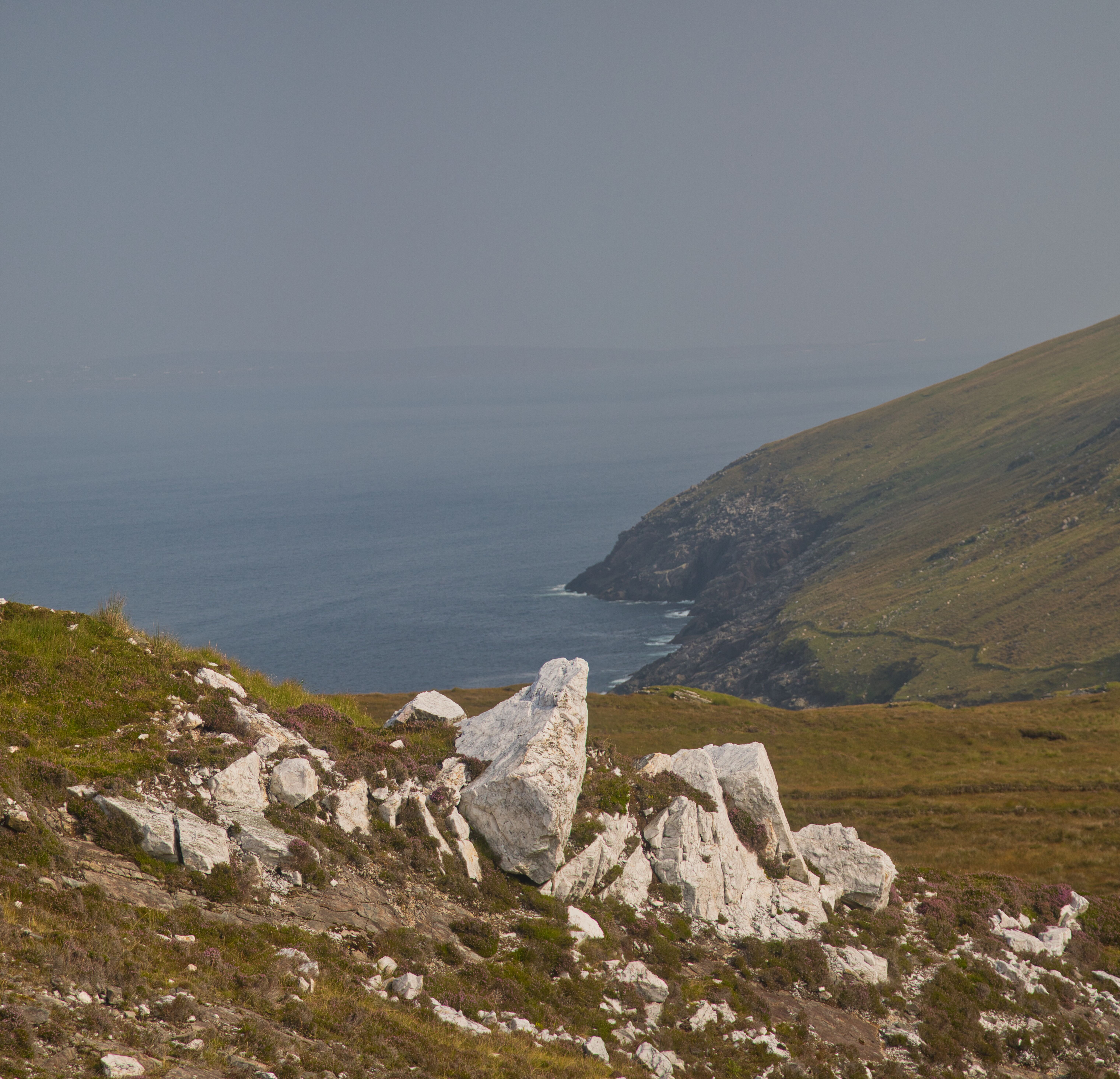
As we start the climb to the tower, the white colour of the quartz rock stands out. The abundant, glittering quartz was historically favoured by the ancient Gaels for construction and is a natural feature of the mountain.
Nestled on the western edge of Achill Island, Croaghaun is a spectacle in itself, standing tall at 688 meters. This majestic mountain is part of a dramatic stretch of cliffs that commences at Moyteogue Head near Keem Bay and continue around the western edge of the island to Achill Head.
Looking down the cliffs from the top of Croaghaun.
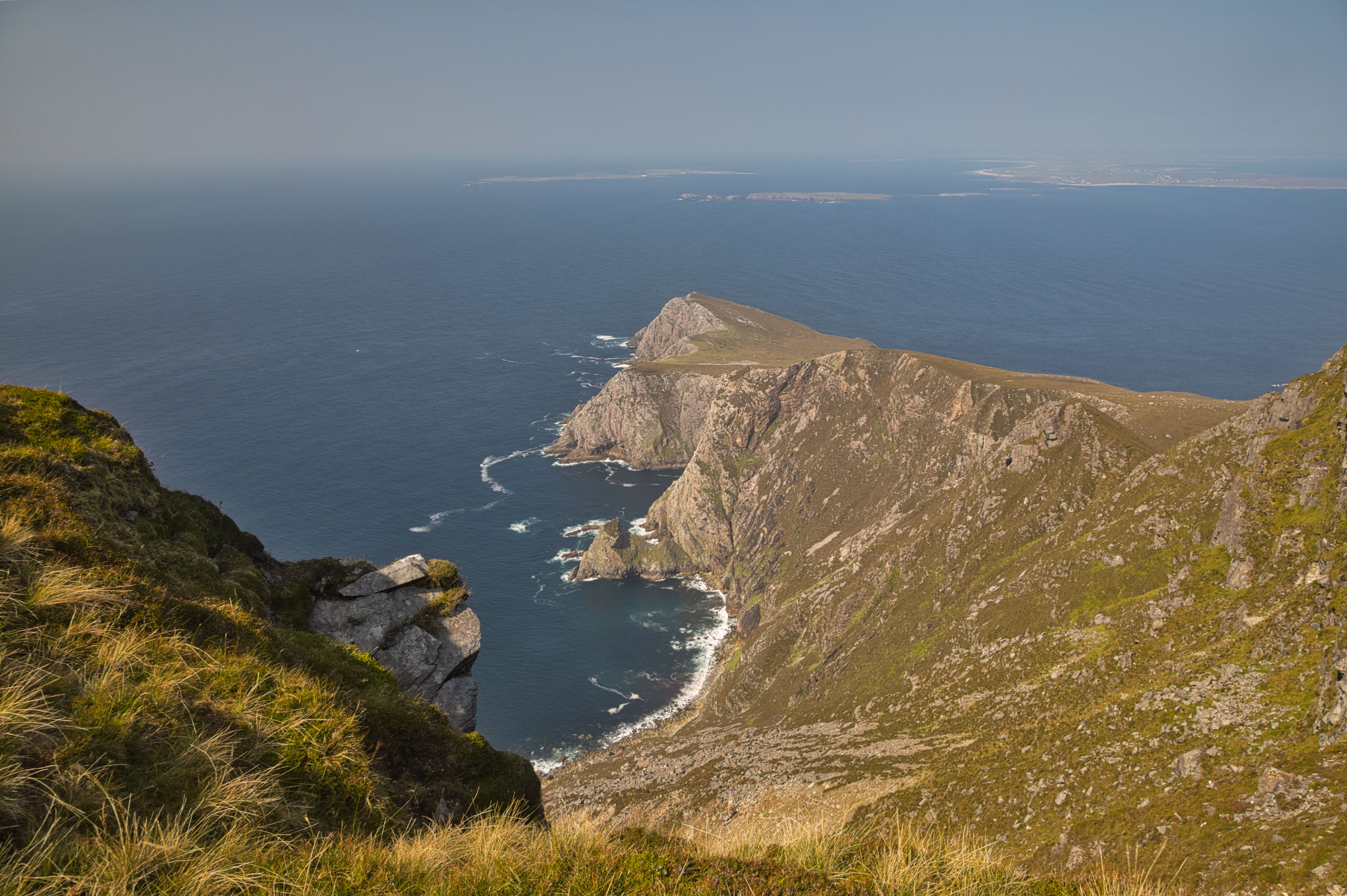
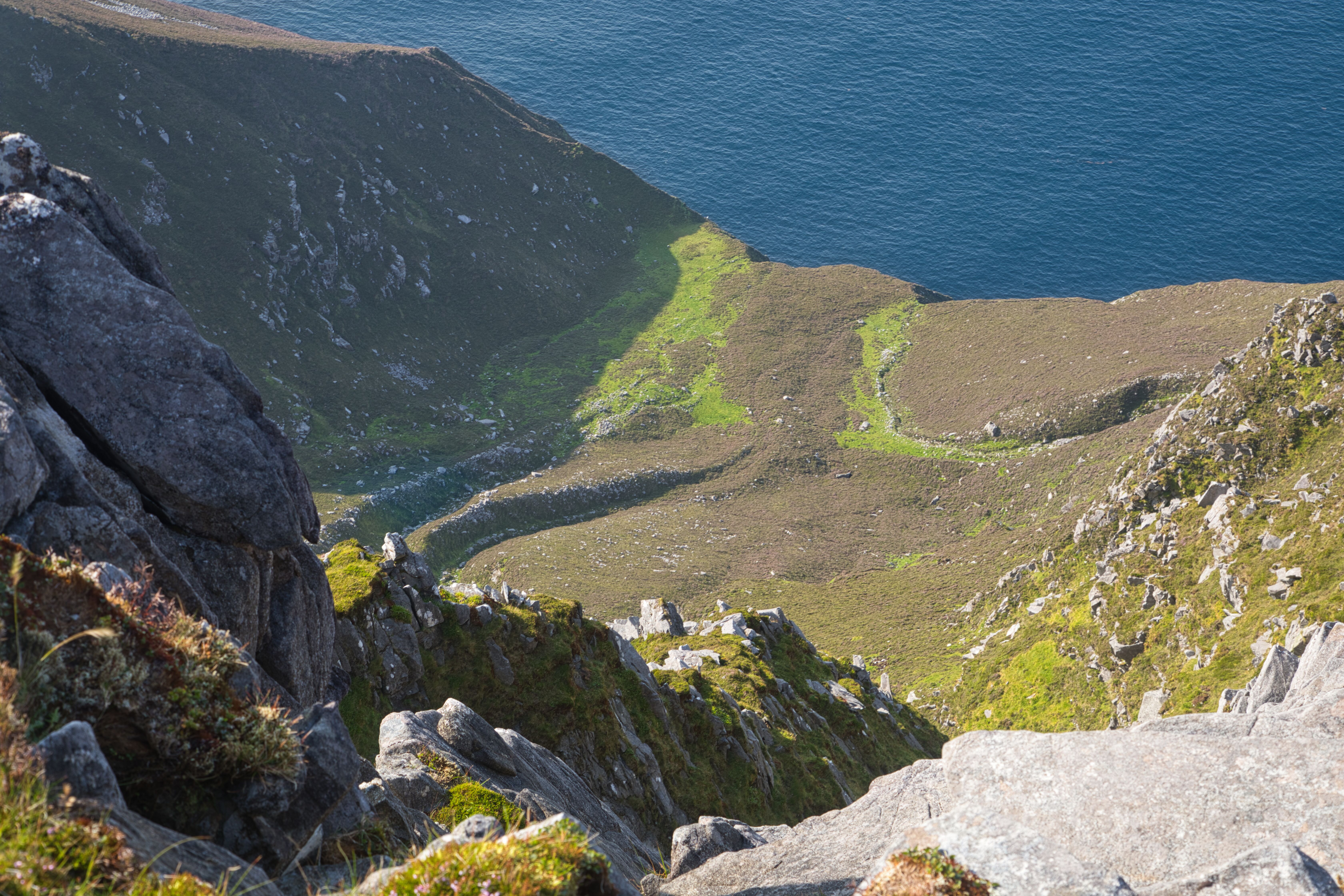
From this elevation, you’ll find yourself captivated by the stunning drop of over 600 meters straight down into the proud Atlantic Ocean, spanning about 2.5 kilometers. Along the way, the serene glacial lakes of Lough Nakeeroge and Bunafreva adds a picturesque touch to the landscape, making every step worth it.
The idea for this hike sparked recently during a previous trip to Lough Nakeeroge where I marvelled at the ascent from the Napoleonic tower on hill 194 to the very summit of Croaghaun. I couldn’t shake the vision that it would make for an incredible trek, and so when my friends Naoimh and Martyn asked to join me for a hike, naturally, I knew the perfect path.
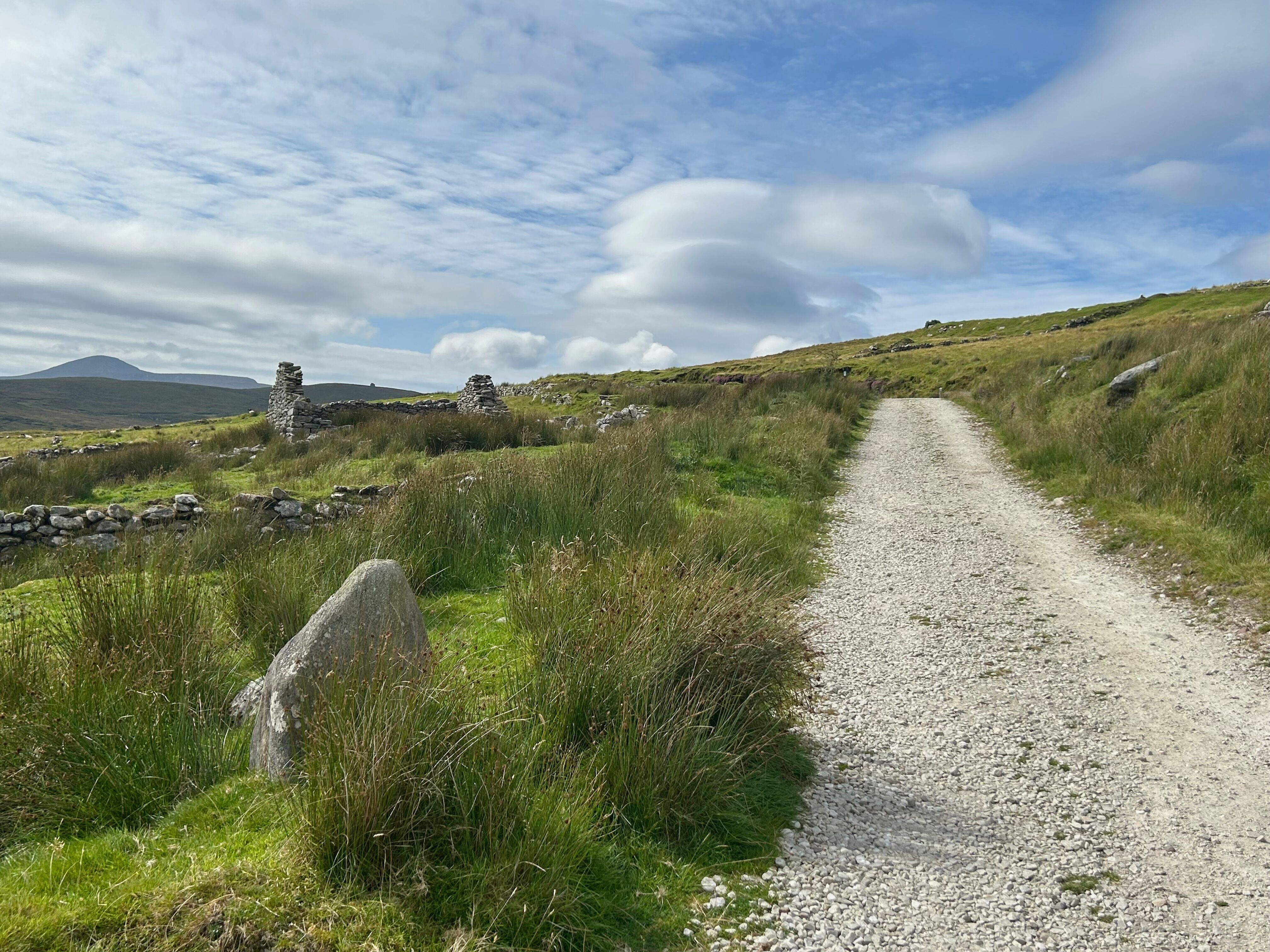
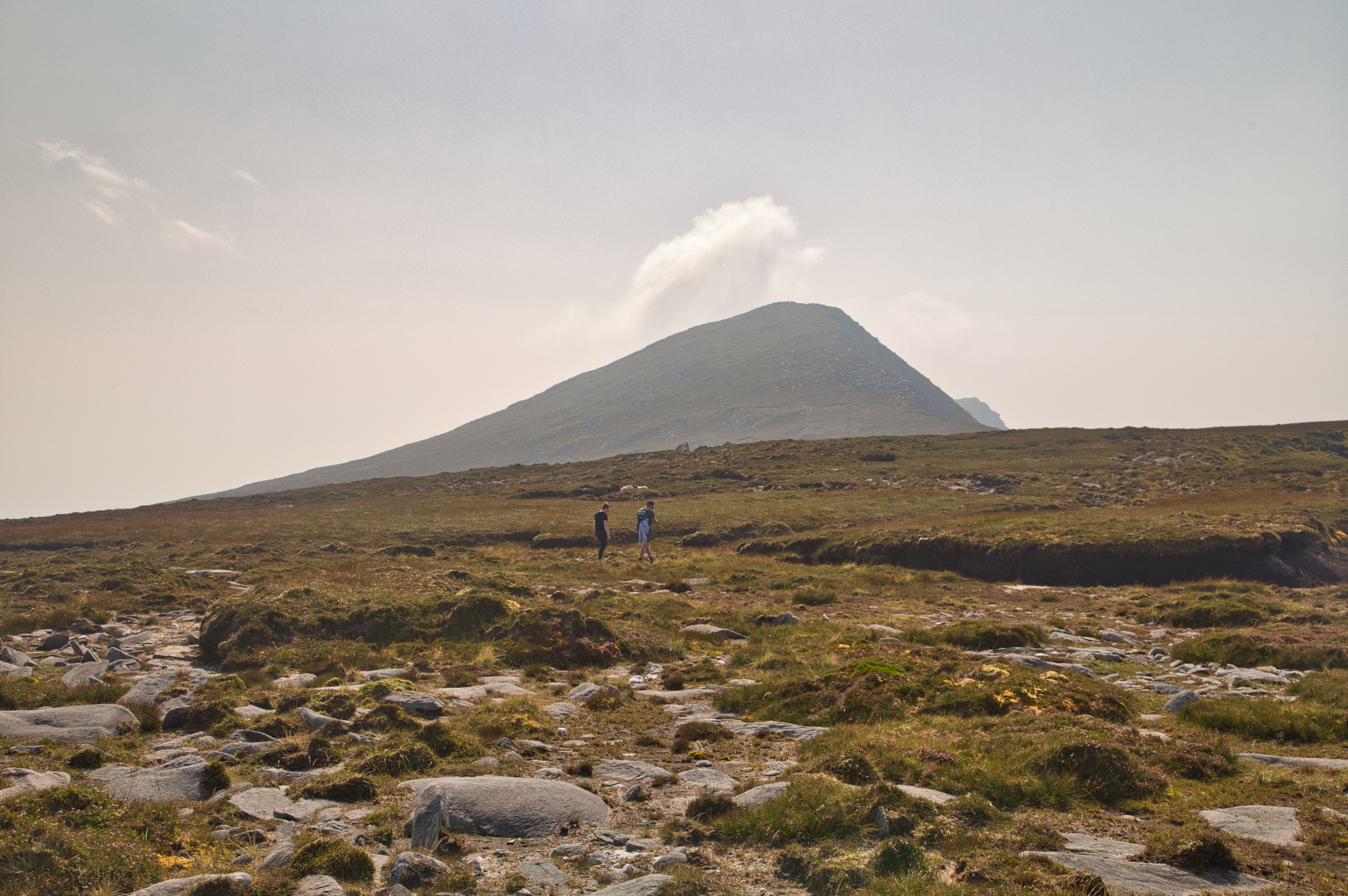
Walking along by the deserted village pathway, the first stop is the Napoleonic tower, the small dot on the hill between the gables of the ruined building on the left.
We parked at the cemetery car park near the hauntingly beautiful deserted village of Slievemore. The day was perfect—clear skies and dry ground, ideal for our adventure. Our ascent began with a trek along the path towards the high ground leading to hill 194, home to the impressive Napoleonic tower. Standing proudly, it served as a fantastic starting point for what lay ahead. With the boggy terrain surprisingly firm beneath our feet due to the recent dry spell, we made our way to hill 269, where, upon cresting the summit, we were treated to one of the best views in all of Co. Mayo.
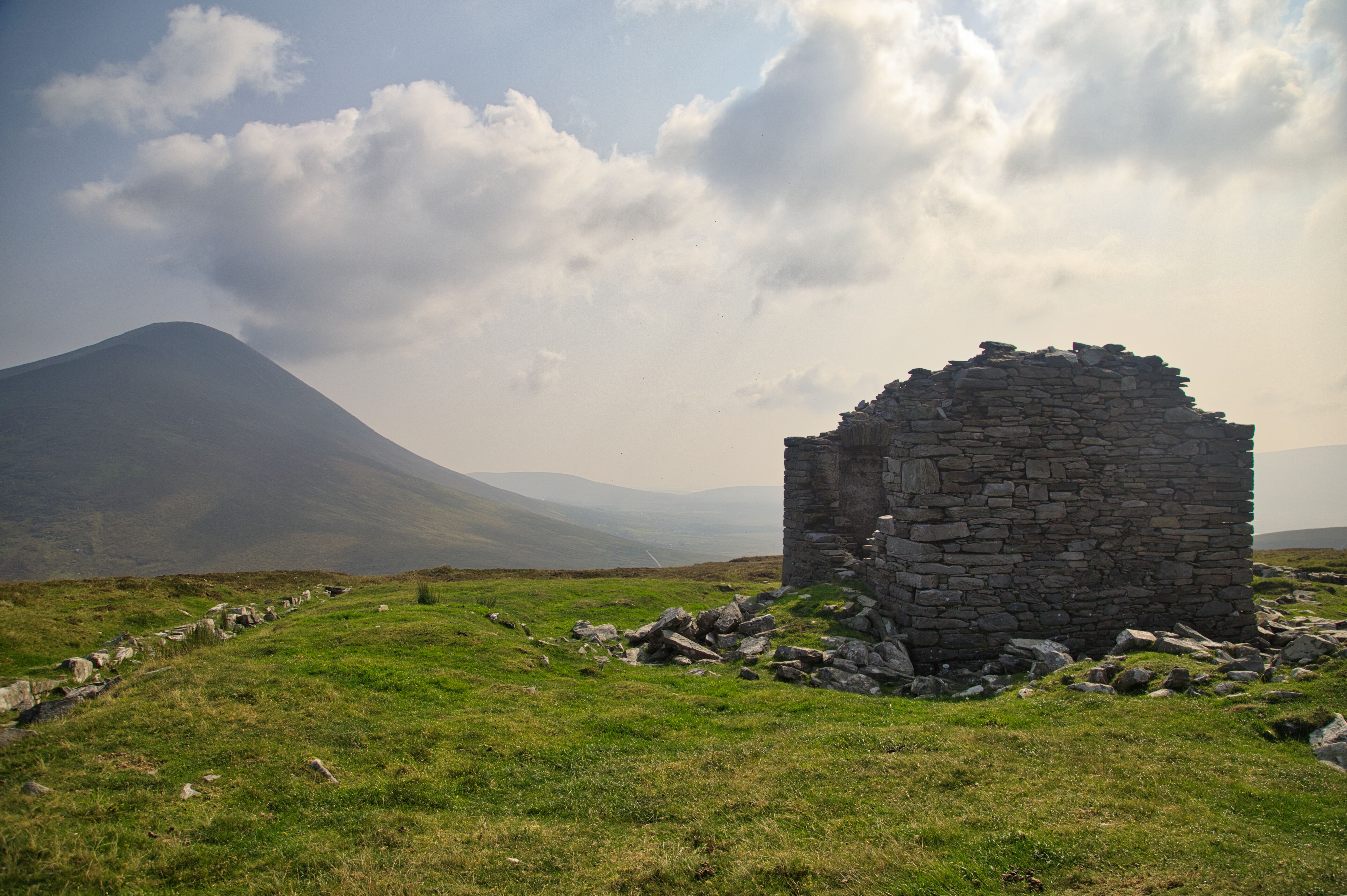
The site of the Napoleonic tower on hill 194
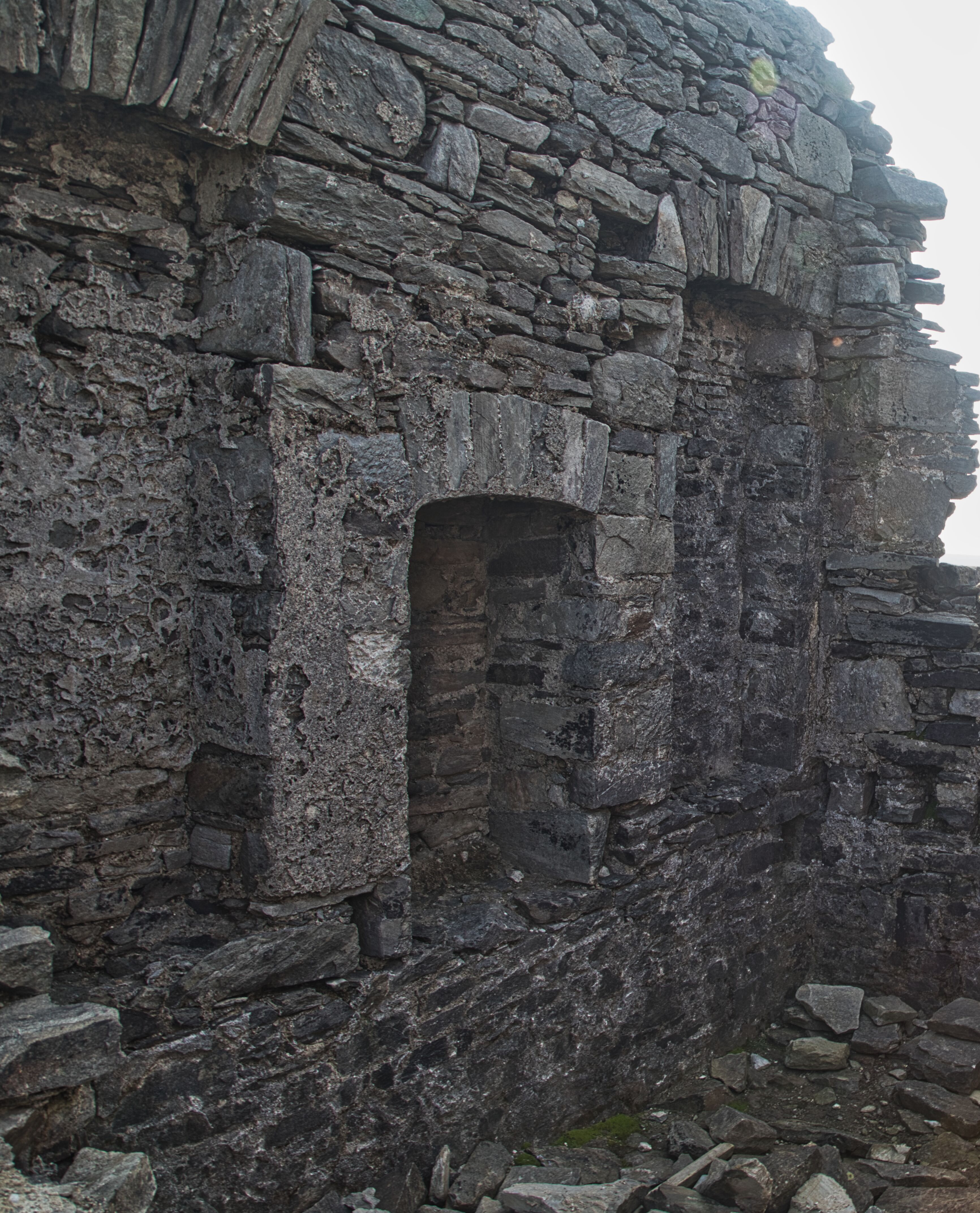
Although erected in 1806 and in ruins, the fireplace can still be made out.
As we gazed below, Lough Nakeeroge revealed itself—a hidden gem nestled in the remote Annagh Valley. This lake, known as the lowest glacial corrie lake in Ireland at just 16 meters above sea level, is accessible only by foot or boat, adding to its enchanting allure. Annagh Valley itself is famous for its steep-sided grandeur, and the small sandy beach at Annagh Strand is a perfect spot for a quiet moment of reflection amidst nature.
From hill 269, the first good view of the route to the summit can be made out.
Sphagnum clumps on wet peat made up of heather, sedge, moor grass, and cottongrass are dotted all over Croaghaun mountain, showcasing the clean, pristine condition of the space up here. This unique ecosystem provides a habitat for various wildlife, thriving in the rich biodiversity that characterises the area.
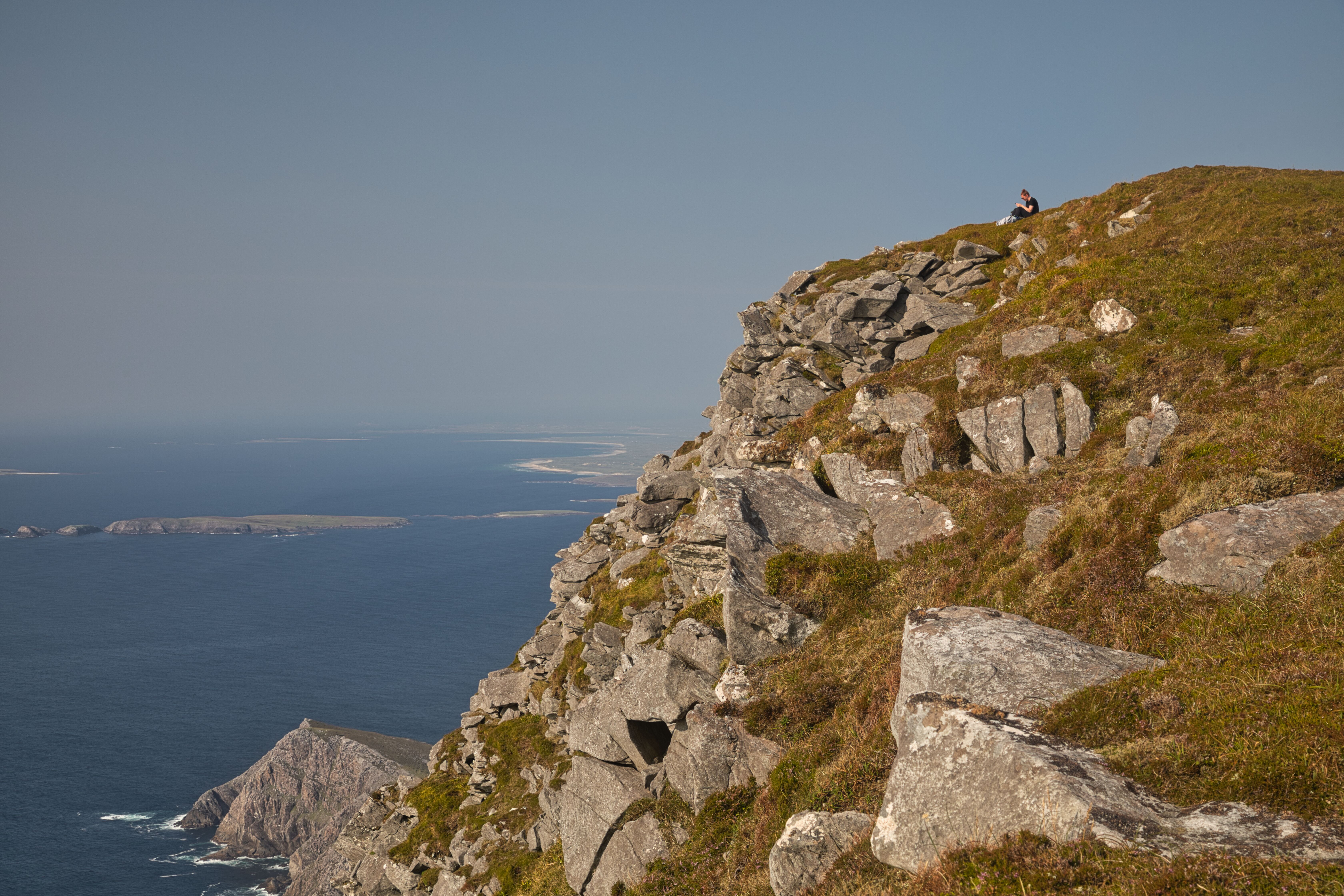
From hill 269, we began the proper ascent to the summit. As we climbed higher, the panoramic views out to sea unfolded spectacularly before us. We could see Tinny Lough and Bunnafreva Lough sparkling in the sunlight down below, their natural beauty emphasized by the surrounding landscape. We chose to keep toward the right of the ridge near the cliffs, which allowed us unbroken vistas for miles as we meandered our way to the peak.
Lough Tinny and Lough Bunnafreva East pictured against the Atlantic and Slievemore backdrop make for a stunning view.
From spot height 574 we had just about a kilometre left to go, the terrain shifted, leveling out and revealing a magnificent hillock that marked the last climb to the summit. We gazed at it in wonder, knowing we were on the brink of a final push. Regaining our breaths, we pressed on like determined demons with a mission, fueled by the anticipation of at last reaching the top.
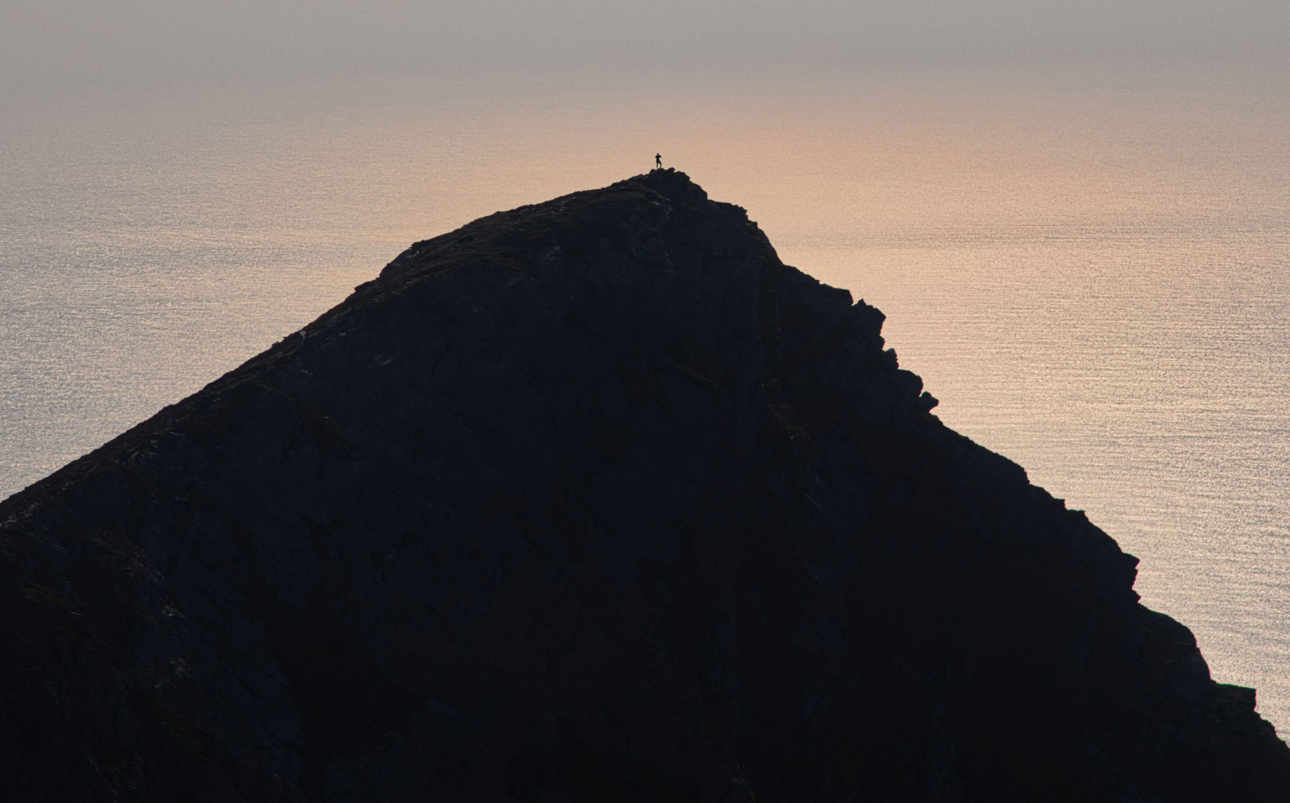
The Napoleonic tower can just be made out as a tiny silhouette on the hills in the middle distance.
Bunnafreva Lough West at 1000 feet is the highest Corrie lake in Ireland. It is not far from the lowest Corrie lake, lough Nakeeroge East at just 52 feet.
Walking across the last half kilometer of stoney surface before the final climb to the top.
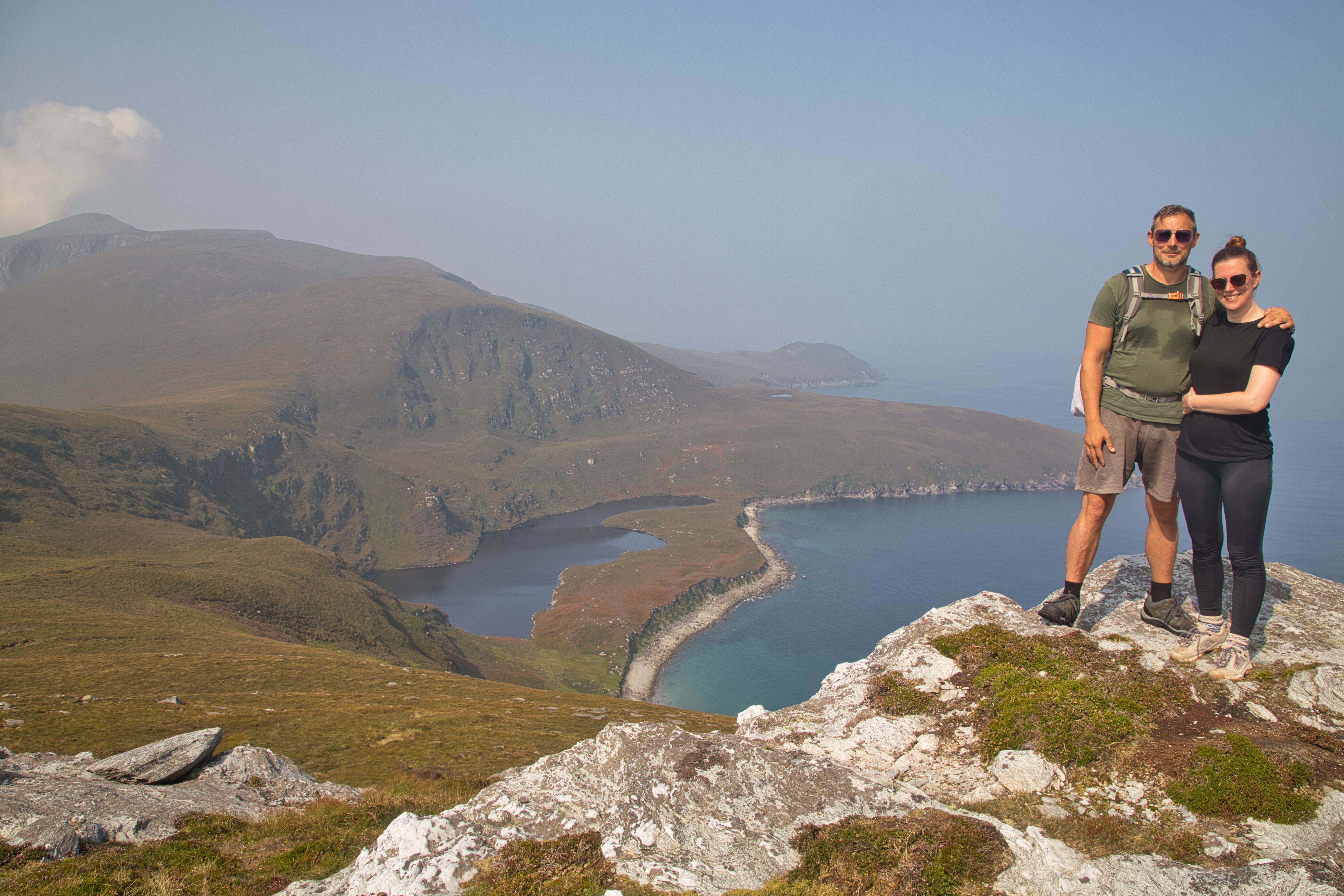
Finally, we made it. The relief that washed over us at the sight of the white stone cairn perched atop the hill was overwhelming. The summit offered breathtaking views of Croaghaun's southwest top and down to Achill Head and to the right, Saddle Head-nature’s grandeur showcased in all its glory.
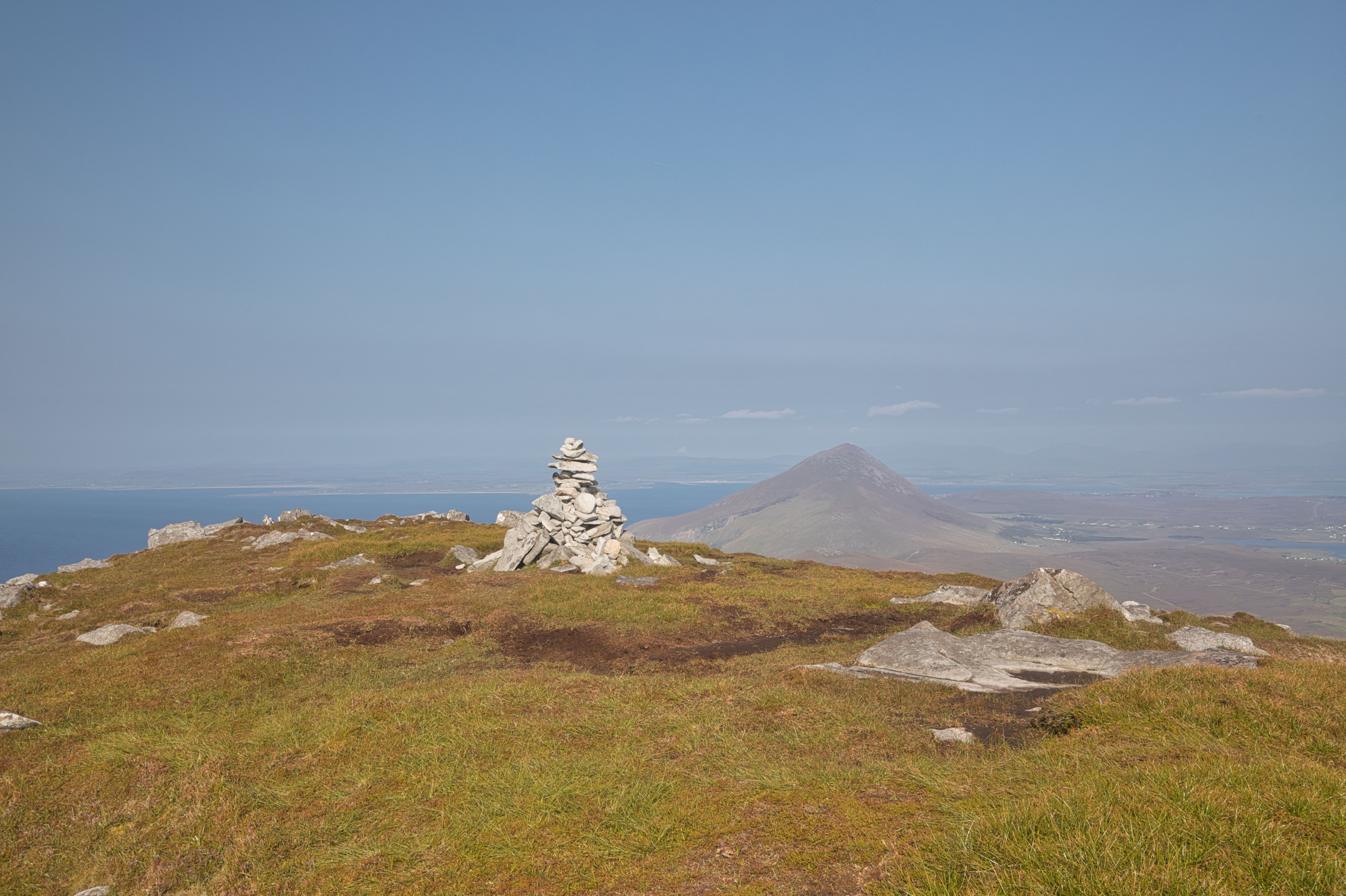
The Cairn on Croaghaun with Slievemore in the background
However, our adventure wasn't over yet. As the sun began to dip lower in the sky, Martyn, ever the adventurous spirit, announced his desire to conquer Croaghaun's southwest top. With a quick drop of his bag, he disappeared down the slope, only to re-emerge midway up the hill. I swear I caught a glimpse of him running—a testament to his impressive fitness levels.
Martyn is pictured standing on Croaghaun South West top at 664mts which is slightly lower that the main Croaghaun mountain at 688mts.
Not to be out done, Naoimh is pictured relaxing on the summit of Croaghaun and probably oblivious to the drop in front of her!.
After spending a bit of time on top, we briefly contemplated retracing our steps back but quickly dismissed the idea, thinking it might take too long. Instead, we opted for a descent towards the site of the 1950 Halifax plane crash, a decision that led us to discover remnants of history. We approached the wreckage, carefully navigating the stony hills. It was a somber moment, reflecting on the lonely fate of the plane and its passengers. Back in 1950, the emergency services would have faced a daunting task in their recovery mission, hindered by rain, mist, and foggy conditions—a stark reminder of nature’s unforgiving power and the potential dangers of hill walking at height.
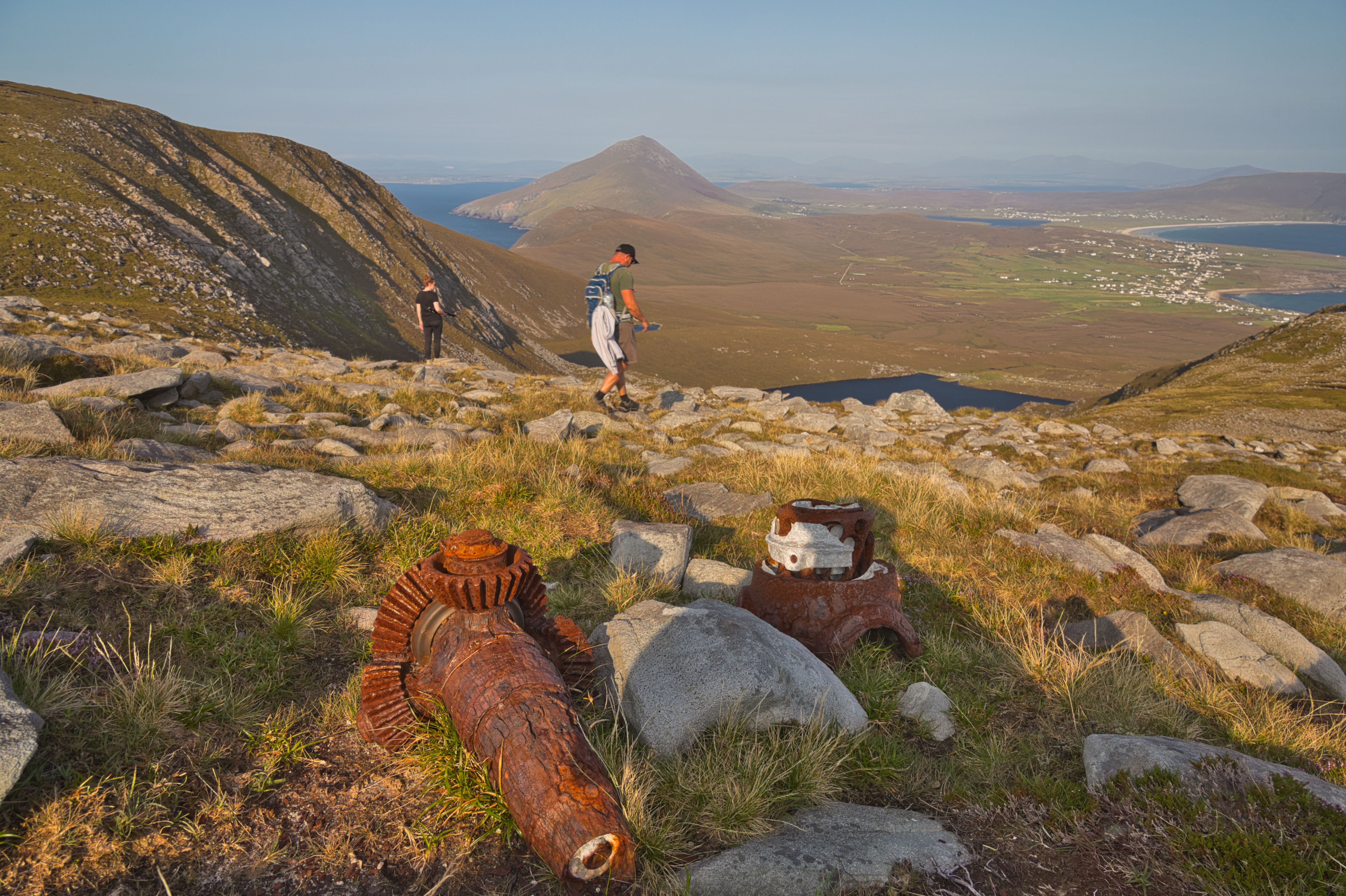
Strewn around The rocky slopes of the mountain are pieces of the crashed plane. Here we find parts of the Halifax bomber propeller reduction gear and what looks like the propeller boss lying beside it.
As we continued our descent, we found ourselves dropping down onto the road that leads into Lough Acorrymore, eventually merging onto the Keem Beach road, taking us towards Dooagh village. By this point, our water supplies were depleted, and the thought of a refreshing pint of cold iced Bulmers at Gielty’s Bar became irresistible. Nothing hits the spot quite like a crisp beverage after a day of exploration!
Fully refreshed, we set off again, this time tackling part of the Dooagh loop trail, which took us through the boggy landscapes of the lower parts of Croaghaun and on to the deserted village trail. Soon enough, we were back at the car, tired but exhilarated, with the sights and experiences of the day etched in our minds.
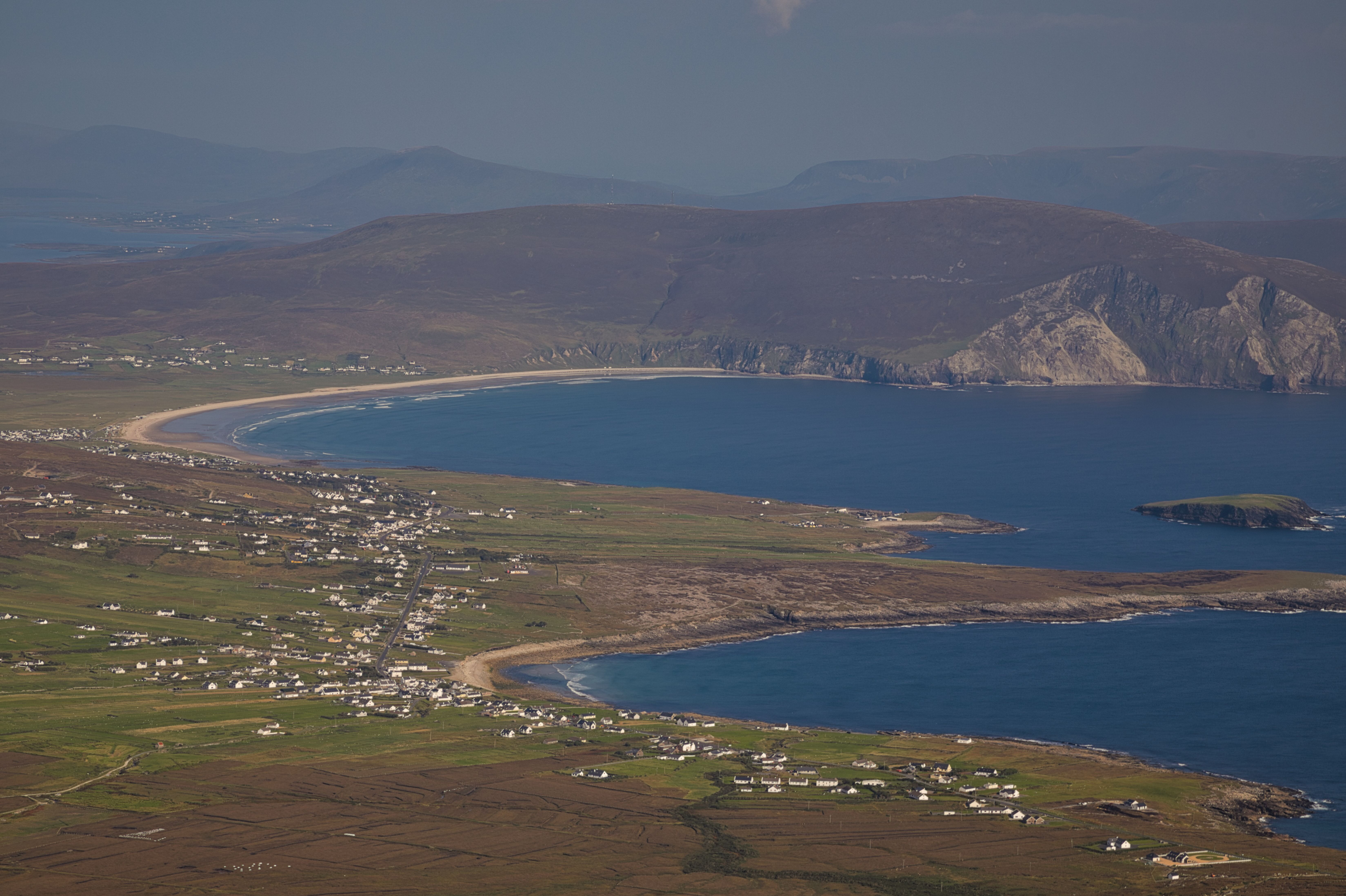
Keel beach in the distance with Dooagh village in the foreground. The start of the Minaun cliffs begin to show on the top right.
Hiking Croaghaun was not just about the destination but the journey—the laughter and the crack shared with relations, the awe-inspiring views, and the connection with the rugged beauty of Achill. We were all pretty impressed by today’s experience and are looking forward to the next adventure or whatever walk that awaits us.
On the summit.
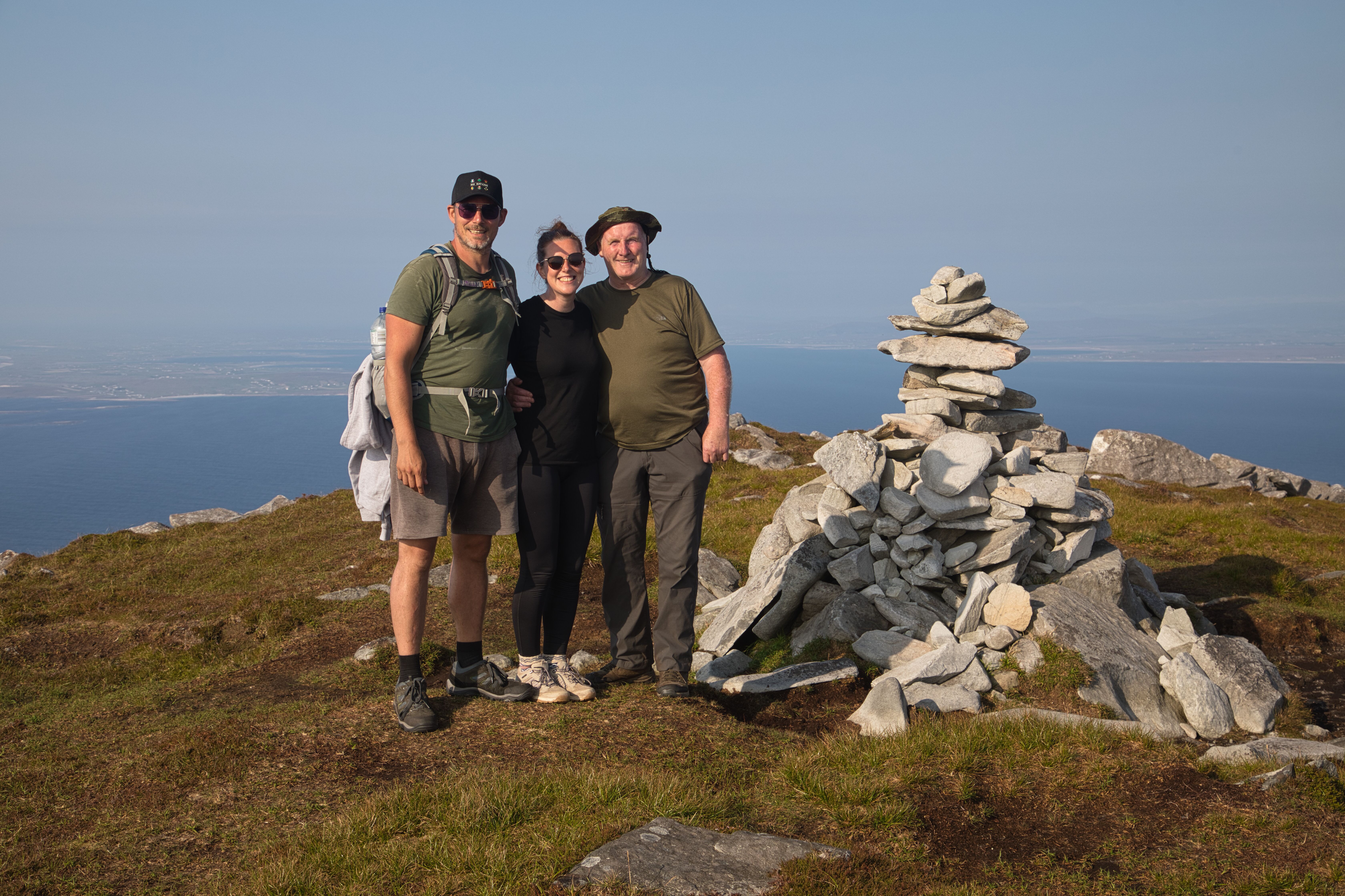
Done it !
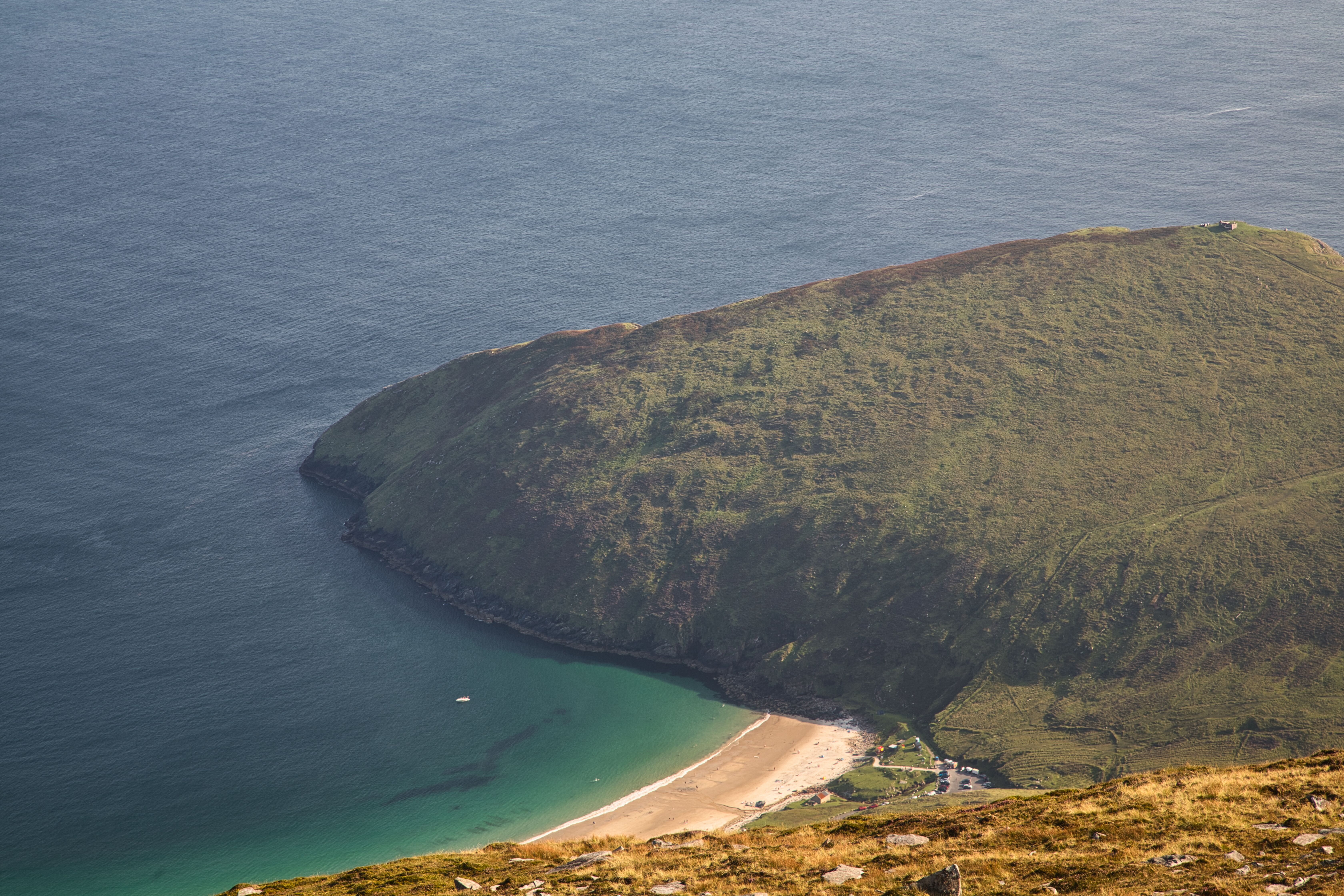
Keem Bay looking like it’s part of the Mediterranean.
Carpe Diem