From a Clapper to a Megalith, a lesser known hiking route around the Louisburgh area 🥾🥾
"In Ireland this world and the world we go to after death are not far apart."
Hiking is one of the most rewarding outdoor activities one can engage in. It not only provides an opportunity to take in the fresh air and scenic views, but it also presents a chance to witness history and culture firsthand. I recently went on a hiking trek in the Louisburgh area with the aim of photographing some stunning images of the Doo Lough valley and surrounding mountains from high ground.

OSI Sheet 37
The area around Corrydavit and Corrymailley at the source of the Bunleemshough river looked ideal. The loop of hills surrounding the valley provided breathtaking views of Clew Bay, the Sheeffry Hills, and Mweelrea and the remnant of snow in patches still lying on top of the mountains made for an even more interesting sight. But before I began my hike, I stopped to see the ancient Clapper Bridge near Killeen, also known as the Bunlahinch Clapper Bridge, gracefully spanning the Bunleemshough River near Cloonlaur.
This pedestrian-only bridge is a remarkable piece of history, measuring an impressive 50 meters in length, making it the longest intact clapper bridge in Ireland. Its construction is reminiscent of bridges found in Devon and Cornwall, with 37 arches showcasing the traditional clapper style. Each arch consists of a flat limestone slab, or clapper, approximately half a meter wide, resting on sturdy piers that elevate it another half a meter above the riverbed. What makes this bridge even more fascinating is its historical significance. It served as an essential part of the Protestant Evangelist Colony that existed in the area during the 1840s. It adds charm and historical significance to the area and is a testament to the incredible engineering and construction skills of the time.

Bunlahinch Clapper Bridge
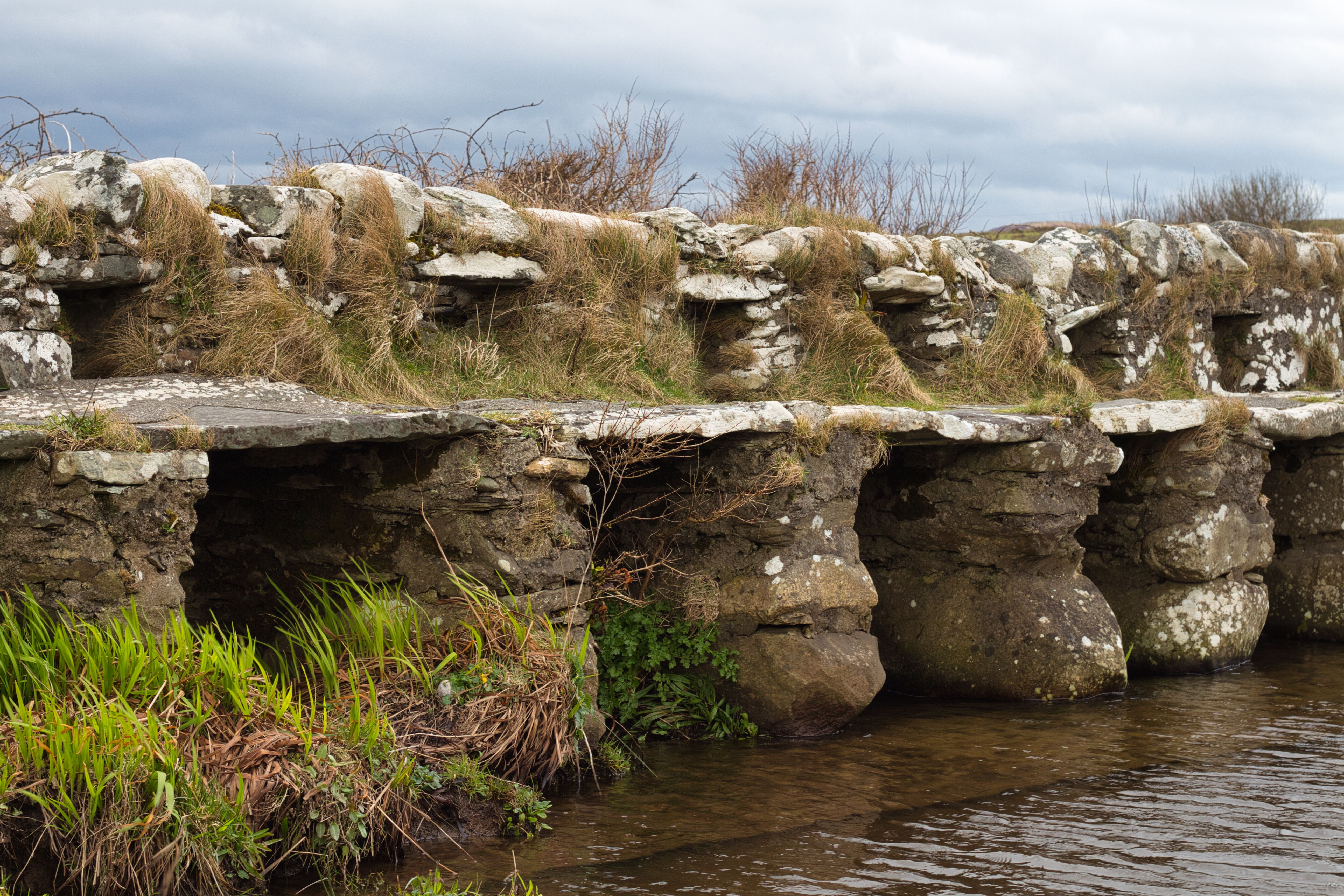
Close up of the bridge noting its foundations

From there, I made it to a small farm track leading up and out onto the hills in the Aillemore area. My aim was to hike the loop of hills following the spot heights in an anti-clockwise direction, taking the time to make a slight detour to see the famous Aillemore Court Tomb on the side of hill 267. This is an almost-complete court tomb located in the rural townland of Aillemore and situated near the summit of a ridge overlooking the Bunleemshough river valley.

Aillemore Court Tomb
Massive, closely packed, steeply pitched roof slabs that previously supported the tomb have been moved to one side, and the entry forecourt has been covered up with displaced cairn debris.
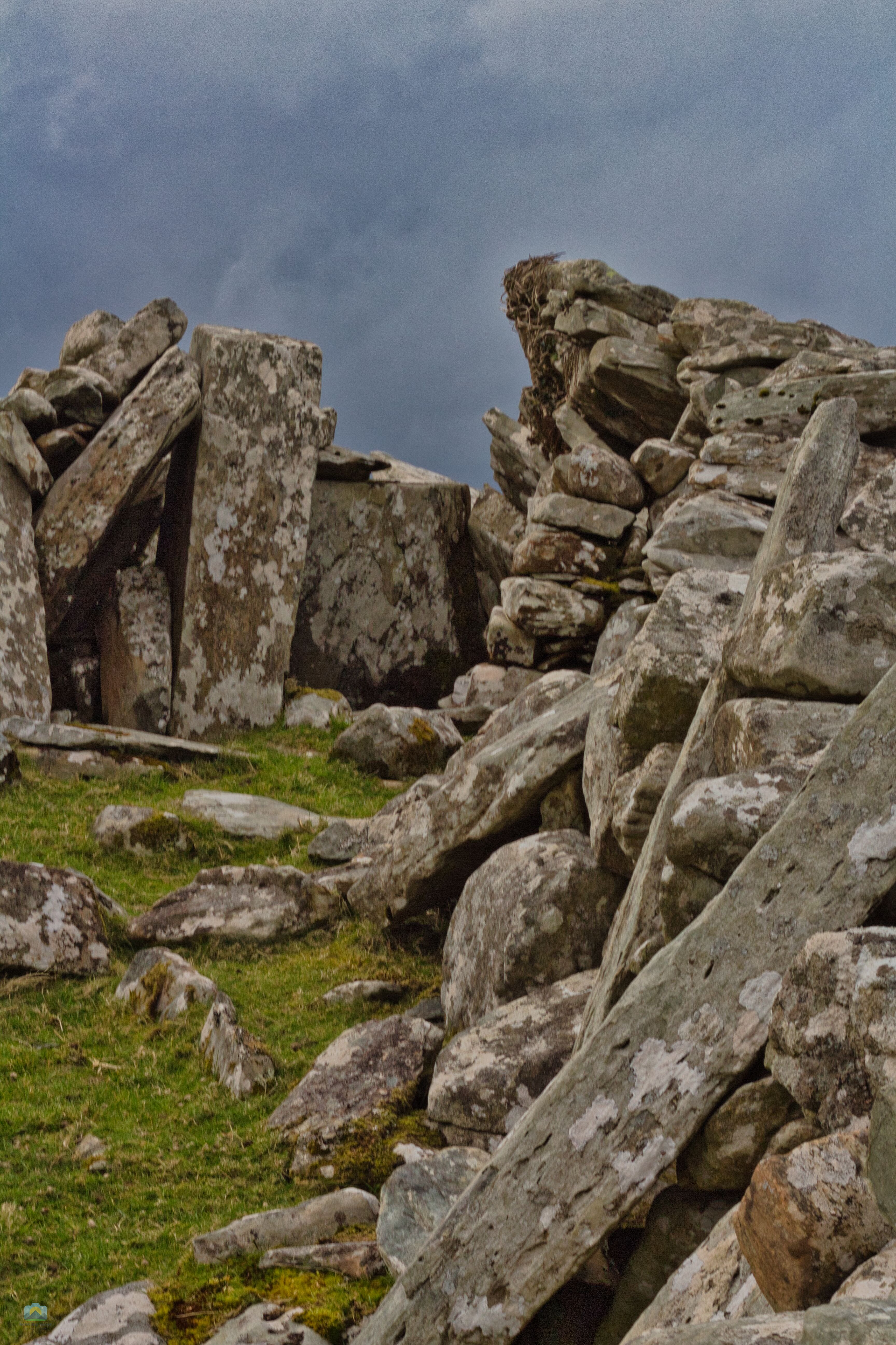
Close up of the entrance to the tomb
The actual tomb consists of a modest, nearly invisible auxiliary chamber below a two-chambered gallery. The surrounding cairn is more than 16 metres long and 14 metres wide, rising to the top of the gallery stones at a height of around 1.5 metres. This court tomb must have been a fine structure in its day when all the stones were in place, and it is amazing that it has survived in such a great state for almost 4,000 years.

A standing stone located only a few feet from the tomb stand sentinel guard
As you hike through the various hills in the west of Ireland, you are sure to come across many stone cairns scattered throughout the hills and mountains. These structures, built by stacking stones on top of one another, have been a part of human history for centuries. While the exact origins of this particular cairn atop hill 267 are unknown, we can appreciate the significance of the structure. Cairns have been built for a multitude of purposes, such as marking burial grounds, serving as ritual sites, providing a space for meditation, and even marking important landmarks.

Looking towards Doo Lough past the cairn on the summit of hill 267 with Mweelrea mountain in the background

White Strand

Carrowniskey Strand
It's a lovely walk from Hill 267 to Hill 286, and the vantage point at the top offers an amazing view of the surrounding countryside. Glancing back north, I can see showers of sleet and rain going past.
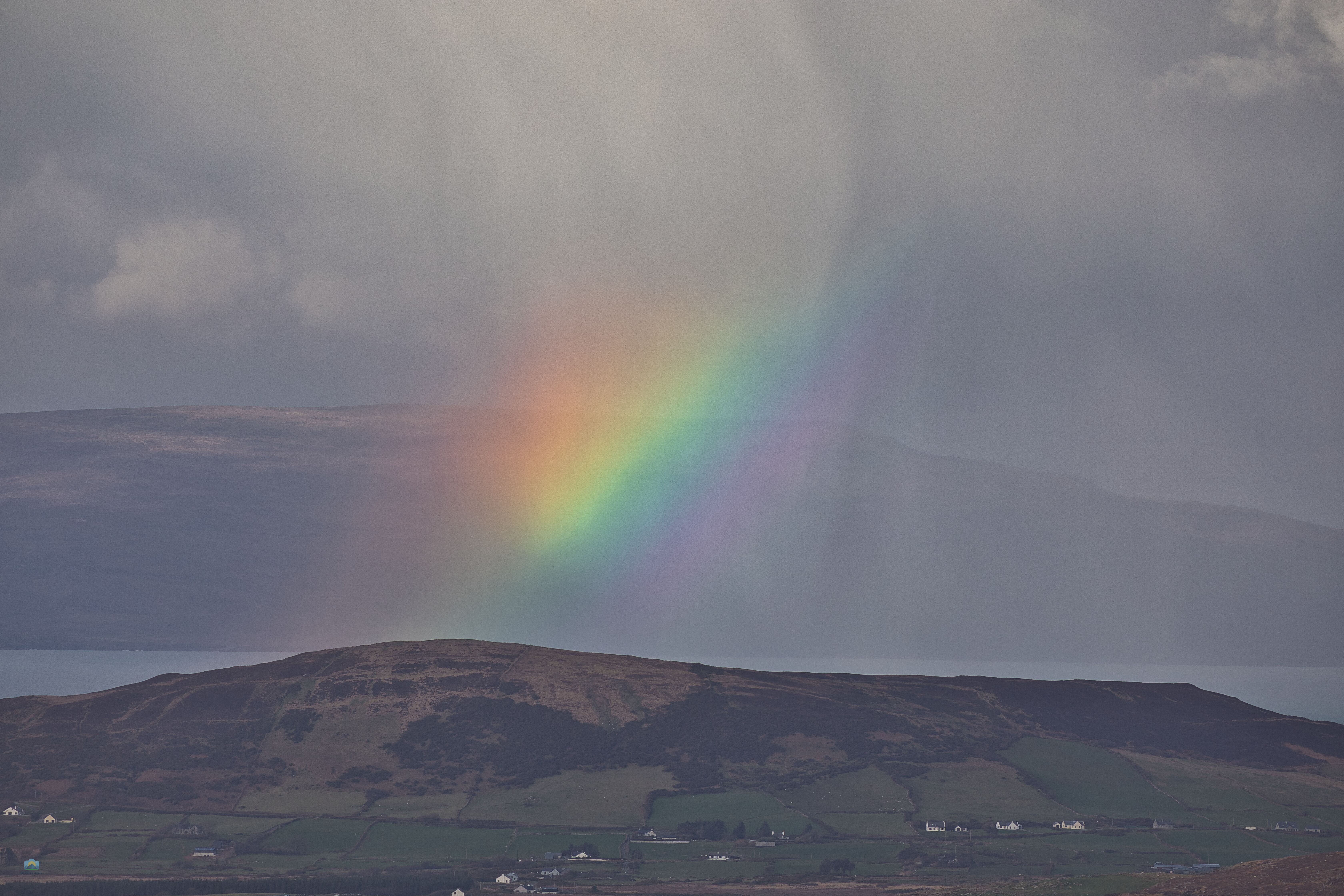
A passing shower carries a rainbow over the hill at Roonagh
The trigonometry point at the top is an interesting feature. These points were used by the Ordance Survey for mapping and surveying purposes. The hand-cast concrete pillar at the top is called a trig pillar or trig point. It has a fitting on top of it used to fix a theodolite or other surveying devices. Each pillar is in view of several others, and their position can be triangulated. This method of surveying was extensively used in the past and serves as a reminder of the rich geographical history of this region.
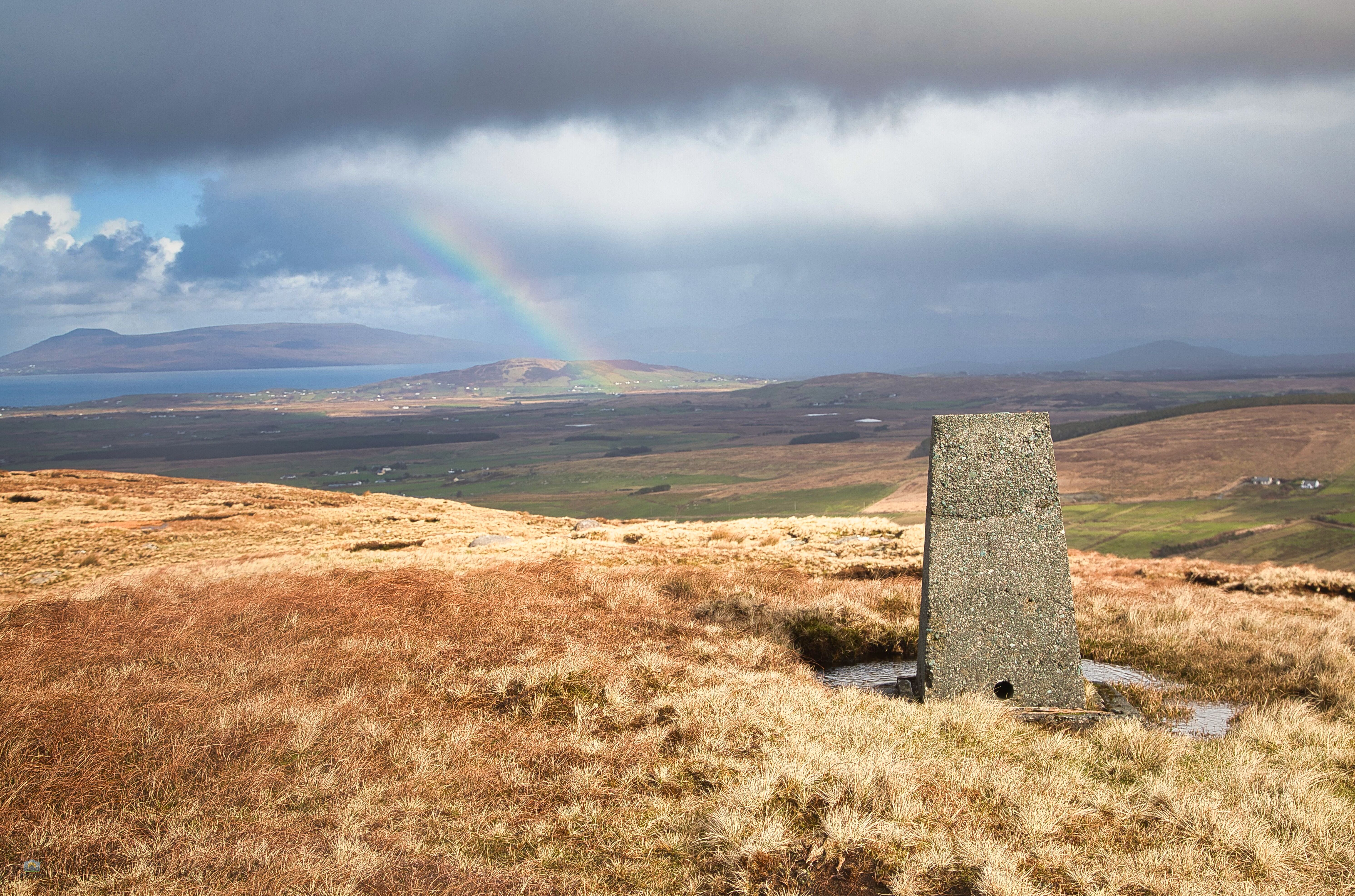
The Trigonometry Pillar on hill 286
From hill 286 and when I made it to the summit of Hill 312, I couldn't help but feel awestruck by the breathtaking view of Doo Lough and its valley in te distance. The lake cutting through the valley and the rich greenery of the surrounding forest created a picturesque scene that I could stare at for hours.

Tawnydoogan Wood stretches into the mountains in the distance, with the striking mountains of Clashcame and Mweelrea on either side of the Doo Lough valley, with Ben Creggan looking stunning in the middle.

The Doolough Valley's splendour can be clearly seen from the top of Hill 312.
As you look down into the Bunleemshough valleyfrom the hills, you will notice a ripple effect on the land. These are the traces of cultivation ridges, mostly for potatoes, made by smallholders during the eighteenth and nineteenth centuries. These ridges were called ‘lazy beds’ because they were seen as a lazy method of farming. However, this was far from true. Each ridge had to be hand-dug using spades to turn over the heavy sods, and fertiliser in the form of manure or seaweed had to be gathered and then transported up to the mountain fields. This method was well suited to locations lacking warmth, deep soil, and drainage, hence its prevalence in the upper boglands of the west of Ireland.

Undulating, wavy patterns of the lazy beds stretch out over the land, leaving a lasting impression.
The raised beds are drier and therefore warmer than the moist, flat ground around them. The beds warm up quickly in the morning and retain heat longer. At night, they protect crops from frost by draining the denser cold air into the ditches compared to flat fields. The lazy beds are the remains of a long tradition of cultivation in the West of Ireland and serve as a reminder of our tragic history during the Great Famine, when the potato harvest failed and the beds were abandoned.

More Lazy beds in the area
In conclusion, exploring the hills of the west of Ireland is a great way to learn about the history and culture of the region. The hills are not just a treat for the eyes but also a source of knowledge and insight into the past. Hills 267, 286 and Hill 312 are just three of the many hills in this region that have, from their summits, amazing views and a whole lot of history.

The light is doing beautiful things, looking towards Galway.
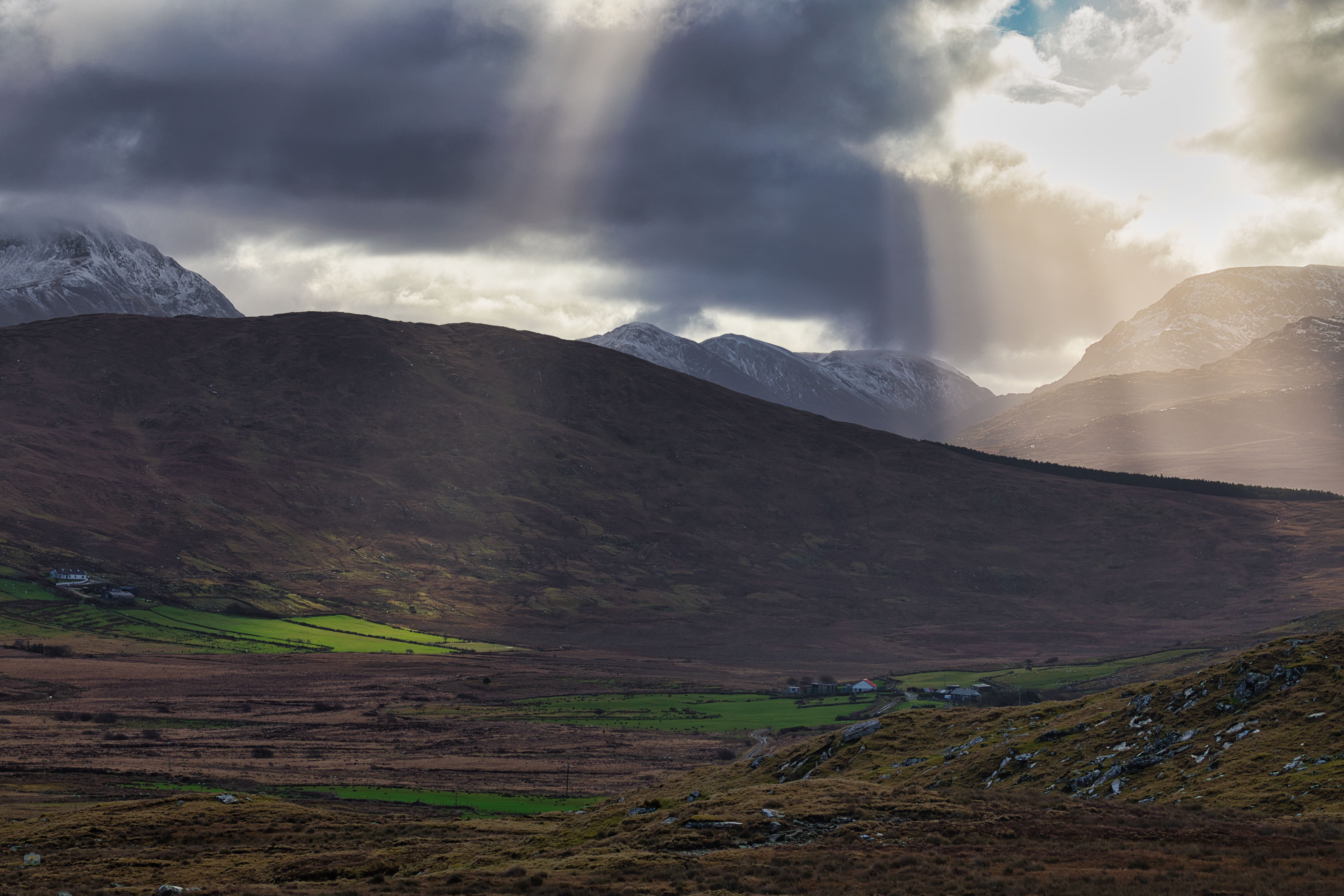
Fantastic light rays looking down into the Bunleemshough River valley
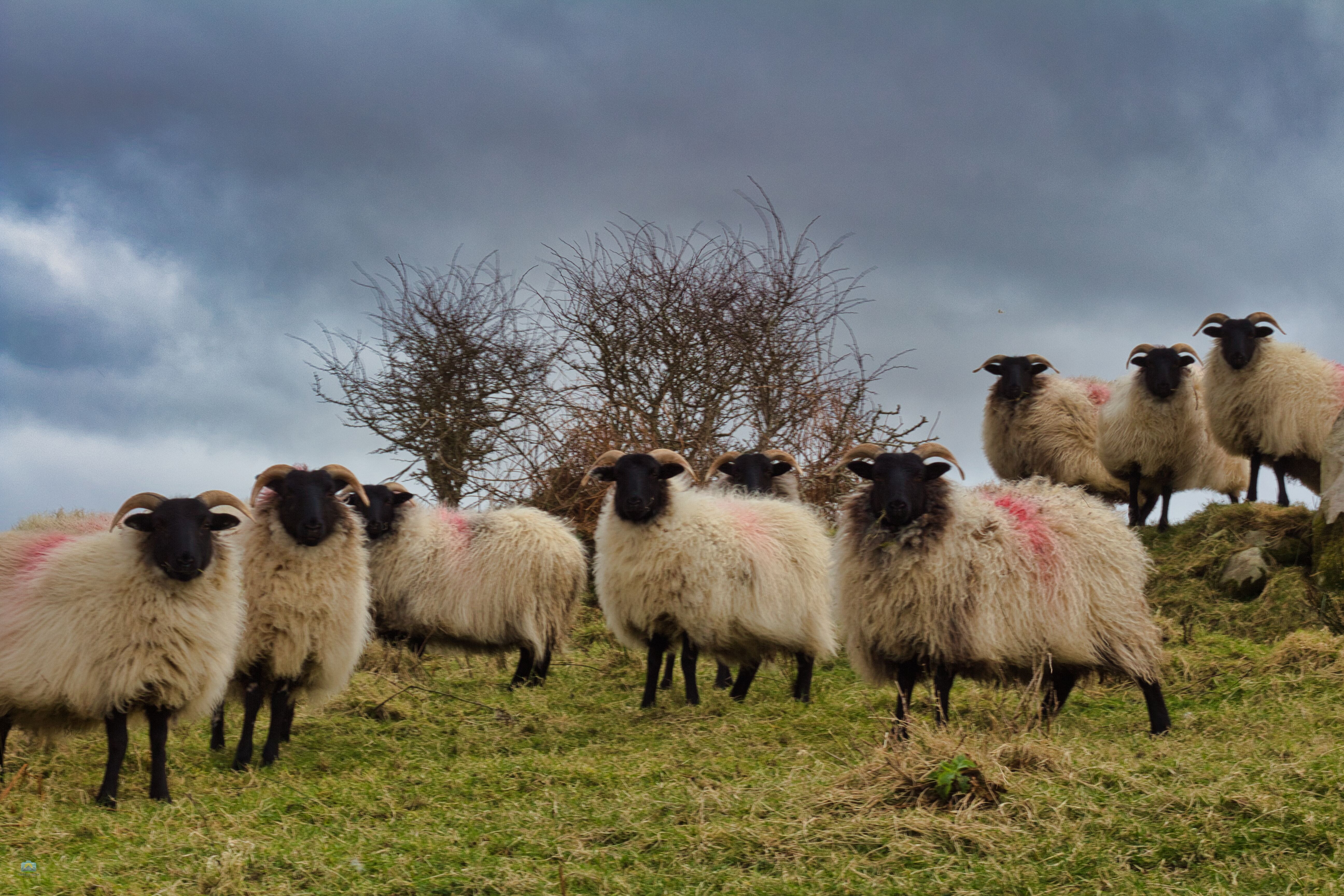
And of course an obligatory picture of the local sheep is a must ! 🐑🐏🐑
Carpe Diem