Exploring the scenic Keenagh Loop Walk and Climbing Knockaffertagh 🧭🧗
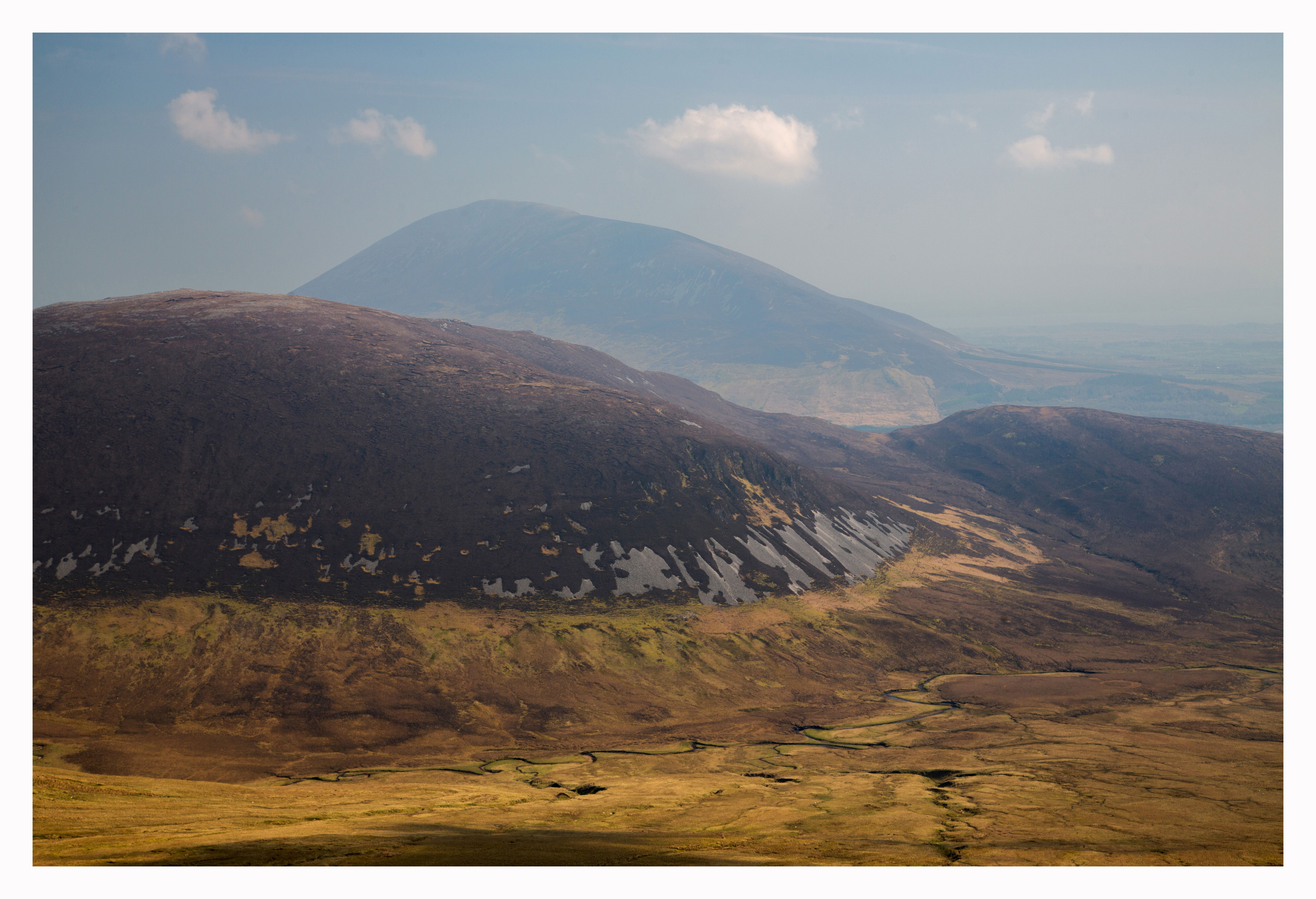
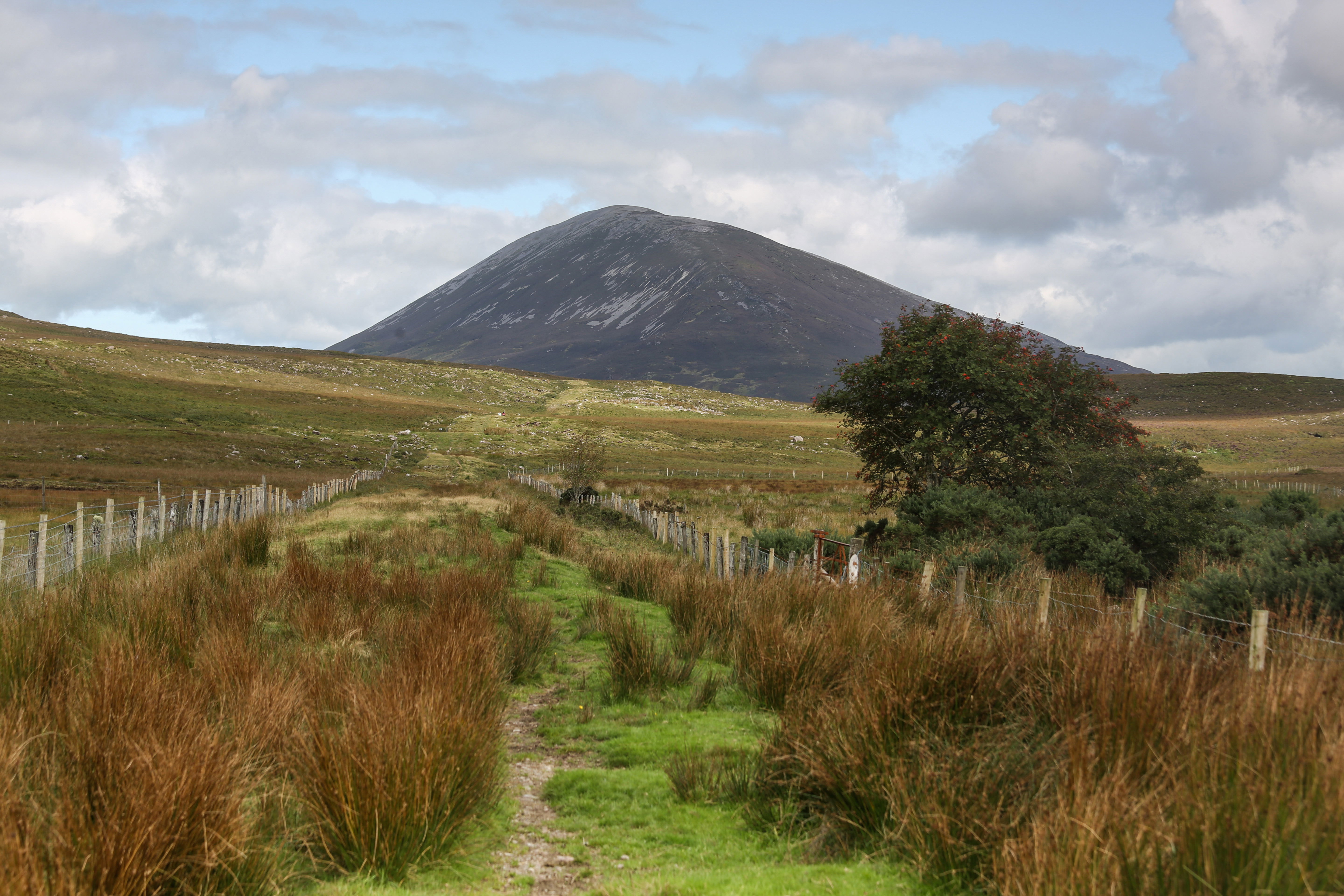
Knockaffertaghi in the middle distance with Nephin in the background taken from the summit of Birreencorragh on an earlier trek.
“For hiking is one of those things that you can only do when you have the determination in you."
Anon
This trek is a continuation of a trip I took to Birreencorragh back in May. I didn't complete the entire ridge line that time, but I swore I'd return to climb Knockaffertagh sometime later this year.

Route, OS Sheet 31, Parking G067 067
(approx 14kms).
The Trek

Fleeting light streaks appear suddenly across the landscape early in the morning.
This walk delivers a tough circuit with a blend of beautiful scenery and a secluded environment for anyone to enjoy, and is especially a great hike for those who have not done the Keenagh Loop Walk before. The loop is usually done in a clockwise orientation, but I did it in an anti-clockwise direction this time since I wanted to include the climb to Knockaffertagh.

Birreencorragh on the left and Knockaffertagh on the right with the Glendorragha River gently flowing out through the valley.
After parking at the Bellanaderg Bridge car park, I followed the road to the right all the way to the end, where it crosses over a couple of stiles and then enters the open countryside. Taking a detour from the Keenagh loop walk proper, I set out on an elevated route of least resistance (or so I thought!) and began the ascent.
The gradient eased off to a more comfortable climb after approximately 200 meters of lung-bursting exertion, allowing me to soak in some of the spectacular panoramas that were now just beginning to materialize. I observed that Nephin hasn't fully awakened yet, and the cloud cover on top is gradually dissipating as the early morning sun rises higher in the sky.

Nephin with the cloud on top in the process of lifting.
On the summit, I discover a traditional cairn constructed of stone approximately one meter high, which is typical of what can be found on mountain tops in these parts of the Nephin Begs. Also uniquely, there was the presence of white quartzite rocks strewn across the ground, as if someone had painted the rocks white with a bucket of white paint. The contrast of white against the grey rocks in the surrounding landscape really made the scene stand out.
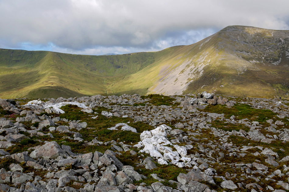
Quartzite rock can be easily spotted among the numerous grey scattered rock with Birreencorragh in the background rising to 700 mts.
The views from the summit of Knockaffertagh are magnificent, especially those of Nephin to the east and Birreencorragh to the west, and the great trout and salmon fishing lakes of Loughs Conn, Cullen and Beltra can be seen far off in the hazy distance.
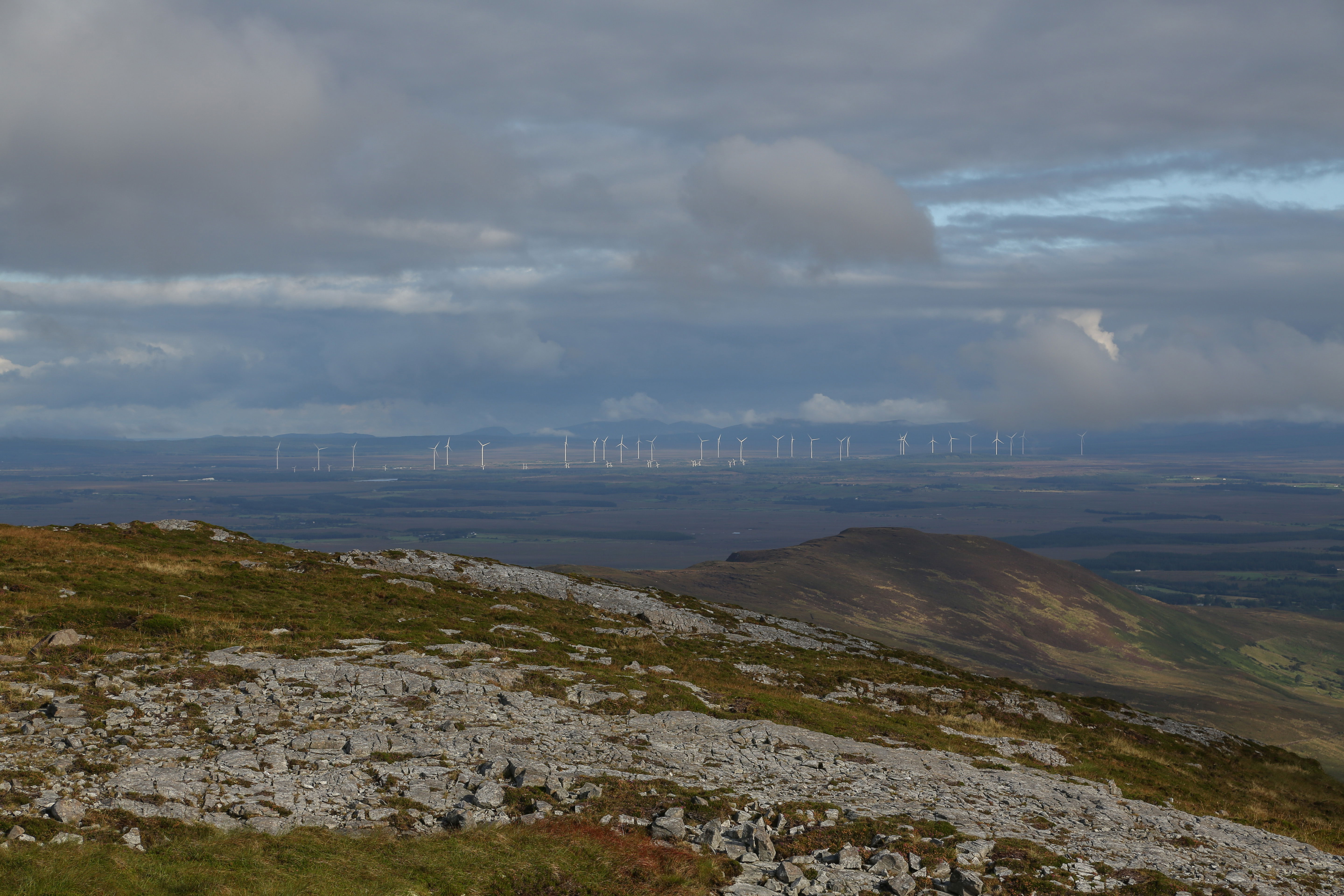
The Wind Farm near Bangor Erris can be clearly seen.
You can also get fantastic views of the neighboring lowlands from the summit. The Glendorragha River rises in a valley between the Birreencorragh and Knockaffertagh mountains, winding its way over the countryside until it reaches the Crumpaun River near Prughlish, where it flows into Beltra Lough. I came across this river on my visit to Birreencorragh earlier and was intrigued by the way it meandered its way out of the steep-sided valley. It occurred to me that what I was looking at was a magnificent, pristine environment that hasn’t changed significantly in thousands of years.
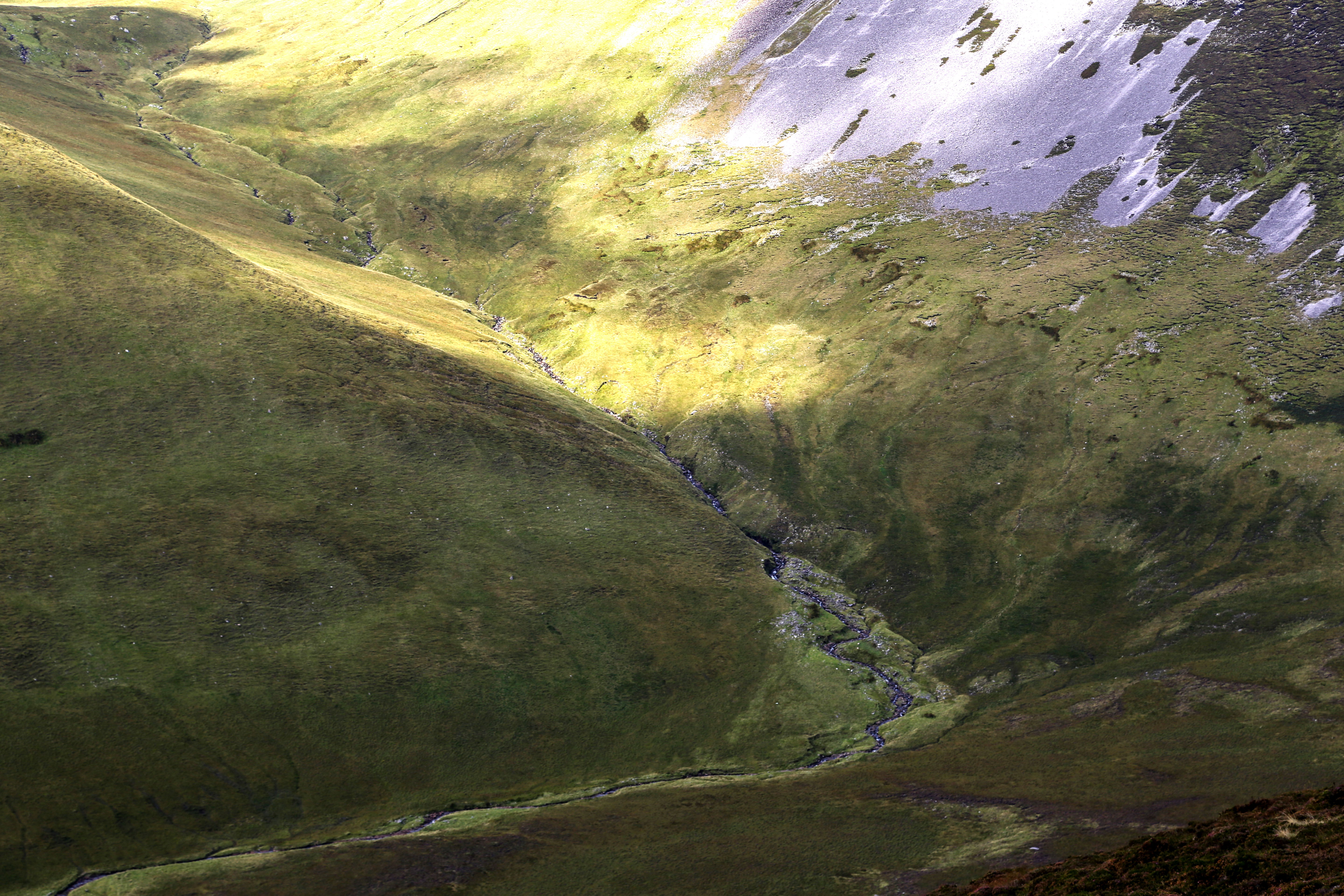
The Glendorragha river rises in the hills of Birreencorragh.
Heading off the side of the mountain, I found myself following a sheep trail that wound its way through the dramatic slopes. After navigating for about a kilometer, I changed direction to the east and descended until I rejoined the Keenagh loop trail. As I continued, I reached the picturesque Glendorragha River nestled at the bottom of the valley. Following its meandering path, I located the ancient trail leading northward toward Nephin Mountain. The sense of history and mystery surrounding the ancient track added an extra layer of fascination to my journey.

A panoramic picture taken from the side of Knockaffertagh. A purple hue can be seen from the colour of the heather this time of year.
The hike culminated with a satisfying return to the parking spot, completing a truly memorable and pleasant walk. The added ascent of Knockaffertagh only enhanced the feeling of accomplishment, making the entire experience even more rewarding.

Looking towards Crossmolina.

Beltra Lough.
Ancient Roads
Exploring the Keenagh Loop Walk in Mayo is a fascinating journey through time and nature. The trail follows an ancient route that once connected Newport and Crossmolina, offering a glimpse into the laborious process of building and maintaining road networks in the wilderness before modern machinery. Mayo's roads began as simple paths and tracks, gradually evolving into more permanent routeways. One such ancient trackway, the Tóchar Phádraig, predates St. Patrick in the 5th century and is believed to have originated at Rath Cruachain in Co. Roscommon, extending all the way to Croagh Patrick near Westport. Another notable route is the Bangor Trail, a 28-mile path from Newport through the Nephin Beg mountains to Bangor Erris. Despite these early routeways, Co. Mayo lacked a comprehensive transport system until the 18th century when individual parishes became responsible for their own roads. This resulted in varying standards and maintenance throughout the county. The rich history of Mayo's roads underscores the resilience and ingenuity of ancient communities, whose efforts paved the way for the modern transport networks we rely on today.
The ancient Newport to Crossmolia highway, now part of the Keenagh Loop leads back towards Nephin Mountain.
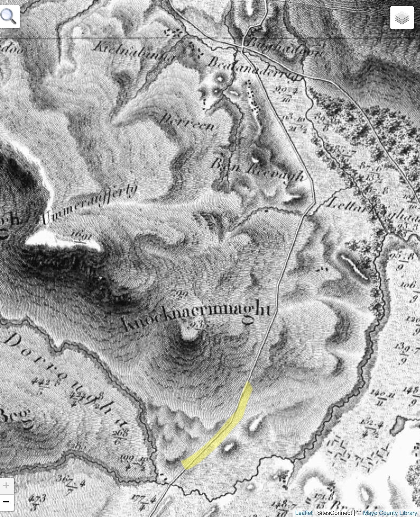
The Bald Map is a map of the Maritime County of Mayo in 25 sheets which commenced in 1809 and terminated in 1817 by William Bald F.R.S.E. Printed in 1830. Now part of the Keenagh Loop Walk part of the ancient Highway pictured in the above image is highlighted in yellow.

Frozen in time, An unusual stone formation found near the summit.
Carpe Diem