Birreencorragh 700mts. ! ⛅️
“Mountains have a way of dealing with overconfidence.”
Hermann Buhl
At last, the time finally came when I was allowed to travel freely again in the county, with COVID 19 easing somewhat due to the long lockdown and the introduction of the vaccination programs. I decided to climb Birreencorragh Mountain to take advantage of the opportunity to get out and about again, especially since I hadn't been out much since Christmas. I have read a lot of good things about climbing Birreencorragh, especially here, where I heard the views from the summit are fantastic.
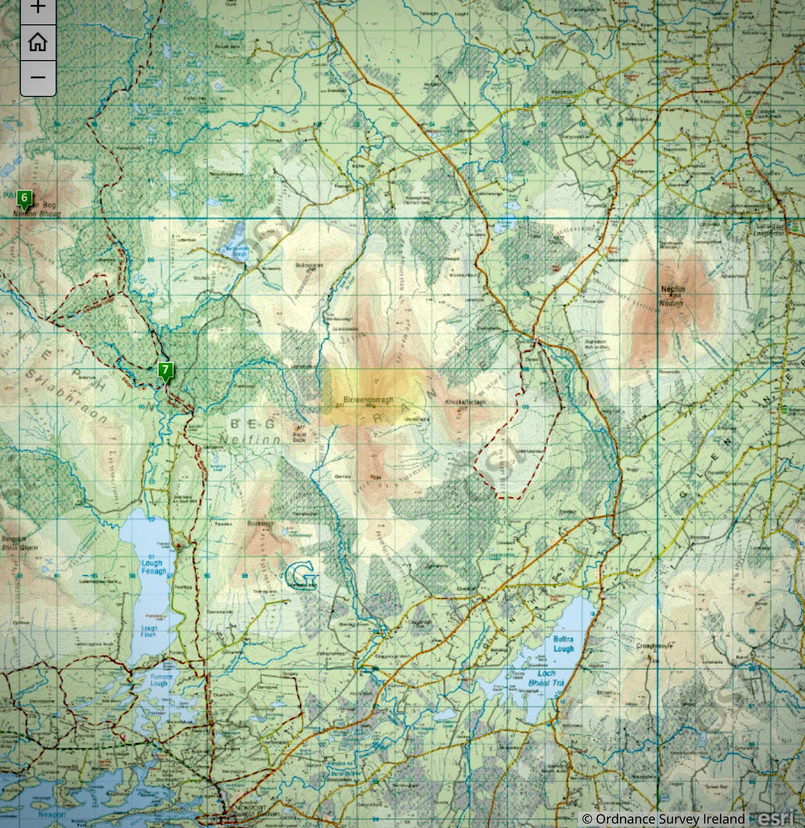
OSI 1/50000 General location of Birreencorragh
Birreencorragh, the Irish name "Birin Corrach," meaning "rocky little spike," is situated about 30 km north of Castlebar in the Nephin Beg range of mountains. According to the OSI, the height of the mountain is 698 m, and like a lot of mountains in this part of the country, a cairn is situated on top. Reading many reviews from people who have climbed it, I note that most hikers decide to climb it from its southern approach. This southern route takes in another summit of Birreencorragh South Top, at 564 meters high. Two for the price of one !
I decided that I would follow suit !
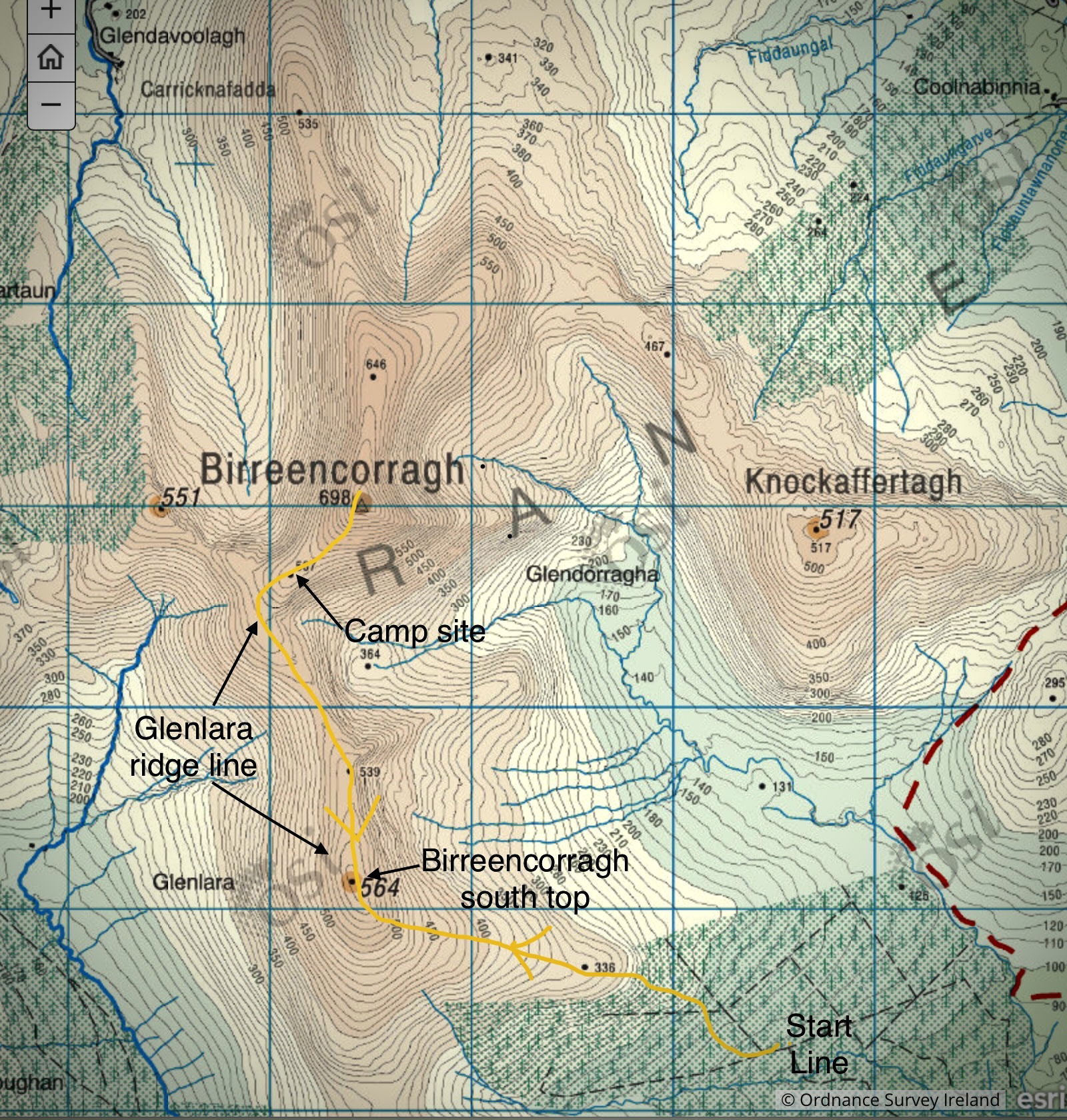
The Route that I followed. Up and Down the same way.

Birreencorragh as seen from my house in Castlebar
Route
1. Birreencorragh South starting line
When I arrived at Coilte Wood, I decided not to drive to the end of the forest track but rather to park my car at a suitable location at the road junction (marked start line on the OS map). From here up to spot height 336, it is tough going as the terrain is steep with felled trees, long grass, and a lot of hidden drain holes underfoot. After this, the terrain peters out to typical short-grass sheep grazing land. In fact, when you clear the forested areas and Hill 336, the going is fairly good. I get my first glimpses of the beautiful landscape from this vantage point after a bit of lung-bursting trekking up to Bireencorragh South Top at 564 m.
 Birreencorragh South Top pictured from the Camp site
 Birreencorragh South Top showing the full extent of the Glenlara ridge line pictured from the Summit of Birreencorragh
2. Birreencorragh South Top to Camp site
There are numerous cairns on Birreencorragh South Mountain, and two of them are listed on the Irish Monuments website. From the top, the vista opens out to reveal the Glenlara ridge line running towards Birreencorragh itself before it sweeps right round to where it begins to rise for the summit. One of the nicest walks you can have on a mountain is along this ridge line, as the whole open landscape towards the west and east is fully opened up. Also, the going is good here as the ground is dry and downhill until it begins to rise again at the top of the mountain. On the day I walked this ridge, the weather was fantastic but a bit hazy.
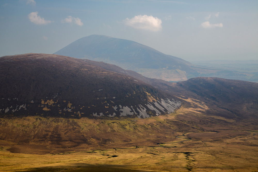
Knockaffertagh with Nephin Mor in the background viewed from South Top looking towards the East.
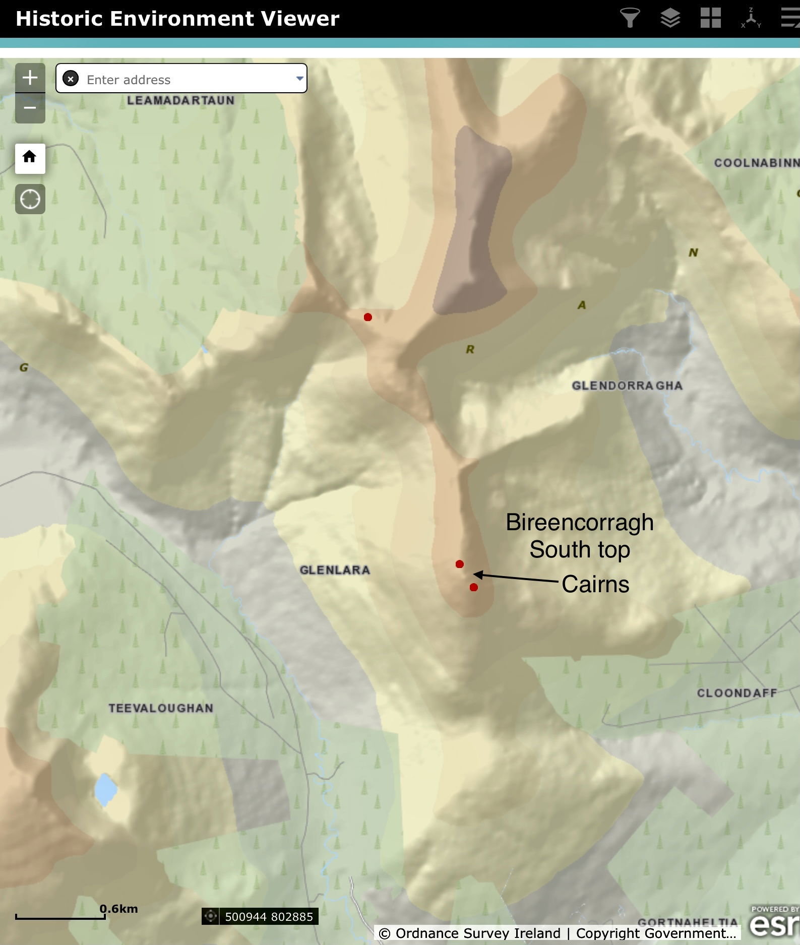
Irish Monuments Website

View from one of the Cairns on South Top looking towards the summit of Birreencorragh
3. Camp Site to the Summit.
My initial thought of the trek was to do the Birreencorragh loop walk, which would have brought Knockaffertagh into play and a stay on the mountain top. When I arrived at spot height 587 (the camp site on the map), I found it to be very windy and thought that staying on the top that night might not be a good idea. I did a quick assessment of where I was stopped and decided that this spot would make an excellent camp site for the night. Observing the summit from here also helped me decide that I would not be going on to Knockaffertagh after all, as the gradient up and over was steep, and it would have been dangerous to attempt to do it with all the gear I was carrying. I decided that I would wait until the morning to climb it, and without all the "luggage" in tow, it would be a lot easier. Besides, it was getting close to sunset time anyway, and I wanted to get some shots of that.
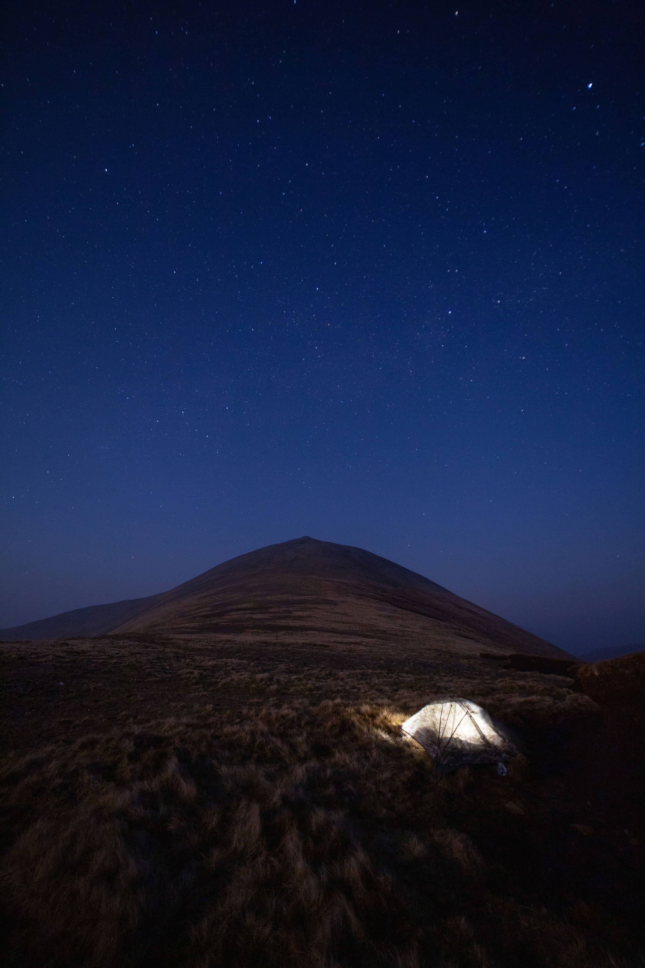 Tent pitched about 100mts from the top.
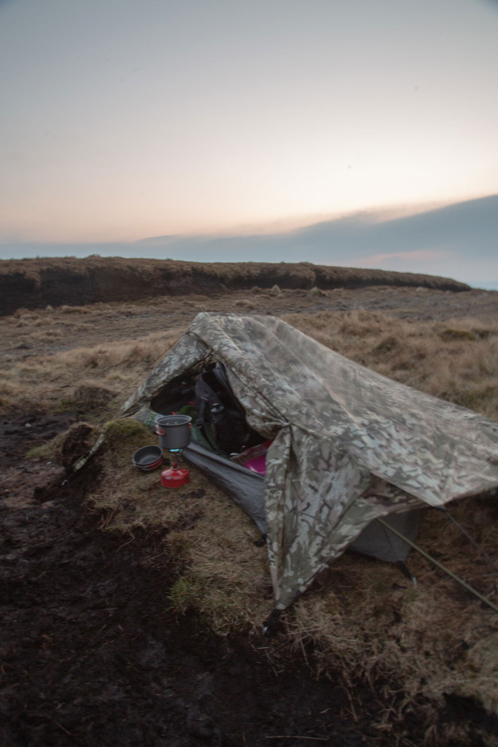
Home for the night
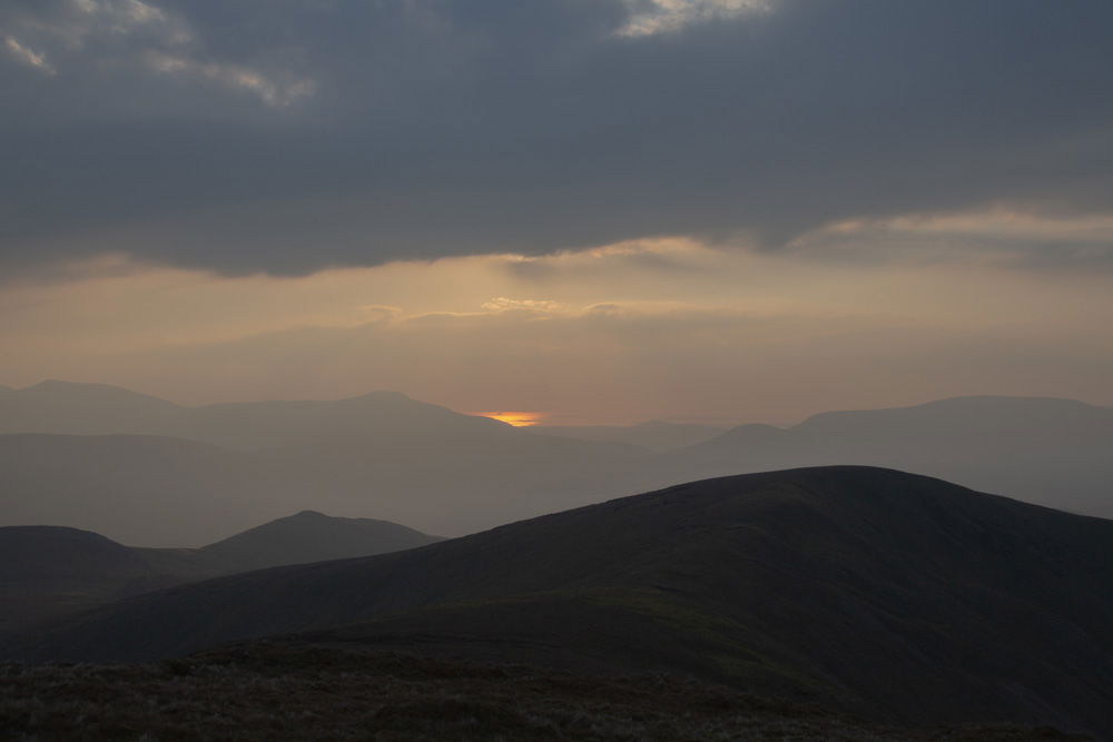
Sun beginning to drop down on the horizon to the West. Blackrock Island can just be made out in the sunlight reflected on the sea.
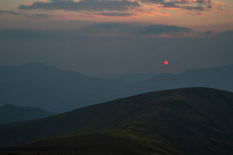
A Red Sun pictured over Nephin Beg and Corslieve to the west.

Looking towards the two Corabinnias In the Mulranny direction.
4. Night
When on a journey like this, I always like to do some astrophotography, but sadly, two circumstances did not work in my favour. Even though there were no clouds this time, the haze that had lasted throughout the day and into the night, along with a waxing gibbous (56 percent) moon, made it hard to capture the stars in any meaningful detail. I might have had a chance to capture the Milky Way even with the brilliant moon if there hadn't been any haze, but I will have to wait a little while longer for that opportunity. I did, however, succeed in capturing a beautiful atmospheric image of the setting moon.
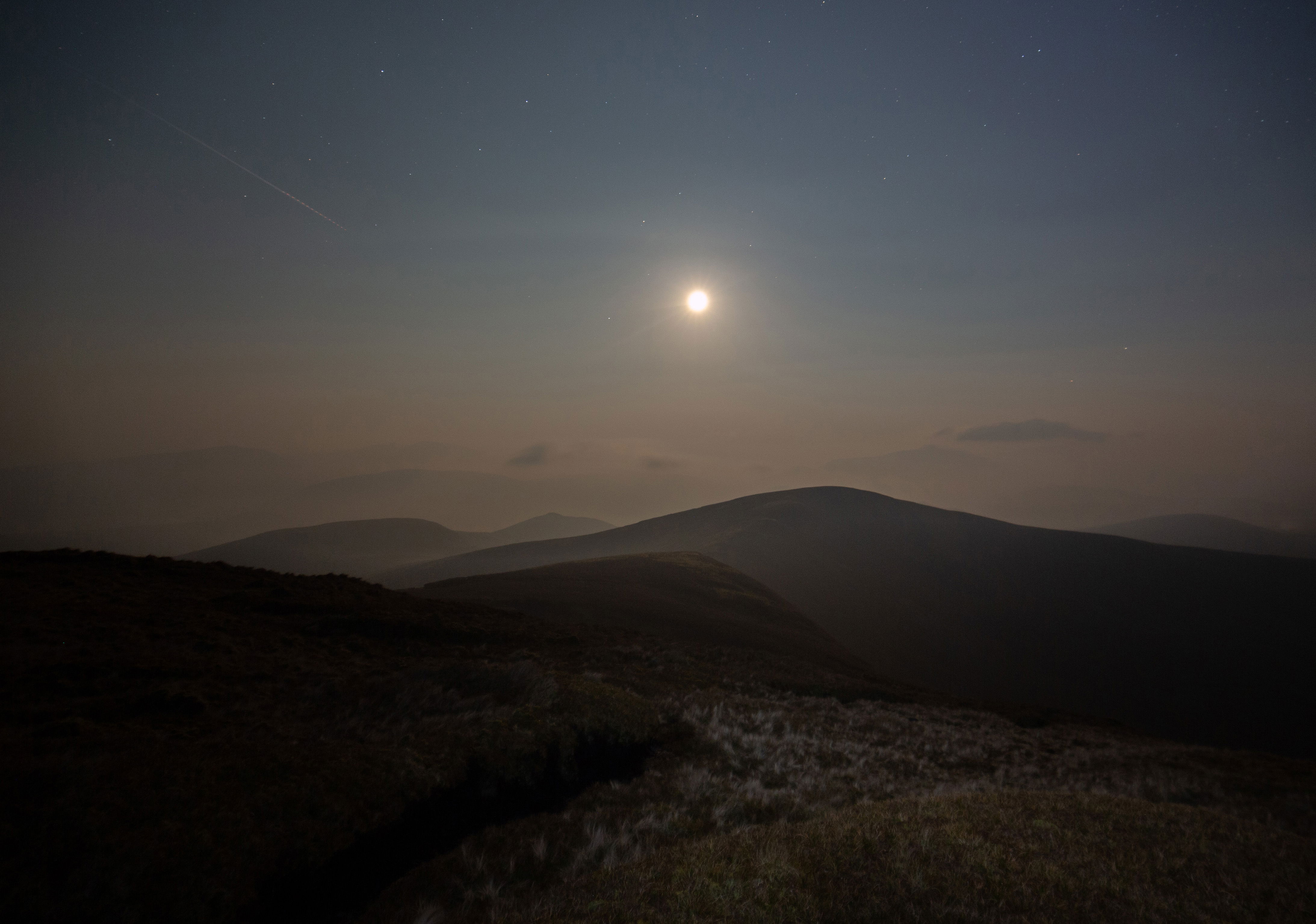
The Moon setting in the West.
5. Sunrise
Sunrise the next morning was a wonderful experience to witness, in that a line of cloud shot up and over the summit from the south, moving like a fast conveyor belt. The sun had just gotten over Nephin, and as it was making its first appearance, I captured this shot from the camp site below. Shortly after that moment, the cloud disappeared, and I felt lucky to have been so close and to have witnessed this wonderful phenomenon.

The Summit with the rapid moving layer of cloud.
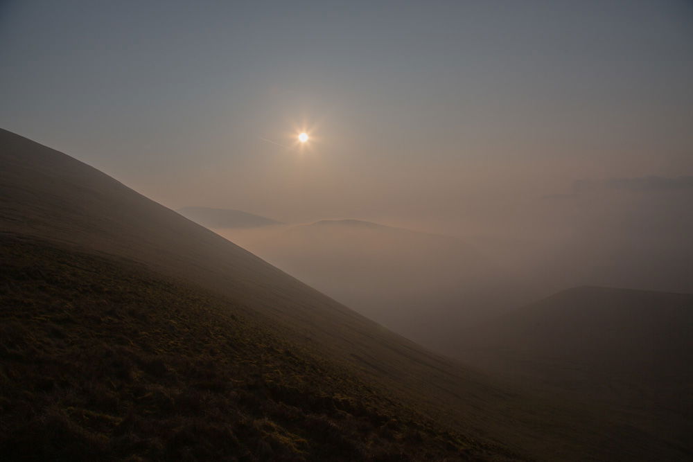
Sunrise looking towards the East and Nephin Mor. Croaghmoyle can be seen just about through the haze on the right.
6. The Summit.
It was time to ascend the final 100 meters once the sun had risen and I had eaten something. By this time, the clouds were gone, but the haze persisted. It was a gorgeous sunny morning as I went out for the summit while carrying my camera and tripod in a small backpack. With the steep incline and loose stone covering the ground, the summit climb appeared to be a bit scary from where I was camping. However, as I made my way up the summit, I discovered that it wasn't as difficult as I had initially anticipated, and before I knew it, I had reached the top.
A cairn once again dominates the top, and strangely, it is not mentioned on the Irish Monument Website, so I could not get any background information on it. Located beside the cairn is a four-wall sort of shelter made of stone. However, it did not appear to be very comfortable for use as a shelter. I am not sure if this construction is of the same age as the cairn or whether it was built by climbers to use as a shelter in more recent times.
Information added by Ger McGreal in response to the above query,
“The Cairn you mention used to support a trig point on top which was knocked down about 15 years ago. I would imagine it was built in the 1930s. The bivy shelter has been added to throughout the years and is relatively new. It provides great shelter on a bad day for a snack. I've never over nighted there but have thought about it lol. The biggest drawback about birreencorragh is access if you have camping gear and it is a slog. There is an alternative route up from the Keenagh side which is long but less arduous.”

The Summit.

The stone Cairn on top of Birreencorragh.


Looking north from the Summit along the spur that leads down into Keenagh.
7. 700 mts !
By placing a few additional stones on the cairn, Birreencorragh, which is officially 698 meters high, was raised to 700 meters on this journey, helping to preserve the structure of course ! 😁🇮🇪😁

GPS to prove it !!!
I spent around three-quarters of an hour on the summit before making my way back down the mountain to grab my camping gear. Before turning around and going back the way I came, I took a few more pictures of the surrounding landscape.
Thanks for taking the time to read this blog about my trip to Birreencorragh. I hope it gave you a small taste of what hiking is like in this area of the West of Ireland. It was a wonderful priviledge to be able to do the trek and I encourage everybody and anyone to take to the Hills and enjoy the freedom an experience like this can offer.
REMEMBER LEAVE NO TRACE !
Carpe Diem