Conquering the Bangor Trail: An Adventure Through North Mayo. 🥾🎒
“Hiking is the answer, who cares what the question is,”
Unknown
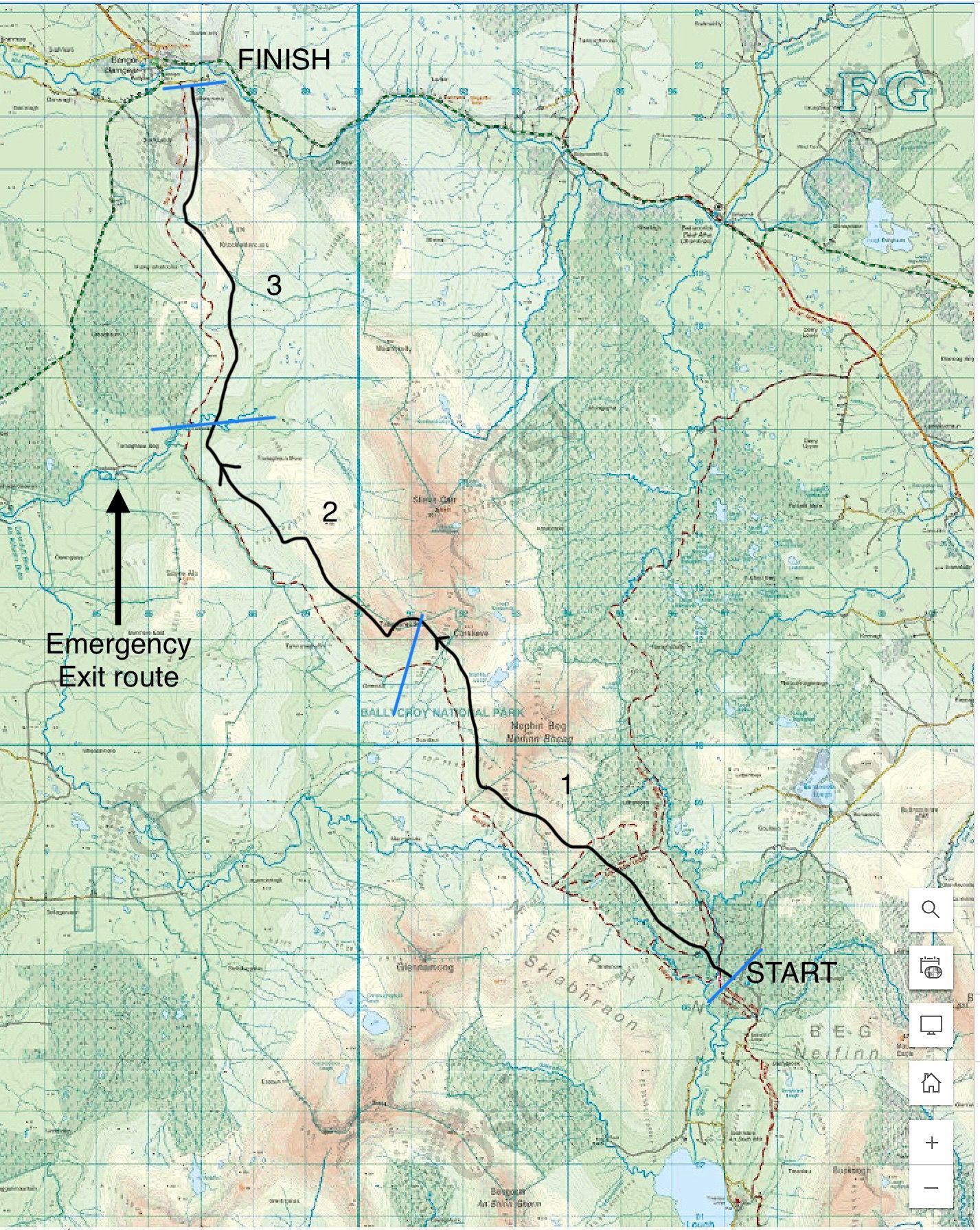
OSI 23
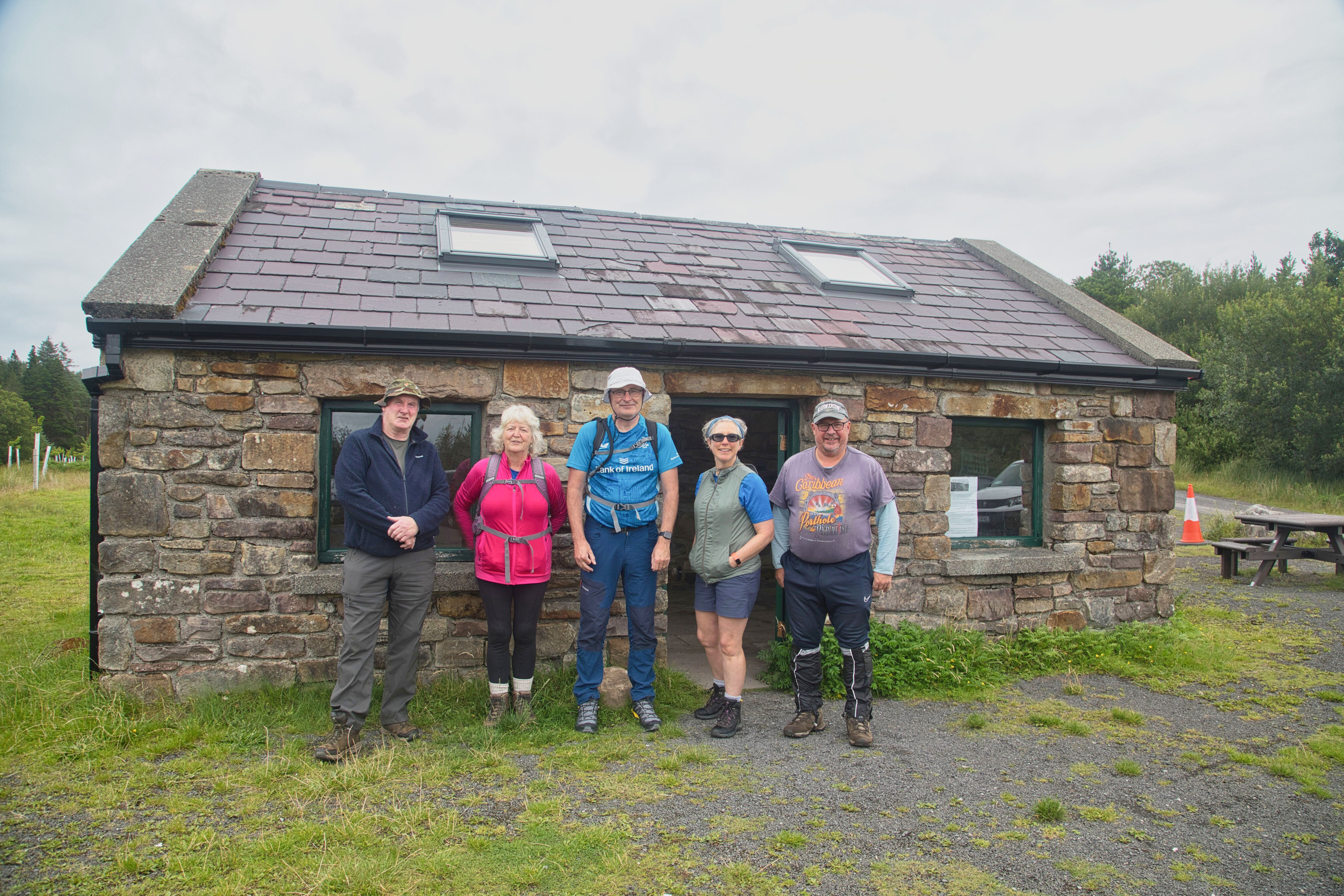
At the Brogan-Carroll bothy in Letterkeen, getting ready for the long trek, myself, Margaret, Sean, Cecily and Mick
Last summer, while traversing the picturesque landscapes of North Mayo with some friends, I couldn't help but notice the end of the Bangor Trail as it gradually descended from the hills near the town of Bangor Erris. Suddenly, it struck me—I had never completed the full trek from Letterkeen to Bangor. Sure, there were fragments of the trail that I had explored before, like when I summited Slieve Carr and Nephin Beg or embarked on shorter loop walks around Letterkeen. But the full trail? That remained unchecked on my bucket list. As our conversation flowed during the car ride, it only seemed natural to contemplate finally conquering the complete Bangor Trail. After some discussion, we all agreed that early August was the ideal time for our adventure. Fast forward to the 1st of August 2025, and I find myself standing at the Brogan Carroll Bothy, all geared up and buzzing with excitement alongside four fellow adventurers, ready to tackle the challenge ahead.
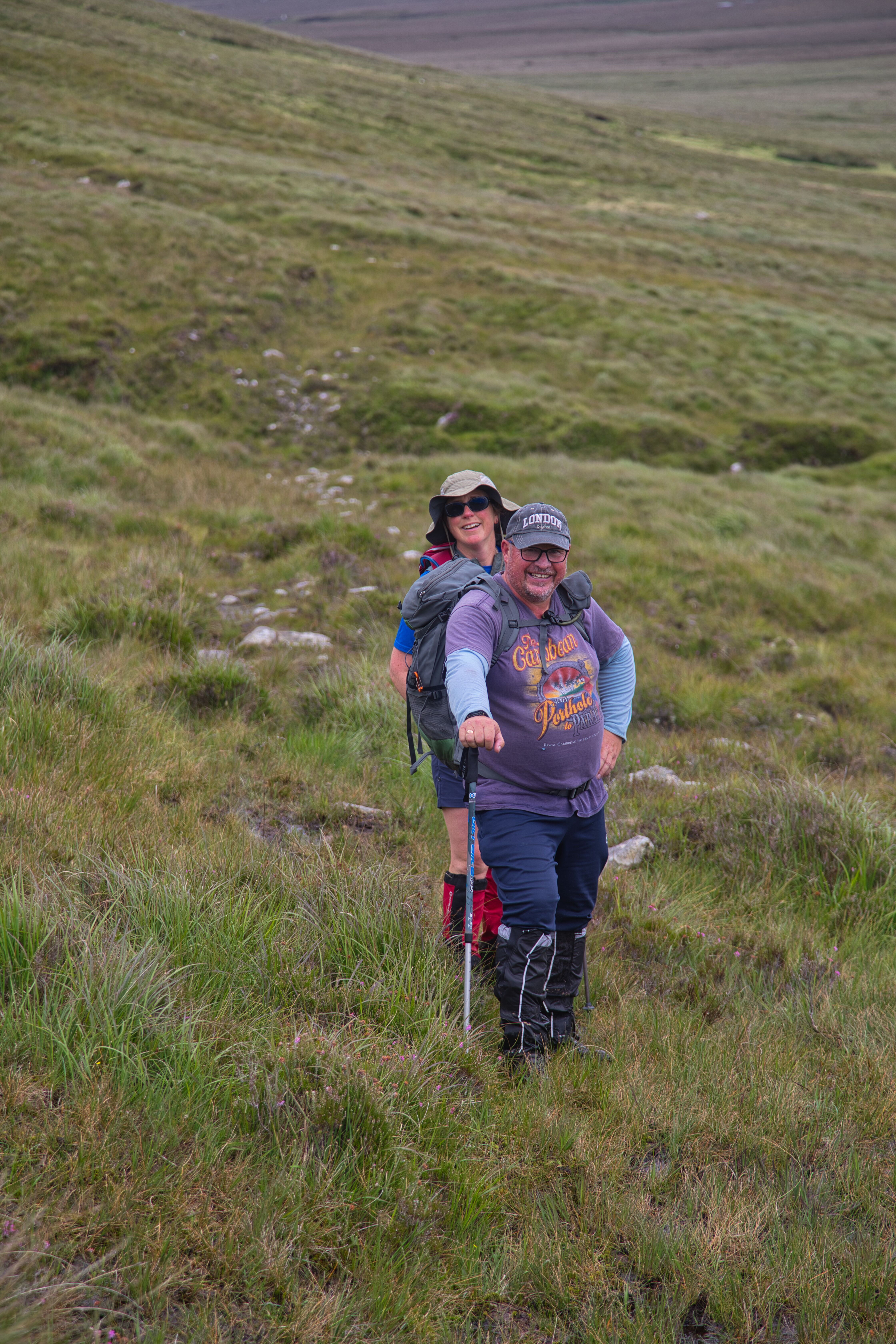
Mick and Cecily pause for a photo out on the trail.
The Bangor Trail is a legendary long-distance hiking route that cuts through the heart of North Mayo’s Nephin Beg mountains, offering one of the most remote and challenging treks in Ireland. Stretching approximately 26–30 kilometres from the Letterkeen trailhead to Bangor Erris, this trail is a journey through blanket bogs, trackless wilderness, and haunting silence, following an ancient drover path that may date back to the Iron Age. The Bangor Trail is famed for its rugged and unforgiving terrain consisting mainly of soft bog with many areas of wet flushes and rocky tracks. The route crosses rivers, open moorland, and remote valleys, with no houses or services along the way.
One of many great views looking back towards Letterkeen
Set against the picturesque backdrop of the Nephin Begs, our adventure begins at the Brogan Carroll Bothy, situated at the start of the Letterkeen trailhead in Srahmore. This charming hut holds an interesting story, named after two Irish-Americans—John Brogan and Barry Carroll—whose love for this striking landscape inspired their generous contributions to its renovation. Their spirit seems to linger in the air as we set off, eager to explore the beauty that captivated them.
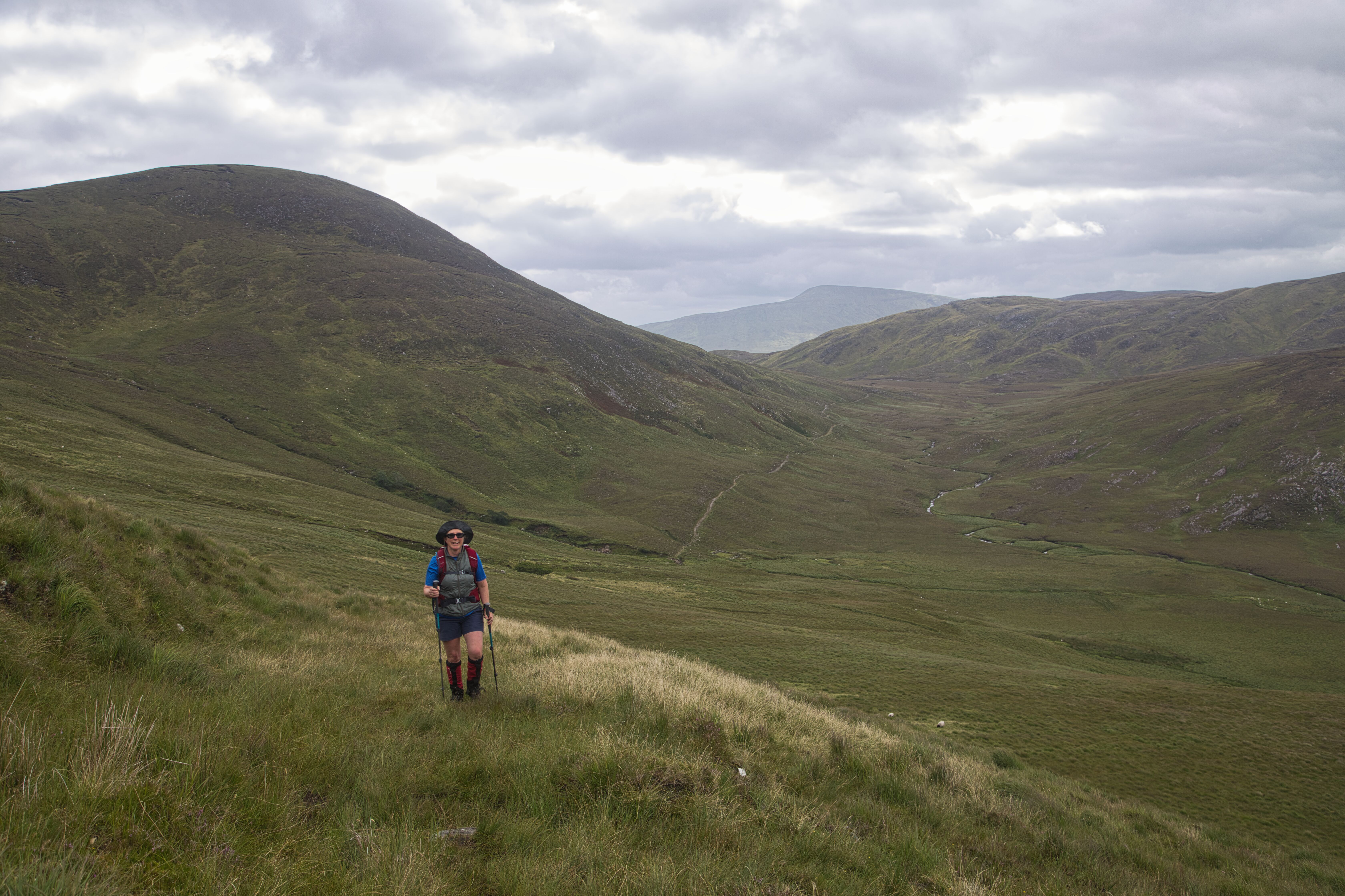
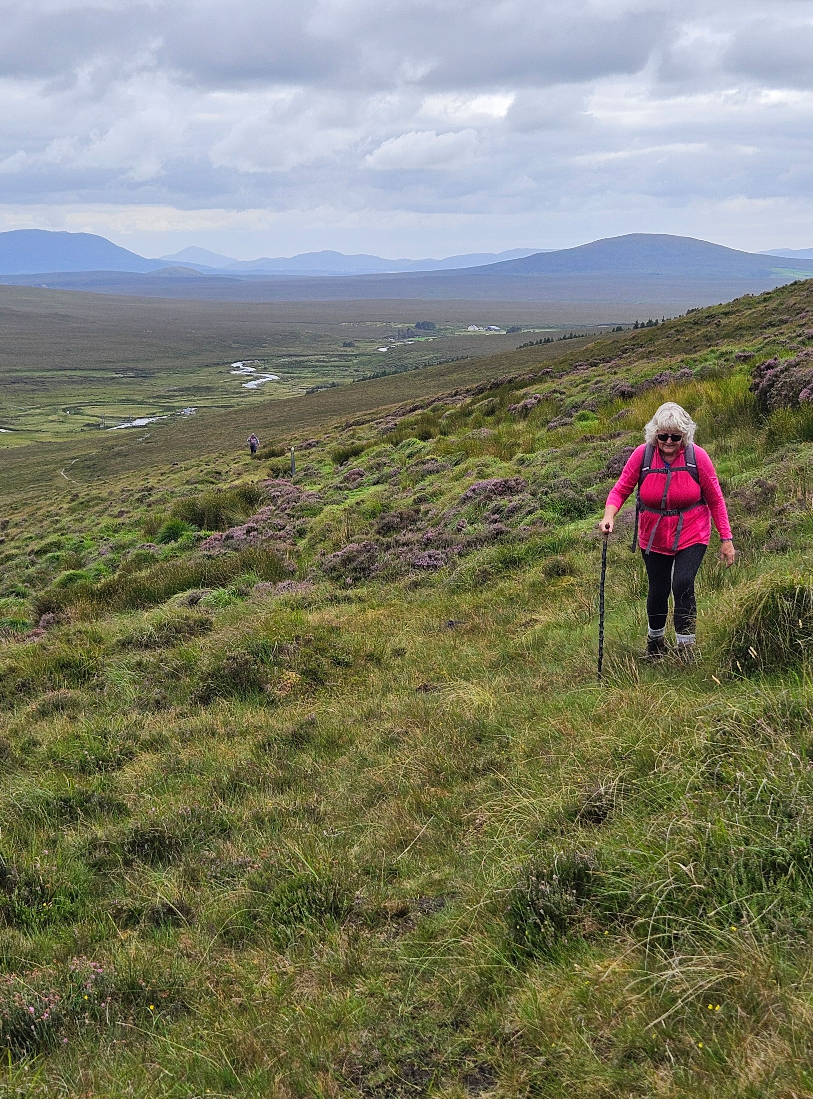
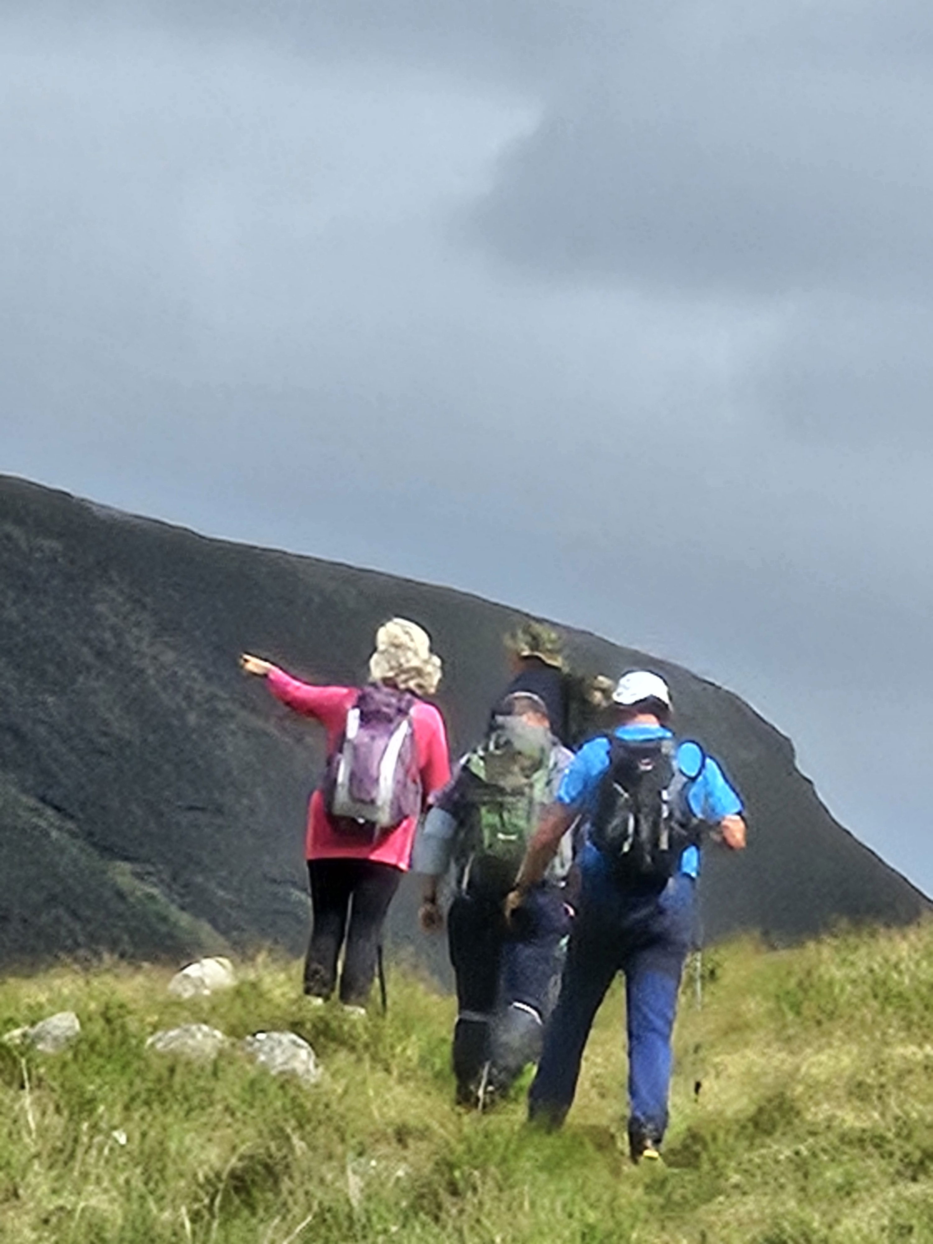 Margaret points out the track ahead!
 Our trek moves alongside the flowing Altacooney river, a serene companion leading us uphill along the forest line to the Lough Aroher shelter, also known as the Mountain Meitheal hut. Sitting at the foothills of the Nephin Beg mountain, this shelter, with its three sheltered walls and pitched roof, offers a cosy respite. The raised sleeping platform can accommodate a small group, making it a perfect stop for weary travellers looking to escape the worst of the elements.
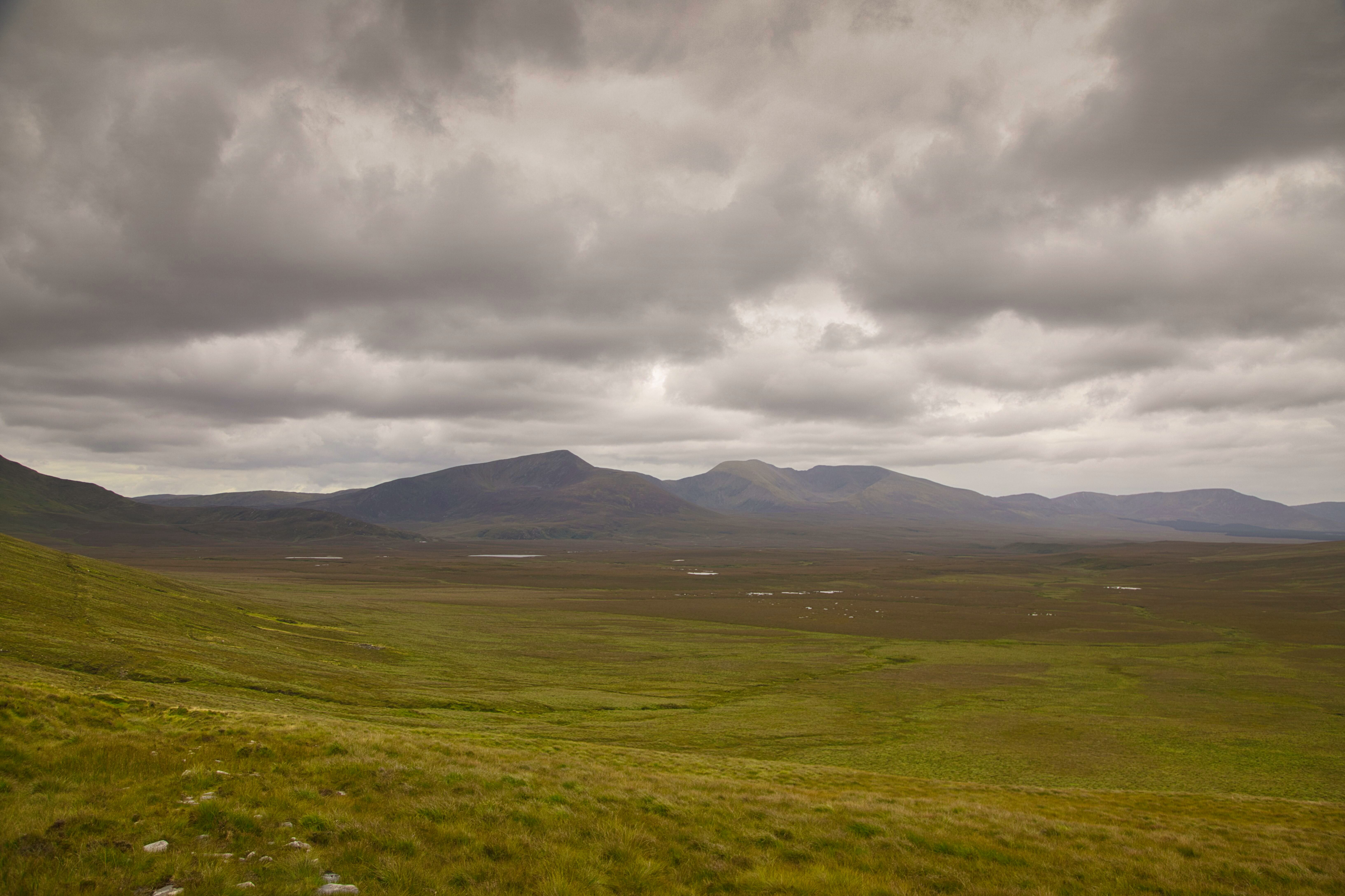
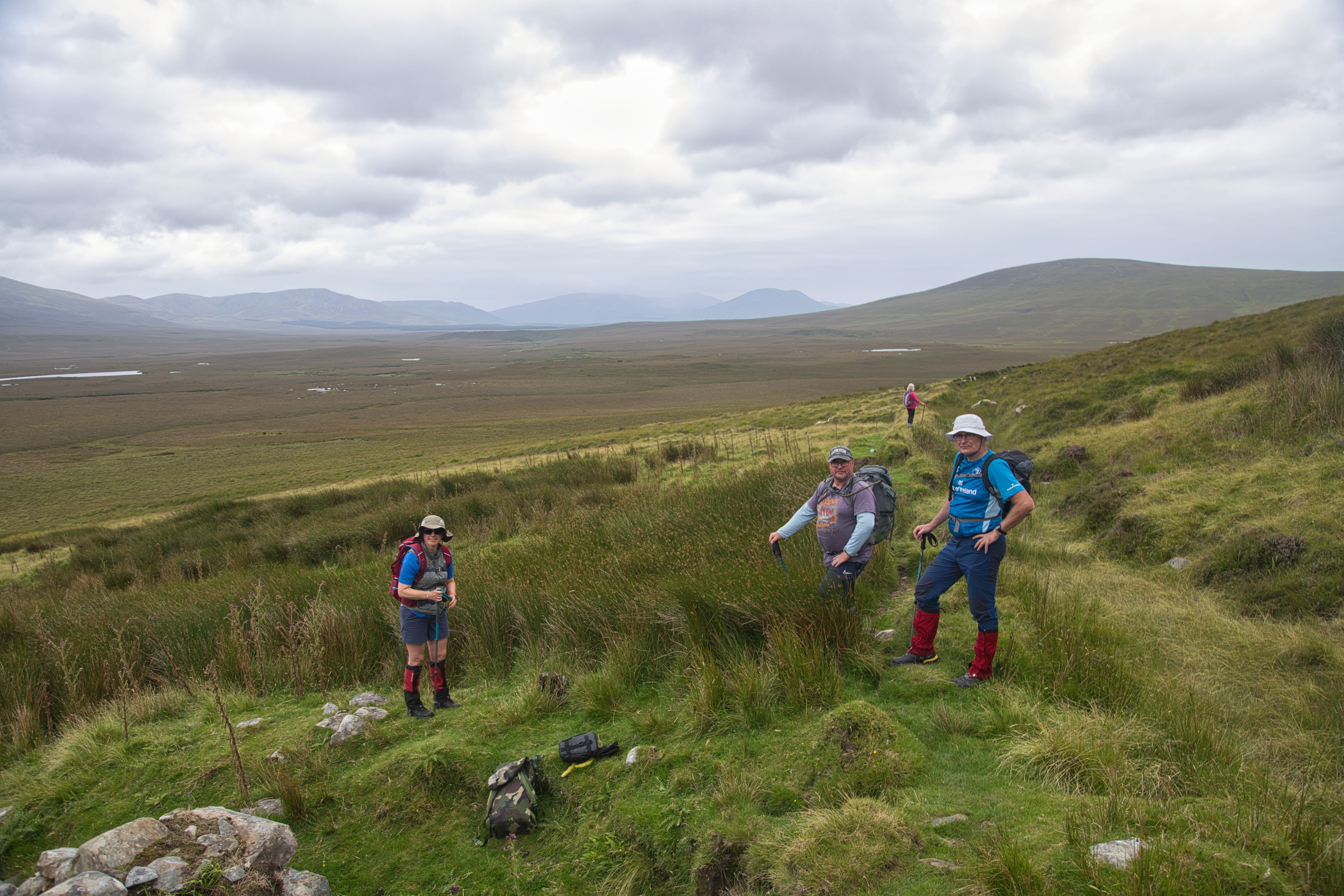
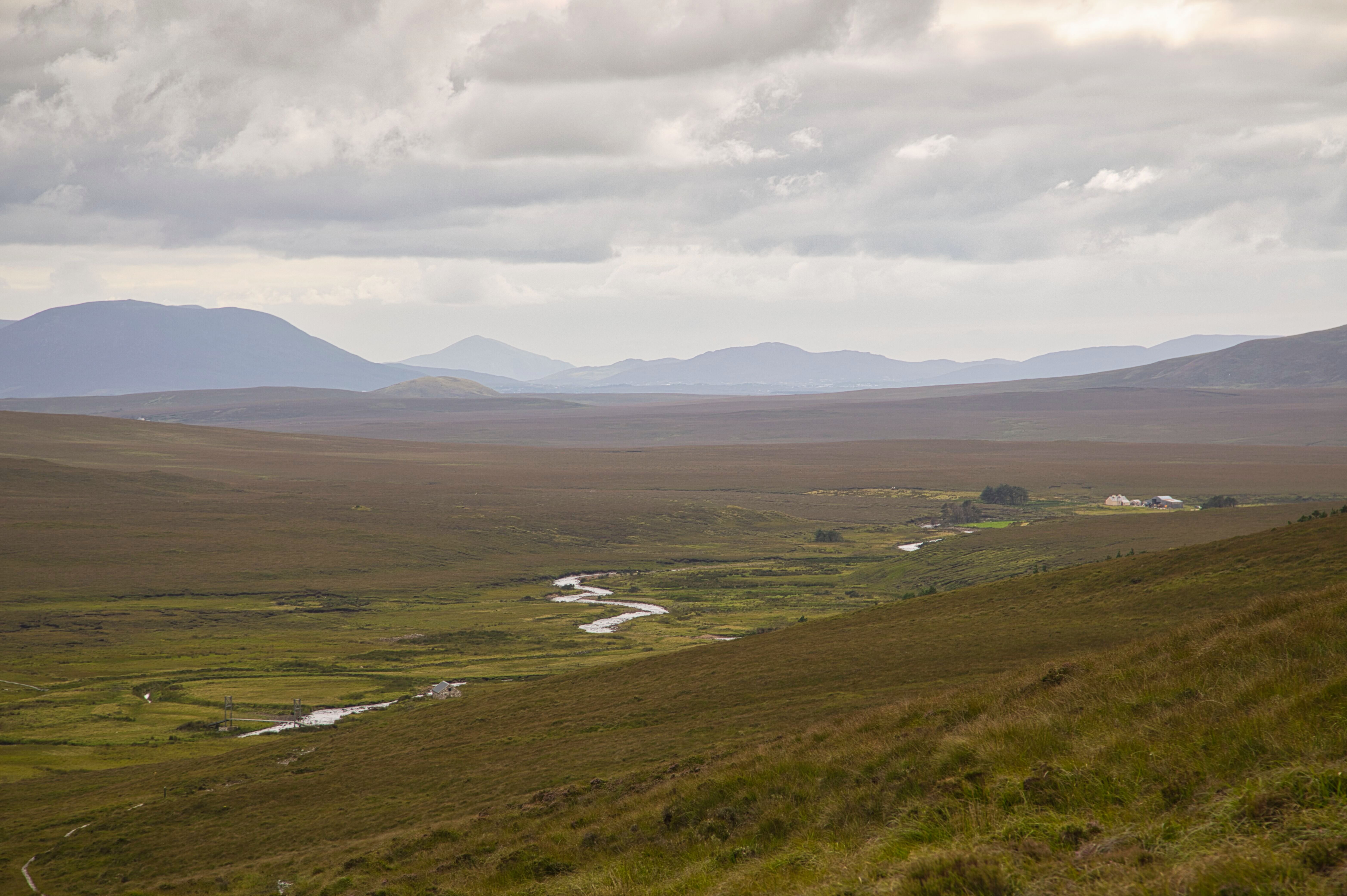
Glenamong and the Corranabinnias stand out across the expanse of blanket bog
Looking towards Tawnyanruddia and Corslieve, the rest stop can be seen on the side of the hill in the middle distance.
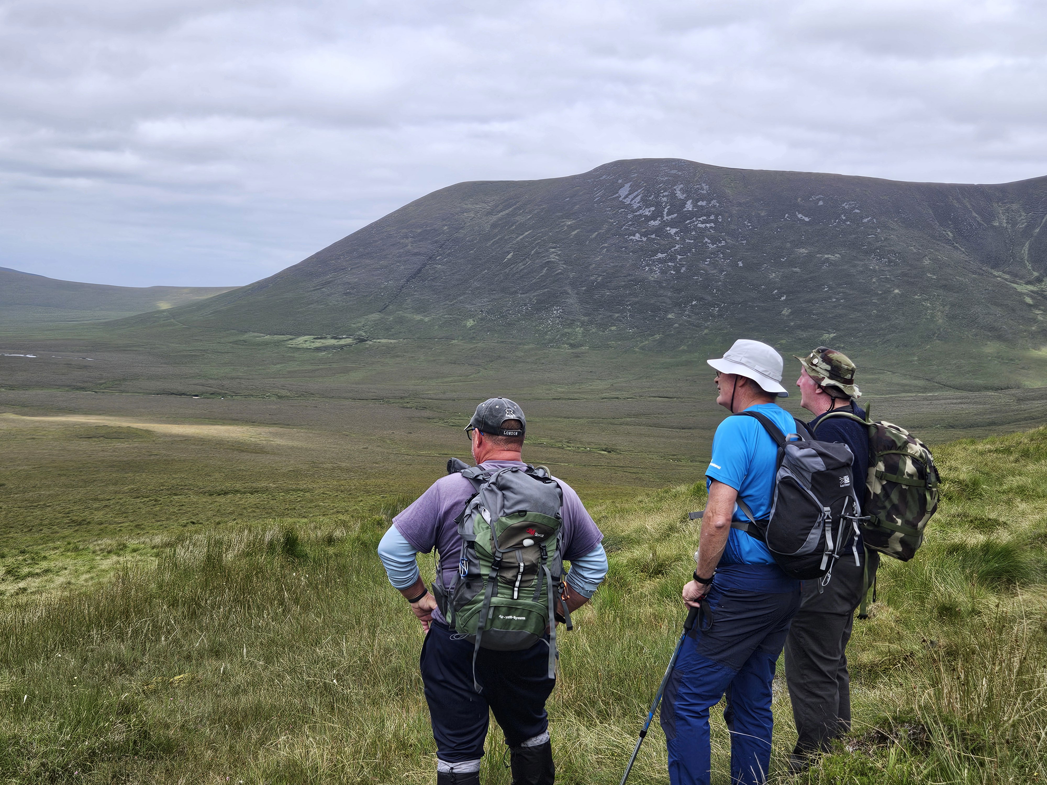
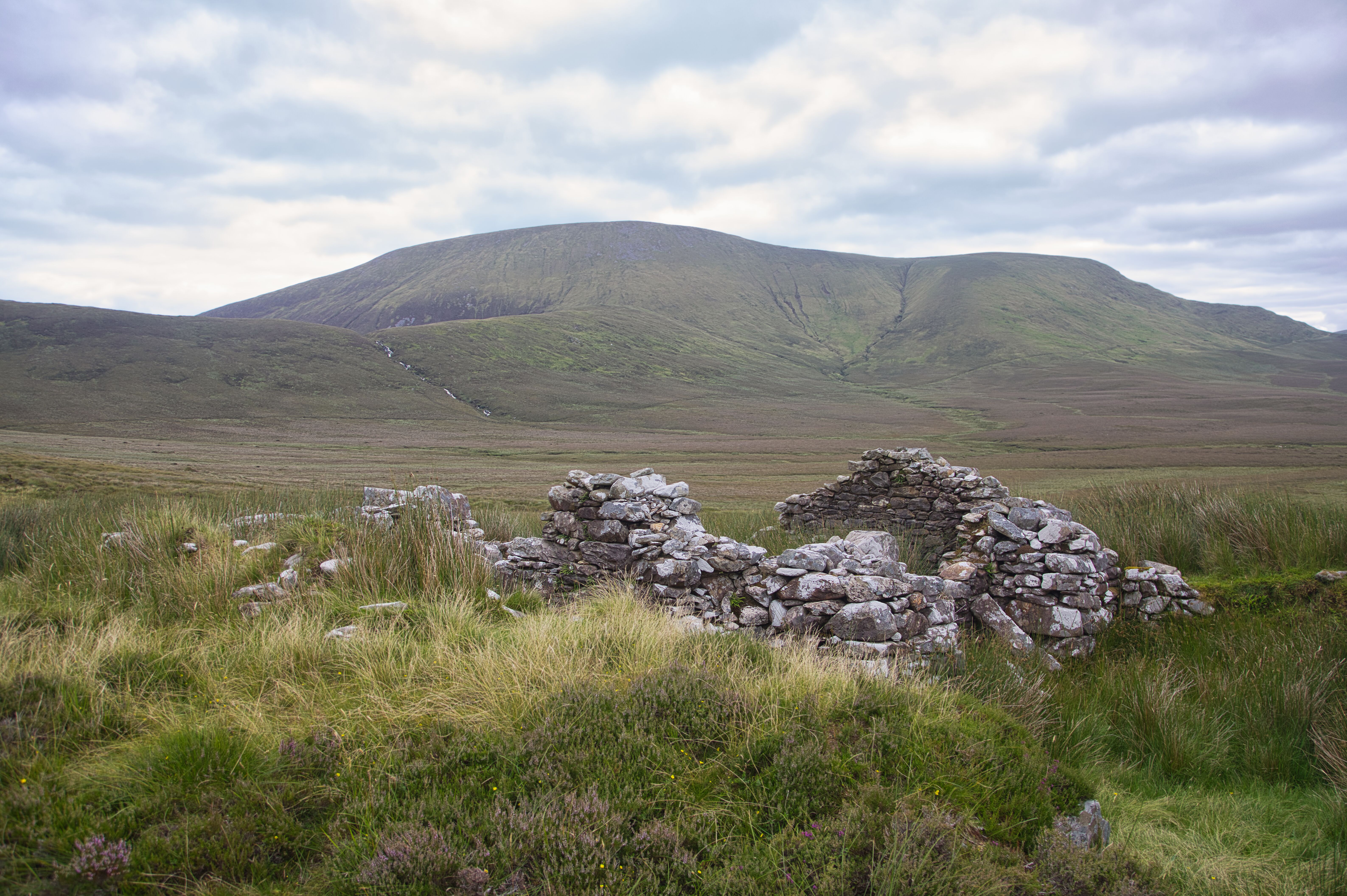
A brief pause at the hut allows us to catch our breath and take in the expansive views surrounding us. The ground leading into the wilderness of the Nephin Begs stretches before us, and my gaze is drawn to an ominous sign: “Caution, Bangor Trail Only Pass this point.” It serves as a reminder that with around 20 km left to reach Bangor, we're about to embark on a commitment requiring us to tread carefully and thoughtfully. As we move along the trail, we leave the shelter behind us, and the breathtaking vistas of Glenamong and the Corranabinnias begin to emerge on one side, while the imposing Nephin Beg mountain and Slieve Carr dominate the other. Each step draws us deeper into the stunning expanse of the Owenduff river valley. The terrain soon shifts, and we hit our first real challenge: the distinctive, squelching feel of wet and flooded blanket bog. It’s a test of our trekking skills, but we persist, aiming for a landmark on the trail—a galvanised farmer's shed nestled amongst the remnants of the ruins of an old farmstead.
looking back towards Nephin Beg.
This is where we plan to take a refreshing break, to reenergize for the next leg of our journey. As we traverse the landscape, I spot a familiar friend: the old oak tree. There it stands, resilient and flourishing in its solitary, remote location. Perhaps its isolation is the secret to its vitality, a reminder that sometimes the quietest places hold the most life.
Preparing to hit the trail again after a break at the farmstead.
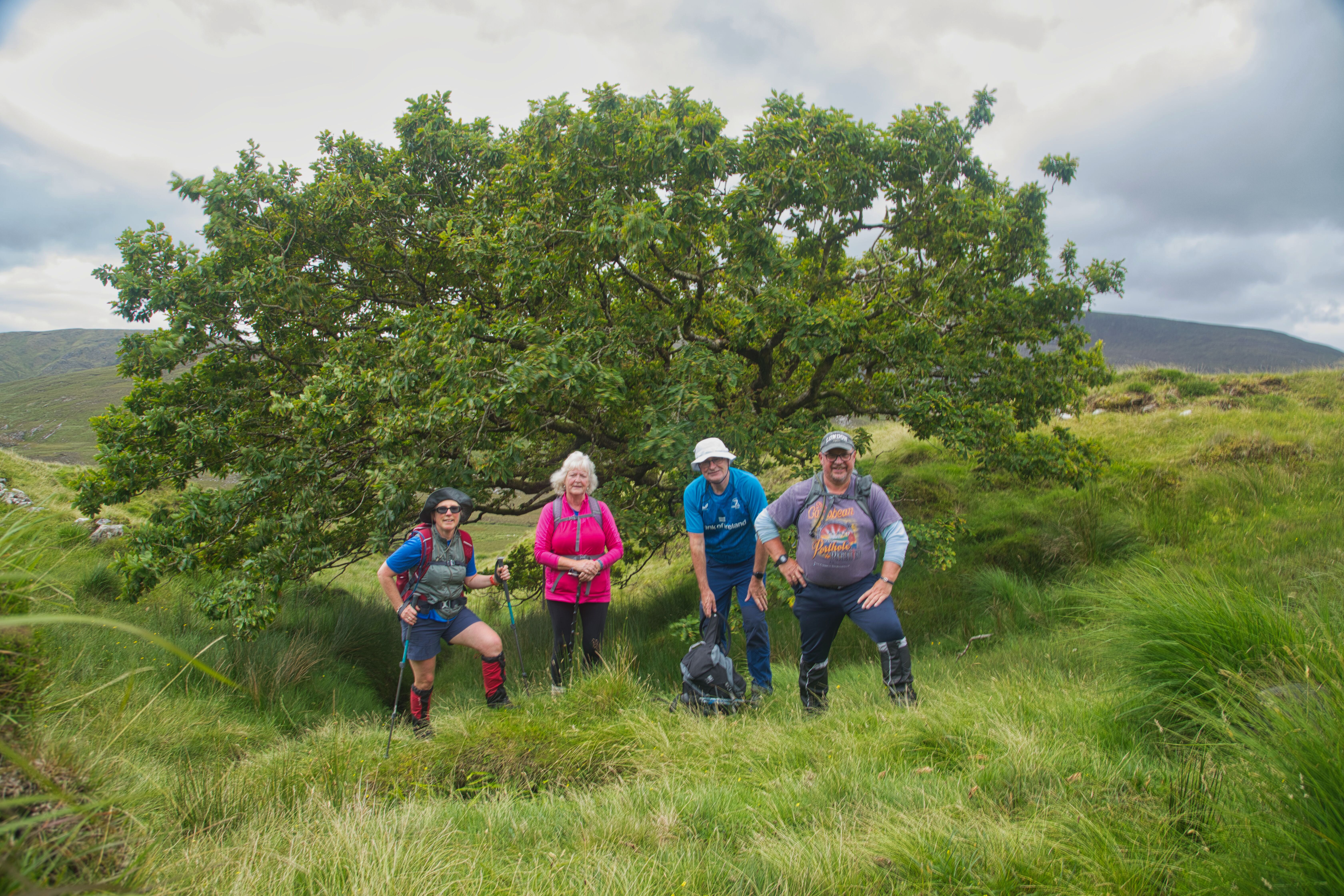
The lonely Oak tree is always an obligatory stop to take in a few photographs.
Margaret on the trail.
After a short break, we bid farewell to the ruins of Tawnyanruddia and press onwards, eager to reach our next destination—the footbridge over the Tarsaghaun River. Stepping back onto the Bangor Trail, we are immediately reminded of one of the defining characteristics: the muddy, wet conditions that hikers inevitably encounter, no matter the season, when doing this trek.
Enjoying the serene atmosphere.
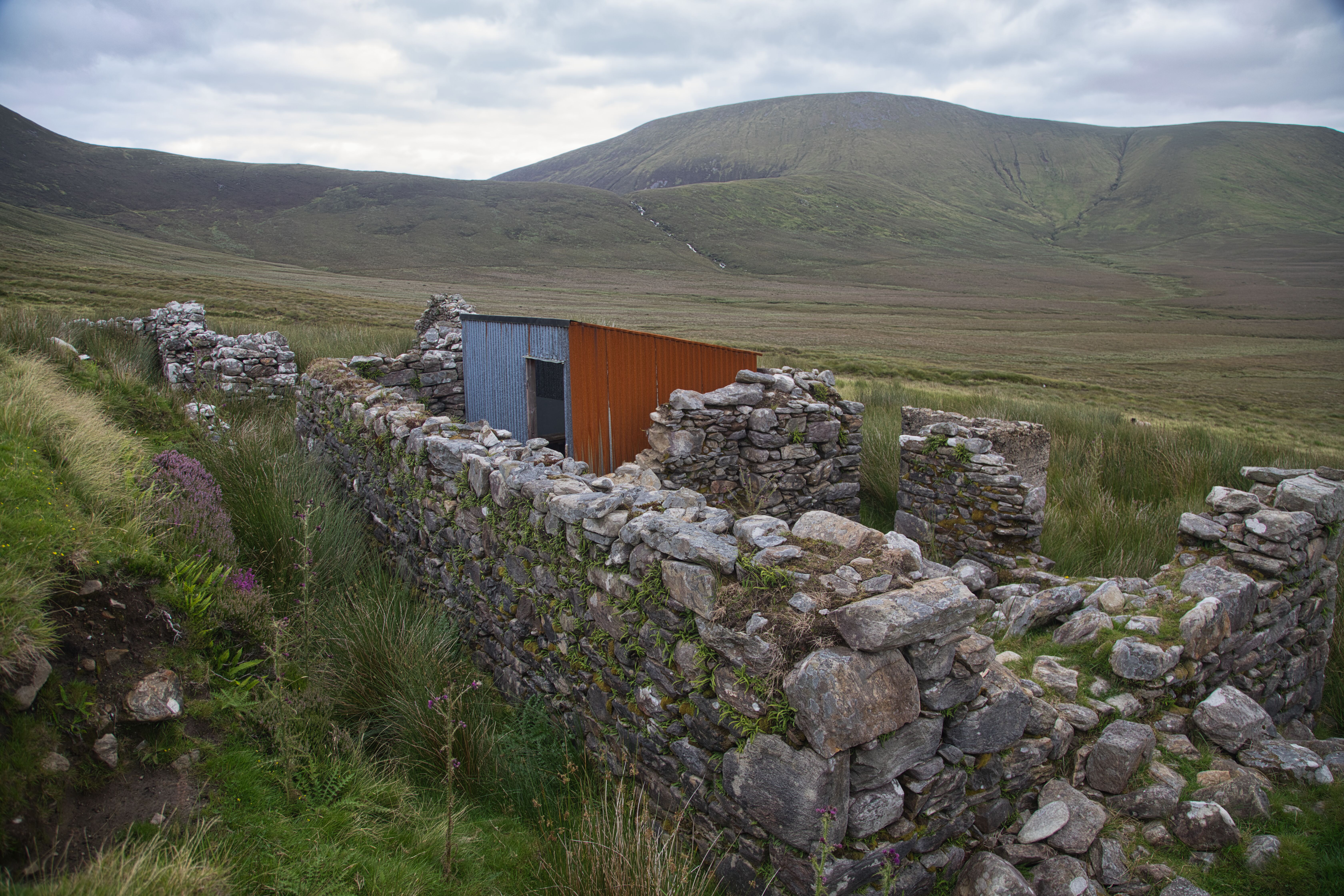
Bartley Dolan's house

Historic information from Griffiths Valuation.
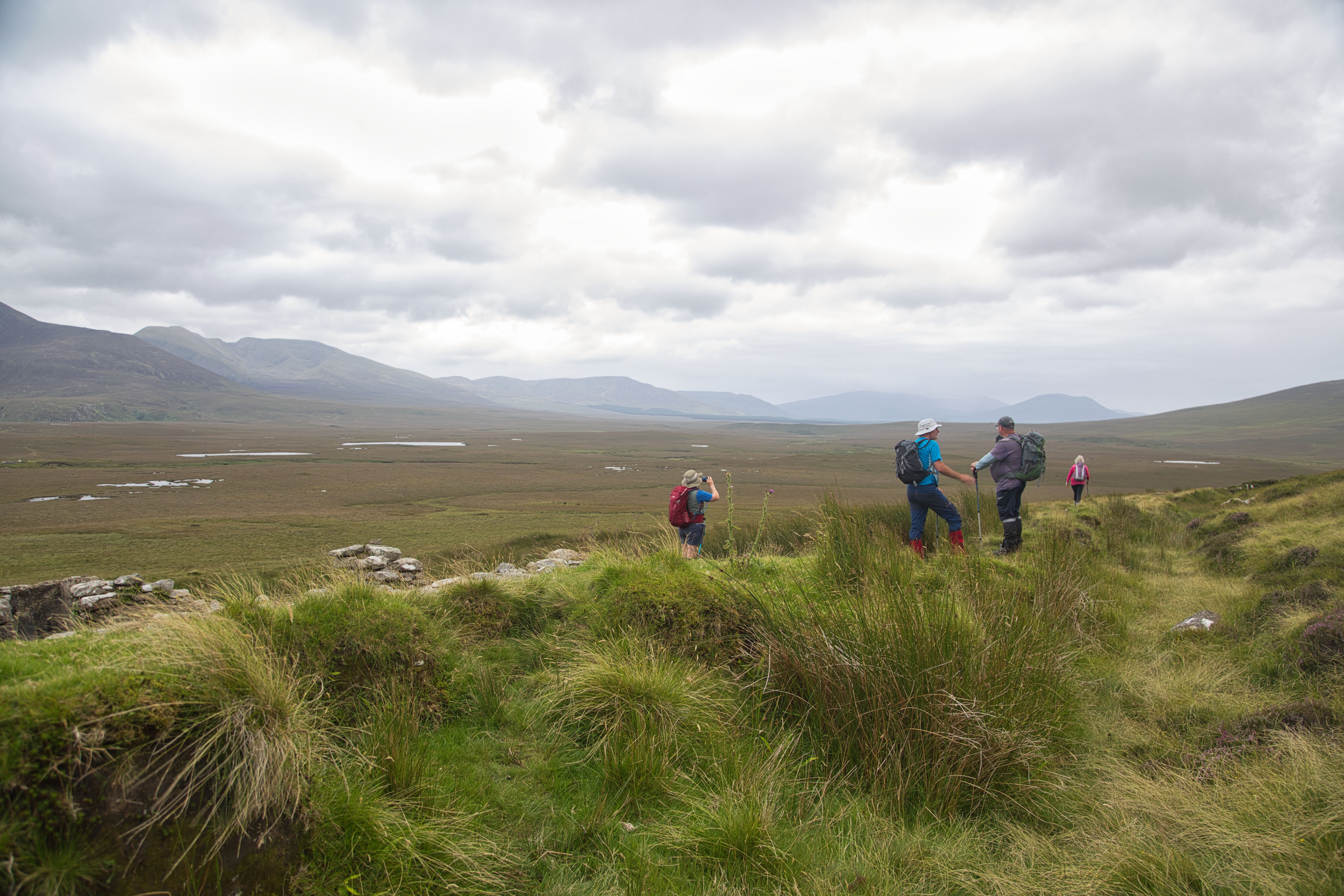
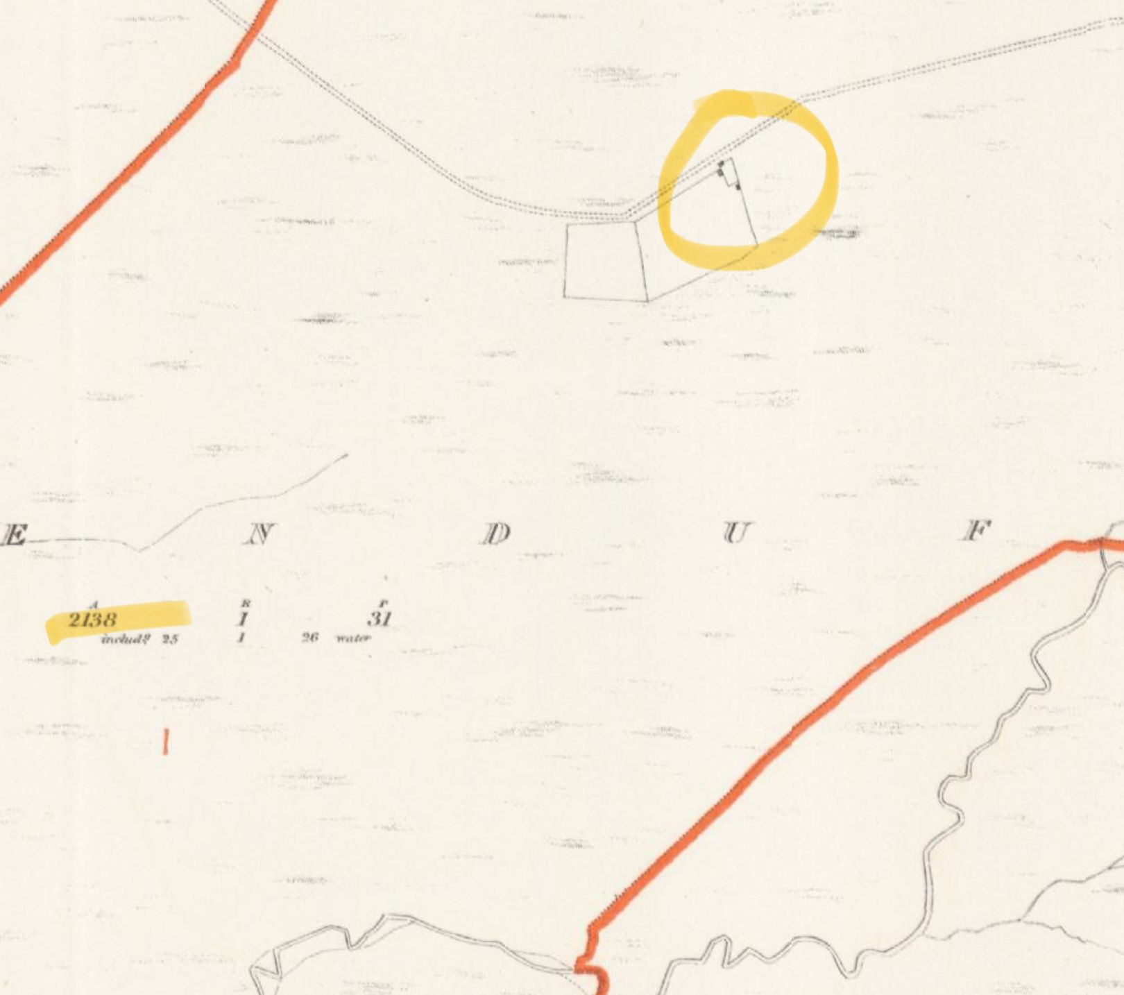
As we venture deeper into the serene surroundings of the Bangor Trail, the remnants of history begin to reveal themselves. Dotting the landscape along the trail are the ruins of abandoned farm settlements. On our journey, I take a closer look at one particular site, the very one where we paused during our first break. A small piece of research into this area unveils intriguing insights about its former inhabitants. Thanks to Griffiths Valuation, we can trace back the history of this settlement to at least 200 years ago and probably much longer—in 1857, the County of Mayo completed its valuation, marking the beginning of a primary source of documented records in the region. Consulting the maps from the early 1800s, I find a house marked in this very location. A name stands out: Mr Bartley Doran. According to Griffith’s records, he occupied the house and leased an astonishing 2,138 acres of land from a landlord called George Clive, encompassing the entirety of the Owenmore townland tract. Imagine—over two thousand acres! This amount of land, especially in a remote and rugged area, suggests that Mr Doran was quite prosperous for his time. The lush green hillsides, dotted with sheep and cattle, must have been a stark contrast to the empty landscape we see today. Marked also on the map are boundary fences around the house, providing further evidence that he not only raised sheep, which were indeed the mainstay of farming back then, but also probably held a number of cattle. It's easy to envision Mr Doran tending to his land, hearing the bleats of sheep echoing in the valleys, or watching the cattle graze on the rich pastures. Although the remoteness of the place might have posed challenges, it also provided a certain beauty and tranquillity—elements that have not waned over the years, as witnessed and felt by us today.
And then as if the present was echoing the past, a quad bike can be heard over the silent expanse of Blanket Bog, and in the distance a farmer with his Collie sheepdogs can be seen herding a flock of sheep across the land! Perhaps he is an ancestor of Bartley Dolan!
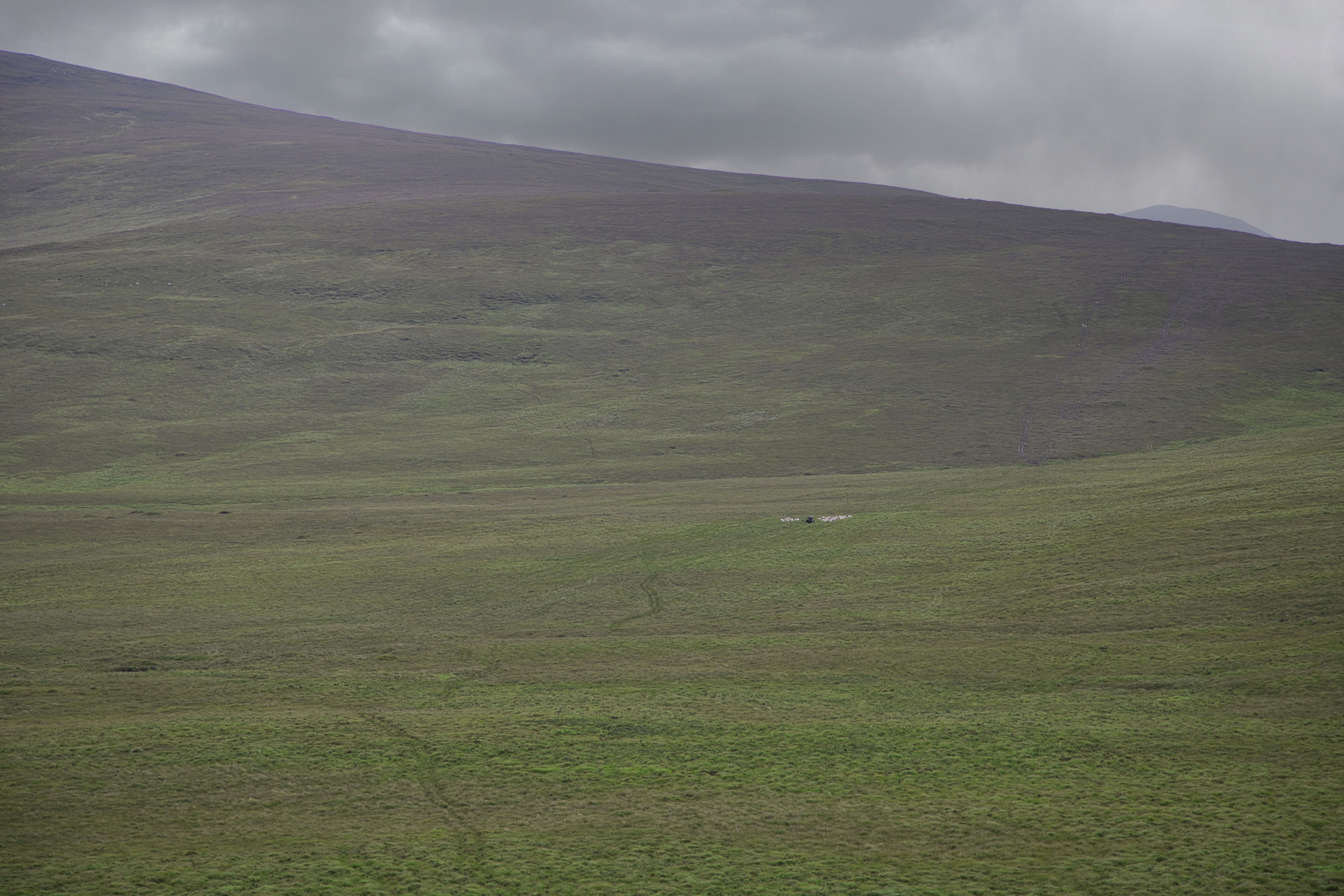
Sheep been herded off the mountain
After a lengthy stretch, we finally reach the footbridge, crossing approximately half a kilometre of boardwalk along the way. Nestled nearby is a bothy, a nice spot many hikers use as a camping retreat while traversing the trail. A quick peek inside revealed a tidy and inviting space, perfect for a night under the stars. However, I was disappointed at the sight of litter scattered here and there—an old bed duvet abandoned by the bridge and an empty discarded wine bottle perched on the windowsill of the bothy. It’s disheartening to see such disregard in these beautiful surroundings, leaving me to ponder the motivations behind such inconsiderate actions.
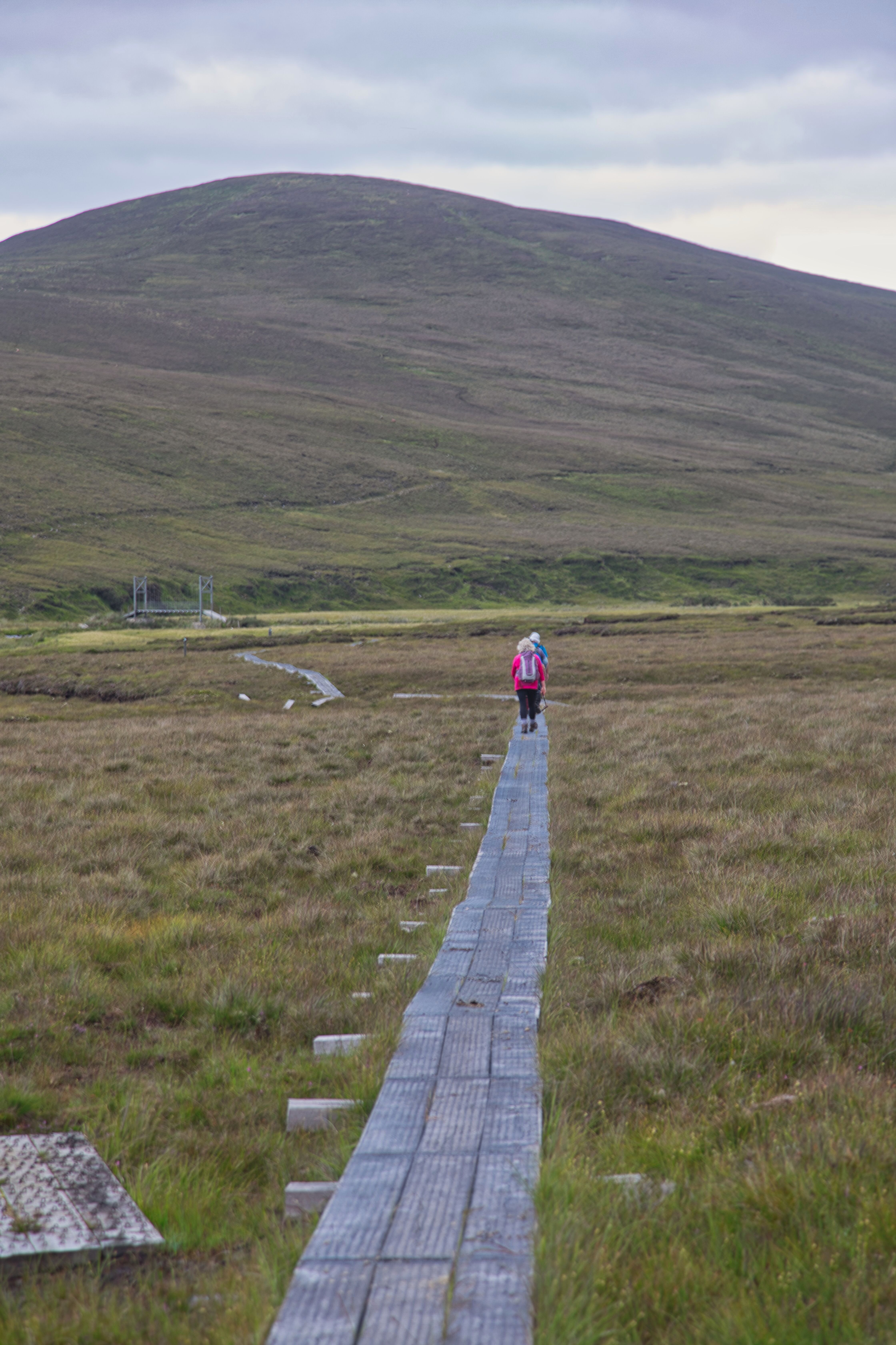
The boardwalk makes a nice break from the soggy path as we approach the footbridge on the Tarsaghaun river.
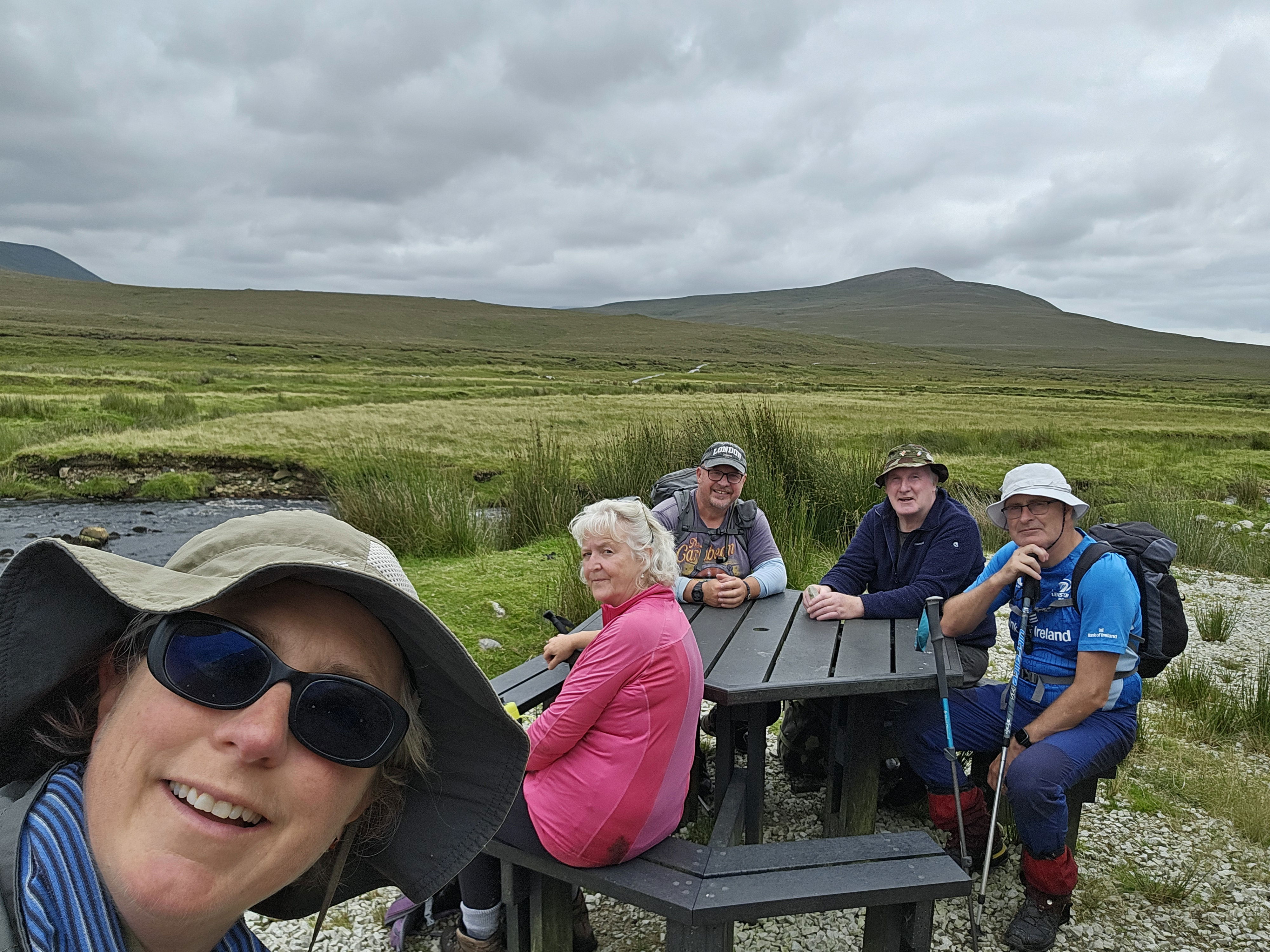
Taking a small rest at the picnic table beside the bridge and bothy.
Just beyond the bothy lies a road providing access to a nearby house, offering the closest exit route for those keen on shortening their journey, but none of my trekking companions nor I want to do that. The final stretch of the Bangor Trail quickly proves to be as challenging as the previous miles. After trekking over 20 kilometres through the jaw-droppingly beautiful yet rugged terrain of this wild landscape, the last 7 kilometres feel like a test of will. That 230-metre climb out of the valley near the footbridge, while seemingly manageable on paper, transforms into a formidable challenge at this late stage of the hike, demanding every last ounce of stamina. (for me at least!)
As we push northwards towards Bangor Erris, the haunting silhouettes of Slievemore and Croaghaun on Achill Island emerge in the distance towards the west, providing fleeting moments of beauty amidst our determination to reach our transport rendezvous point.
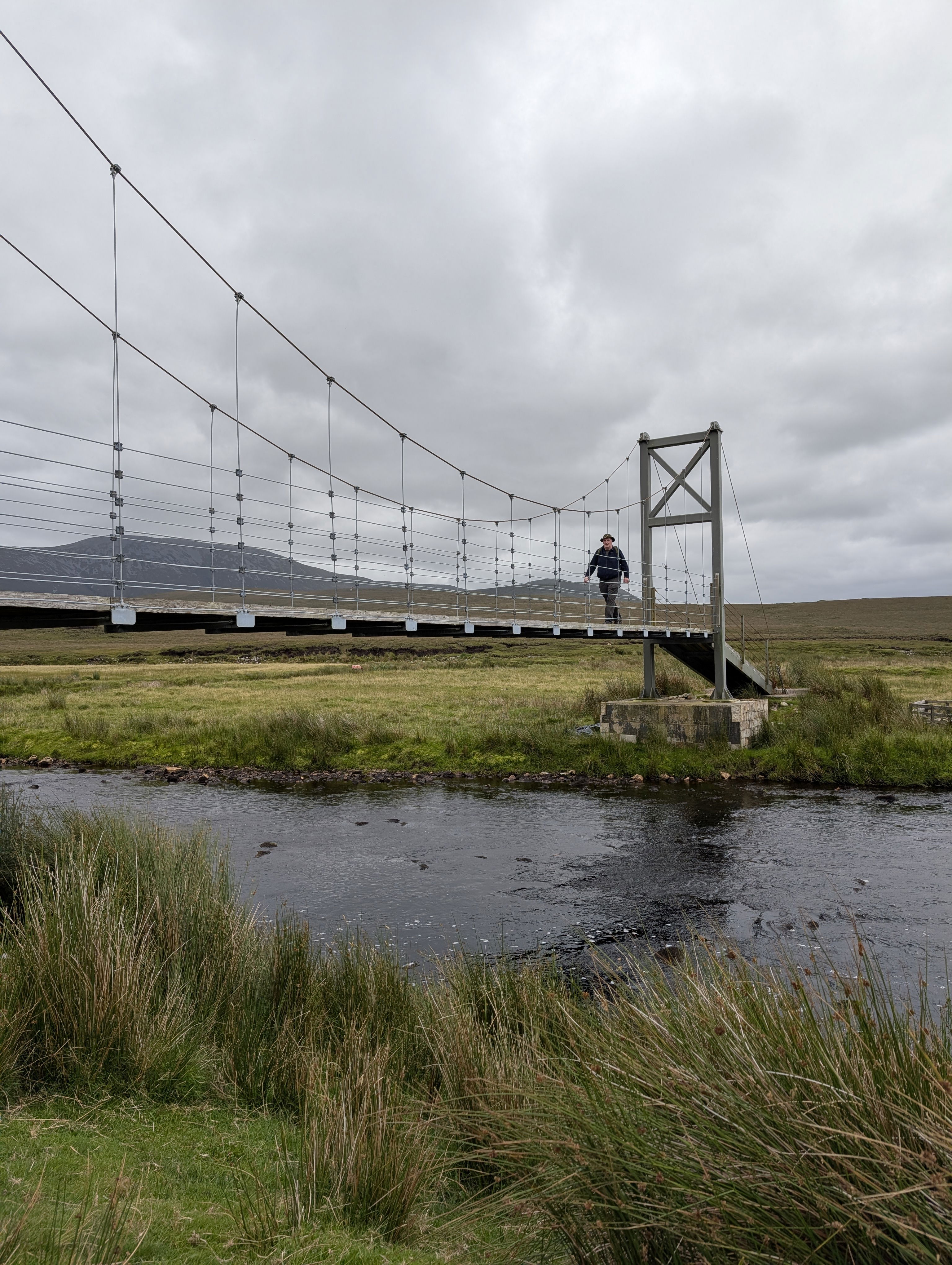
Crossing the footbridge over the river.
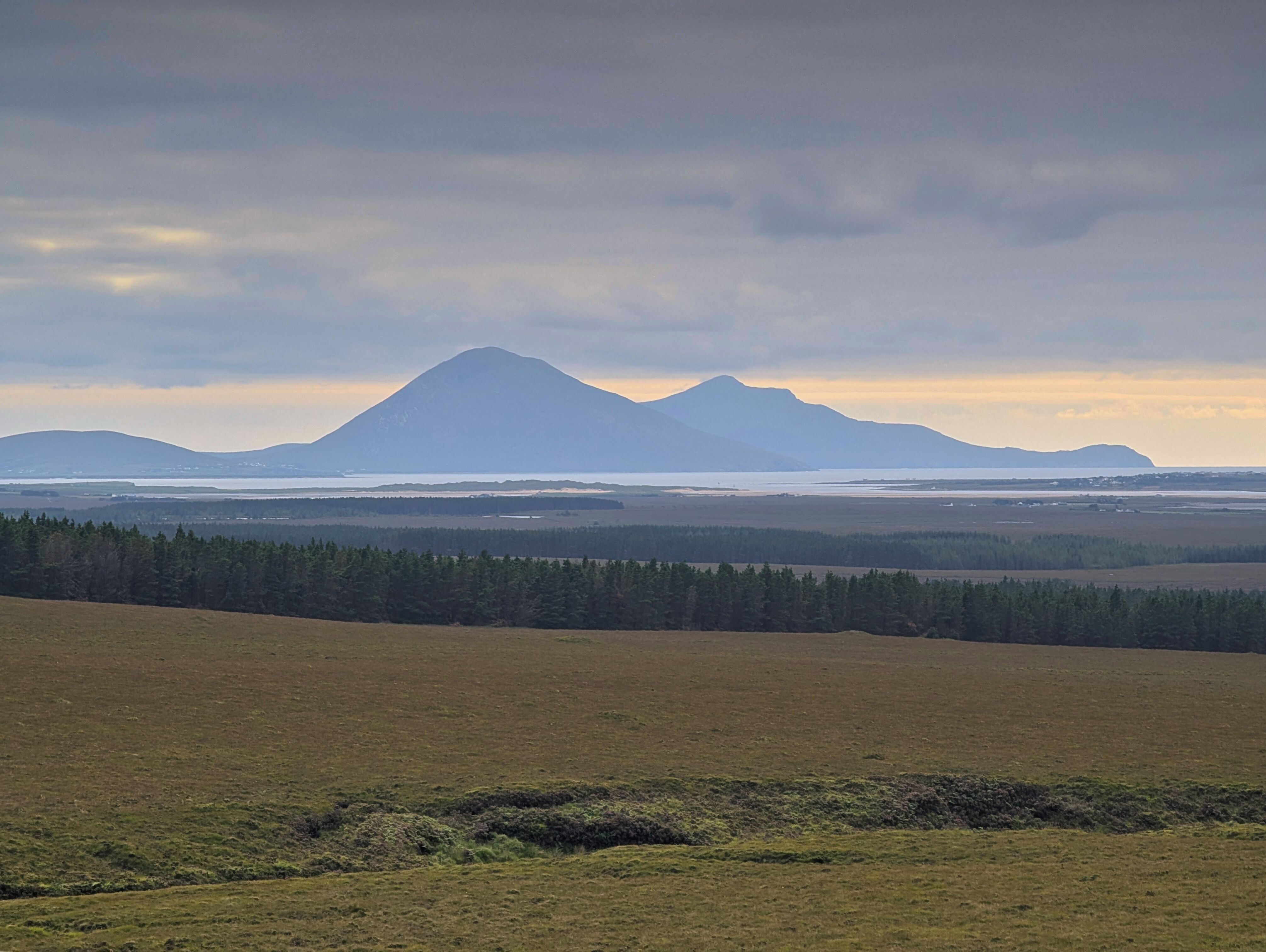
Slievemore and Croaghaun as seen from the Bangor trail.
However, the satisfaction of those views is quickly overshadowed by the trail transforming once again into a soggy gauntlet, especially around Knocklettercuss, where flushes and streams of water conspire to slow our progress.
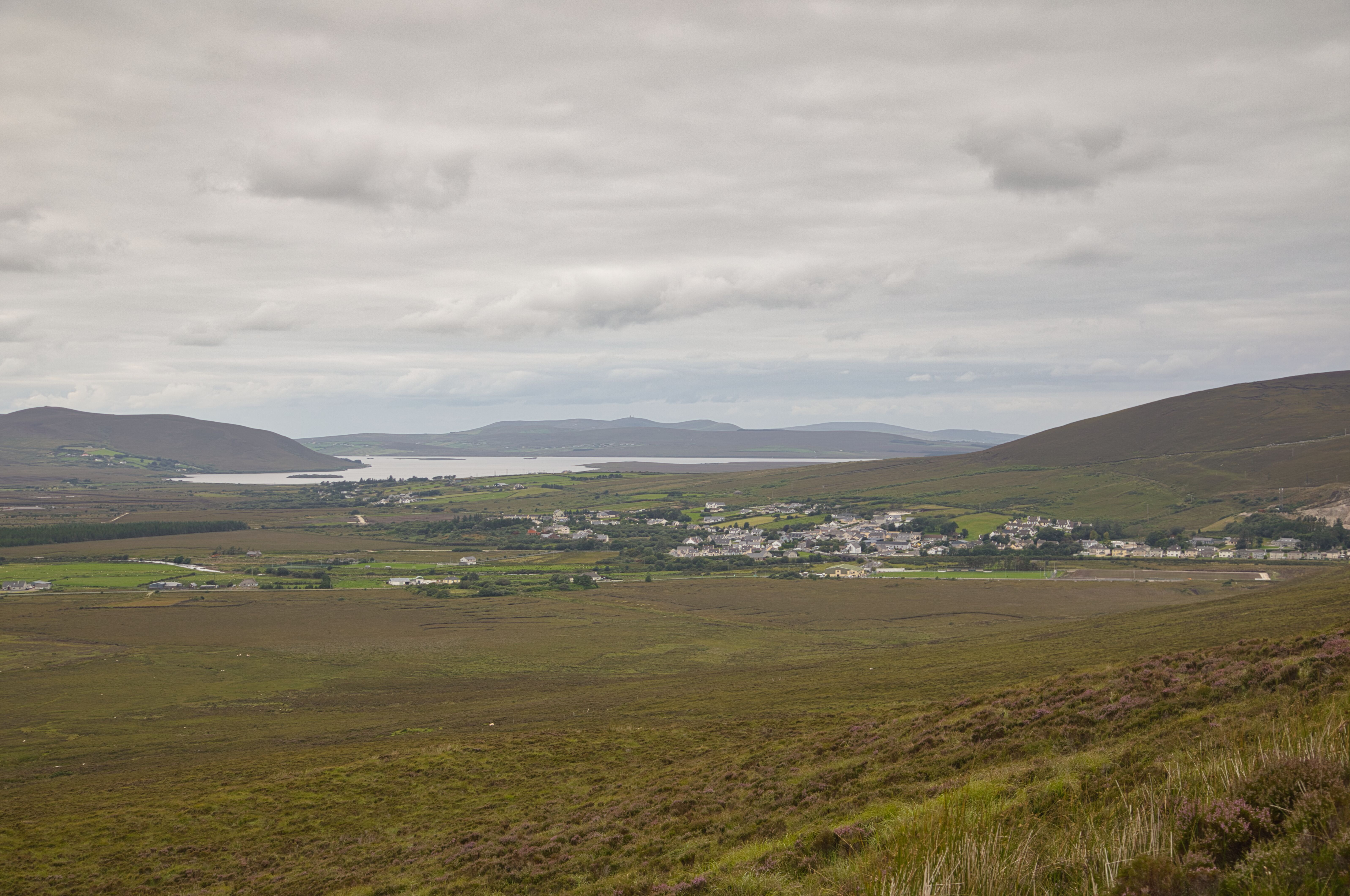
Finally Bangor Erris comes into view and the thought of the finishing line is near!.
At last, with just 3.5 kilometres to go, the sight of Bangor Erris materialises in the distance, bringing with it a surge of relief and renewed determination. Our pace quickens, spurred by the tantalising promise of rest and refreshment, and we finally descend into the car park where our awaited transport is ready to whisk us back to Letterkeen. As I survey muddy boots and tired legs, a quiet sense of triumph washes over us. We have just successfully conquered one of Ireland’s wildest remote trails, creating memories that will linger long after the soreness fades.
With another adventure ticked off the bucket list, I find myself already contemplating the next trail or climb to tackle. After all, there’s nothing quite like the thrill of exploring the untamed beauty of the Irish countryside—muddy boots and all!
A last look back leaving the the valley of the Tarsaghaun river.