Glendahurk Horseshoe Trek, (Part 2), Corranabinna South West Top. 🏔️ 🌄
“Climb the mountain not so the world can see you, but so you can see the world.”
David McCullough Jr.

OSI sheet 30
Corranabinnia - Coire na Binne - hollow of the peak*
I didn't expect it to take this long to return to the mountains outside Newport after my first trip to Bengorm earlier in the year. A bout of COVID, among other things, kept me from getting back into the hiking mode until a trek undertaken last Monday, January 2nd, to Corranabinnia’s south-west summit changed that. This trip can be considered the second part of the Glendahurk loop walk mentioned in my previous blog on Bengorm, which was the first of a three-part trip I wanted to undertake at a pace that allowed me time to do some photography.

Following the spur line all the way up to the summit with a great view of Clew Bay and Croagh Patrick in the background.
Unusually for this mountain range, the name Corranabinnia does not exist as a named mountain top in the Nephin Mountains. The name is only found on a lake on the western side of this mountai. The two mountain peaks located beside each other, known locally as Corranabinnia south west top at 681 m and Corranabinnia at 714 m, command some of the best views and vistas to be had that the west of Ireland has to offer and are well worth the effort to get here at any time.

Corranabinnia Lough and part of the Corryloughaphuill lakes in the foreground with Slieve Carr in the background lit up with the morning sun.
Starting off likewise when climbing Bengorm, I parked the car at the same small car park and followed an old gravel road for about a kilometre before turning into the mountain to follow along a spur line to the top. For about the first 200 meters or so, the going was rather wet and boggy underfoot, with water seeping from the mountain lodging in a few places making the area slippy to hike on. This, coupled with areas that had not thawed out yet from the cold spell, especially in the shadows, made the climb a bit more dangerous. Once I climbed over the 200- to 250-meter wet area, the going got good, and as I ascended a bit more, the going got better but the temperature got a lot colder. The temperature today was 0–3 degrees Celsius, with a wind chill factor of about –3–4 degrees.
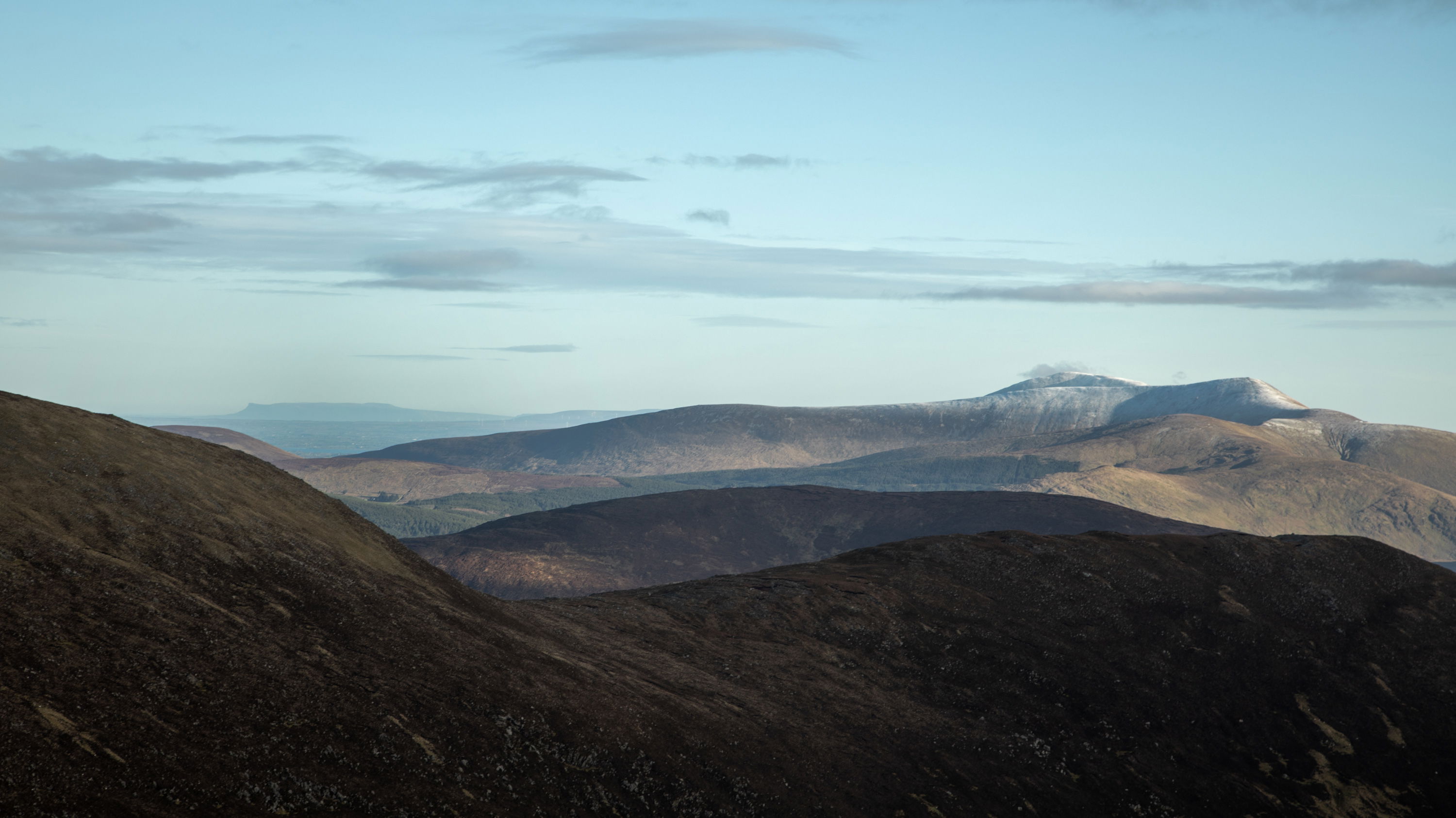
Benbulbin in Co Sligo on the left and the frost covered Birreencorragh on the right.
Anyone who enjoys climbing and hiking hills will attest that reaching the summit of a mountain after several hours of slogging up it is the best moment of the journey. When all of the great sights suddenly come into view and hit you in the face, you know that you are in a special place. You realize that you are lucky to be here, as this is a place that not many people will ever get to see.

Beautiful Clew Bay and the surrounding mountains looking south.

A shower of rain and hail crosses over Clew Bay and looks like it could be heading this way !
Moving between the two summits.

The photo of the arête between Corrannabinnia SW top in the foreground and the main mountain of Corrannabinnia on the skyline show the precarious nature of the terrain.
The ridge between the two mountain summits on the Glendahurk Horseshoe Trail is a really fascinating sight to see. Anyone who wants to finish the circuit must cross over the ridge line. This region, known as "Mayo's Best Ridge Line," is not for the faint of heart because, as you can see from the photograph, there are steep drop offs on both sides of the narrow path that cross the ridge, and any complacency here whilst traversing the ridge could end in catastrophe. Looking at it from the top of Corranabinnia SW top, I noticed that it still had quite a bit of frost on the grass and rocks and decided that today was not the day to try to attempt this crossing. This will be done on another day when I hope to return for the third and final part of this adventure when I will approach this area from the Glanamong direction.
Great views from the mountain.

Looking into the Glenthomas river valley with the river meandering through the hillside heading to the sea.

The top of Glenthomas valley looking roughly in the direction of Mullranny.

Photographed from the side of Corranabinnia SW Top, Knockmore on Clare Island peeks through the clouds with an enigmatic, dark appearance.
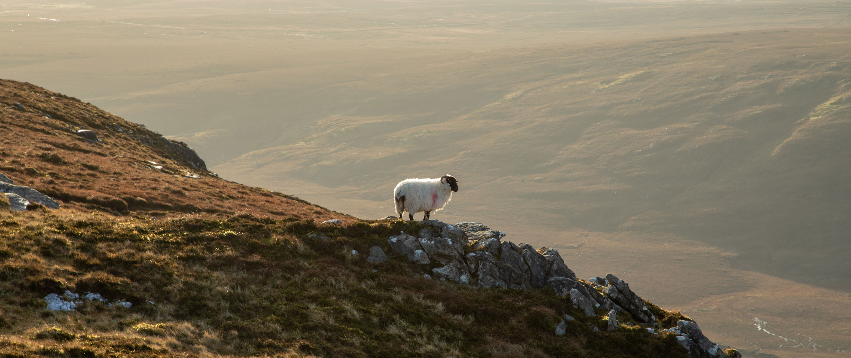
Never too far away from you in the Nephin Begs, are these woolly fellas !
After a rather shorter time than usual on the summit due to the very cold wind that was blowing there, it was time to do an about-turn and head down the mountain again. The descent was pleasant because the slope wasn't as steep as I might have imagined, and I was able to stroll down the mountain at a leisurely pace. This, coupled with the fantastic views facing me out onto Clew Bay, made this day's trek a very memorable one. I can't wait until I return to do the third leg of the horseshoe!

Sunset
The sun setting over Clewbay taken from the site of an old abandoned sheep enclosure on the side of the mountain.
Carpe Diem
* Irish Hill and Mountain names, Paul Tempan